EarthExplorer: A Gateway to Free GIS Data
Table of Contents
Download Free GIS Data from EarthExplorer
In the realm of Geographic Information Systems (GIS), access to reliable and up-to-date spatial data is crucial. EarthExplorer, a web-based application developed by the United States Geological Survey (USGS), has become a cornerstone for researchers, scientists, and GIS professionals worldwide. This platform offers an extensive repository of free GIS data, making it an indispensable tool for various geospatial applications.
What is EarthExplorer?
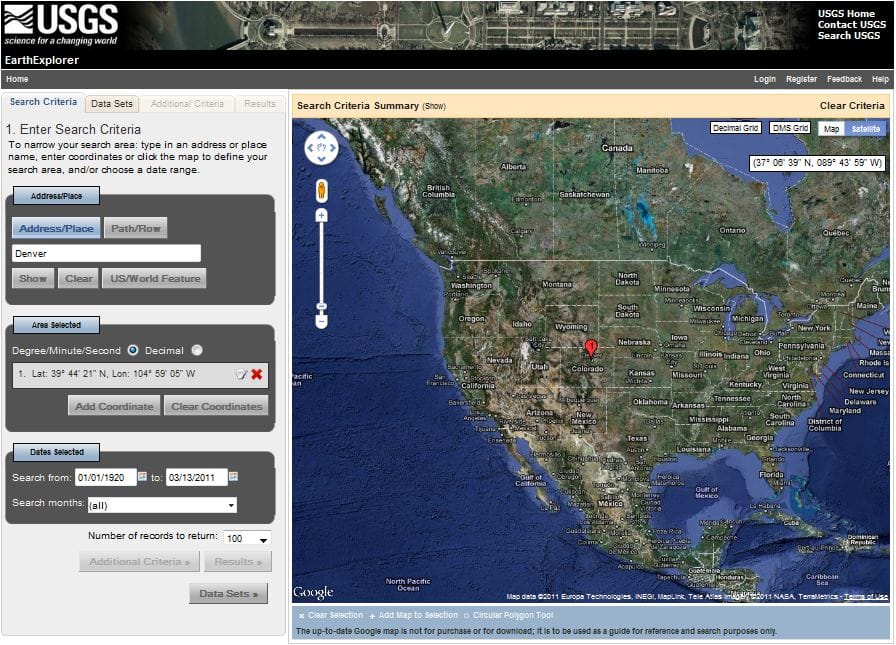
EarthExplorer is an online search, discovery, and ordering tool that provides users with access to a vast collection of remote sensing data. It primarily serves as a portal for satellite imagery, aerial photographs, and cartographic products. With a user-friendly interface and advanced search capabilities, EarthExplorer allows users to easily locate and download data that suits their specific needs.
Key Features of EarthExplorer
- Extensive Data Repository: EarthExplorer hosts a wide range of datasets, including Landsat imagery, MODIS data, Digital Elevation Models (DEMs), and aerial photographs.
- User-Friendly Interface: The platform’s intuitive design allows for easy searches based on location, date, and data type.
- Advanced Search Capabilities: Users can refine searches with filters like cloud cover, acquisition date, and spatial resolution.
- Free Access to Data: EarthExplorer provides free access to a vast amount of GIS data, democratizing data access for all users.
Importance of EarthExplorer in GIS Applications
EarthExplorer plays a pivotal role in various GIS applications, including:
- Environmental Monitoring: Monitor environmental changes such as deforestation, urban expansion, and climate effects.
- Disaster Management: Access data quickly for damage assessment and emergency response during natural disasters.
- Urban Planning and Development: Use high-resolution imagery for land use analysis and infrastructure planning.
- Agriculture: Optimize agricultural practices through crop monitoring and resource management.
By offering free and easy access to a wealth of GIS data, EarthExplorer empowers users to make informed decisions, conduct groundbreaking research, and contribute to a better understanding of our world. Whether you’re a seasoned GIS professional or just starting, EarthExplorer is an invaluable resource that brings the world of geospatial data to your fingertips.

