Algeria Regions Shapefile for Download
Resource
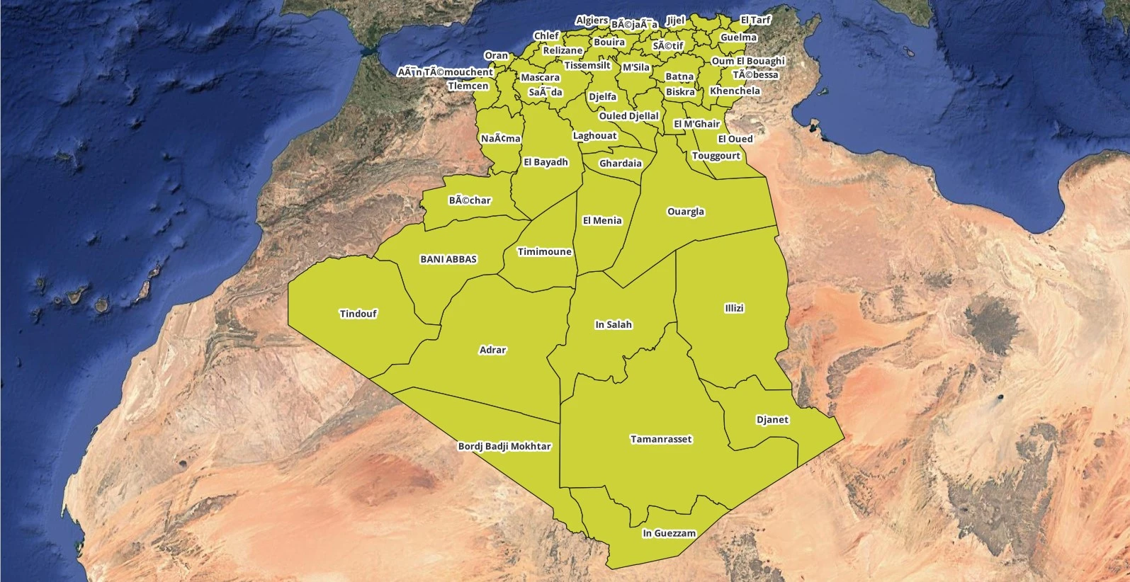
If you’re working with Geographic Information Systems (GIS) and need to analyze Algeria Regions shapefile, a shapefile of the country’s regions (wilayas) is an essential tool. A shapefile is a common format used for storing spatial data, and in the case of Algeria, it includes the boundaries and attributes of all its 58 regions.
Algeria’s Administrative Regions (Wilayas)
Algeria is divided into 58 administrative regions, each known as a wilaya. Here’s the full list:
- Adrar
- Chlef
- Laghouat
- Oum El Bouaghi
- Batna
- Béjaïa
- Biskra
- Béchar
- Blida
- Bouira
- Tamanrasset
- Tébessa
- Tlemcen
- Tiaret
- Tizi Ouzou
- Algiers
- Djelfa
- Jijel
- Setif
- Saïda
- Skikda
- Sidi Bel Abbès
- Annaba
- Guelma
- Constantine
- Médéa
- Mostaganem
- M’Sila
- Mascara
- Ouargla
- Oran
- El Bayadh
- Illizi
- Bordj Bou Arreridj
- Boumerdès
- El Tarf
- Tindouf
- Tissemsilt
- El Oued
- Khenchela
- Souk Ahras
- Tipaza
- Mila
- Aïn Defla
- Naama
- Aïn Témouchent
- Ghardaïa
- Relizane
- El M’ghair
- El Meniaa
- Ouled Djellal
- Timimoun
- Boudouaou
- Ouargla
- Djelfa
- Batna
- Khenchela
- Bechar
Why You Need the Algeria Regions Shapefile
The Algeria regions shapefile is invaluable for:
- Geospatial Analysis: Analyze regional data like population or economic activity.
- Mapping & Visualization: Create maps that highlight Algeria’s regional boundaries.
- Urban Planning: Plan infrastructure and services based on administrative divisions.
Download the Algeria Regions Shapefile
You can download the shapefile from several Here:
How to Use the Shapefile
To work with the shapefile, use GIS software like QGIS, ArcGIS, or Google Earth. These tools allow you to load, analyze, and visualize Algeria’s administrative regions.
Conclusion
The Algeria regions shapefile is an essential resource for anyone working on projects involving Algeria’s geography. Whether for research, planning, or analysis, it enables detailed mapping and spatial insights into the country’s 58 administrative regions. Download the shapefile today and enhance your GIS projects.
Available for Download in TechGEO:
World countries ShapeFile
Morocco Regions ShapeFile
USA counties Shapefile

