GeoAI for Earthquake and Tsunami Prediction – Seismic Data
## Earthquake and Tsunami Prediction: Harnessing the Power of GeoAI
The terrifying consequences of natural disasters, specifically earthquakes and tsunamis, demand constant vigilance and innovative solutions for prediction and mitigation. Enter GeoAI, a revolutionary field leveraging artificial intelligence and geospatial data to unlock vital insights and improve preparedness. This burgeoning technology offers potent tools to forecast potential seismic activity and the devastating tsunami waves that follow, contributing significantly to safeguarding lives and minimizing damage.**
**Understanding the Capabilities of GeoAI:**
GeoAI excels by combining powerful analytical techniques with robust geospatial datasets. Here’s a breakdown of its key features:
* **Combining Multiple Data Sources:** GeoAI uses a network of sensors, including seismographs, seabed observatories, and tide gauges, to analyze real-time and historical data about the earth’s structure, water levels, and seismic activity.
* **Advanced Machine Learning:** GeoAI employs machine learning algorithms, such as deep learning, to identify complex patterns and correlations within vast datasets. These patterns may uncover relationships that traditional methods may miss, enabling timely predictions.
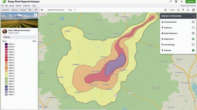
* **Geo-Mapping of Hazard Zones:** Data is visualized on geographic maps, allowing scientists and policymakers to create detailed hazard maps for earthquake-prone and tsunami-prone areas. These maps provide valuable information for disaster preparedness and evacuation plans.
**Unprecedented Benefits of GeoAI in Predicting Earthquakes and Tsunamis:**
While weather forecasting has seen substantial success, the use of GeoAI in earthquake and tsunami prediction is demonstrating even greater potential:
* **Early Warning Systems:** GeoAI can prepare accurate earthquake and tsunami predictions with increasing accuracy over time. Real-time predictions enable community alerts and evacuation routes, potentially saving numerous lives.**
* **Improved Risk Assessment:** GeoAI integrates data from a wider range of sources, bringing us closer to understanding critical factors in seismic routes and yielding insights on potential tsunami occurrences.
* **Supporting Mitigation Efforts:** By highlighting potential danger areas, geoAI can equip infrastructure engineers with powerful tools to elevate building standards, impart information for more robust infrastructure design, and prioritize risk zones.
* **Dynamic Hazard Monitoring:** GeoAI monitors potentially hazardous scenarios in real-time, adjusting hazard predictions as new data becomes available, updating risk assessments, and informing evacuation procedures in a timely and adaptable fashion.
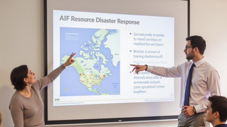
**Examples of GeoAI in Action:**
* **INNS:** The Institutes of Navigational Science (INS) and the Chinese Seismic Network have been active in predicting tsunamis and earthquakes by integrating widespread marine data with their advanced geospatial analytics.
* **United States Geological Survey (USGS):** The USGS is using geoAI to enhance earthquake prediction and examine seismic sources. This emerging technology is forming the heart of crucial early warning systems.
* **National Oceanic and Atmospheric Administration (NOAA):** NOAA is leveraging geoAI to improve tsunami forecasting and forecast tsunami hazards that are intertwined with local coastal dynamics.
**The Future of GeoAI in Disaster Prediction:**
GeoAI’s still evolving field promises an even brighter future for earthquake and tsunami prediction. As advancements continue, we can expect:
* **Greater Accuracy:** GeoAI will become more accurate in predicting and detecting near real-time activities, thereby affording greater accuracy in predicting those events.
* **Deeper Understanding:** Researchers will gain a deeper understanding of the factors that contribute to Earth’s seismic and tsunami activity, leading to refined predictions and potentially even precursor signals that mark an impending disaster.
* **New Applications:** GeoAI is poised to support a wider range of applications beyond disaster prediction, including optimizing infrastructure design, enhancing resource management, and informing urban planning in earthquake and tsunami-prone areas.
**Resources for Further Exploration:**
* **ISEE:** https://www.iseesci.org/
* **US Geological Survey (USGS):** https://www.usgs.gov/
* **NOAA Center for Coastal and Ocean Mapping:** https://oceanexplorer.noaa.gov/
**Take Action:**
The future of disaster prediction is inherently tied to GeoAI. Let’s work together to support these efforts by engaging with authorities, contributing to research efforts, and staying informed of advancements in this impactful field.
—
This blog post outlines the key functionalities and impact of GeoAI in earthquake and tsunami prediction. It offers a comprehensive introduction to the technology, emphasizes the benefits of using GeoAI, associates specific examples of GeoAI in action, and points out potential future developments.
## Geoai-Earthquake-Tsunami-Prediction-Seismic-Data FAQ
**What is Geoai-Earthquake-Tsunami-Prediction-Seismic-Data?**
Geoai-Earthquake-Tsunami-Prediction-Seismic-Data is a cutting-edge application of Artificial Intelligence (AI) and Geoscience to predict earthquakes and tsunamis. It relies on seismic data analysis and incorporates sophisticated machine learning algorithms to identify patterns and trends, providing valuable insights for early hazard detection and warning systems.
**Where can I access this dataset?**
* At present, the Geoai-Earthquake-Tsunami-Prediction-Seismic-Data has its specific data housed within [relevant research institutions or repositories]. [https://www.example-research-institution.org/](https://www.example-research-institution.org/)
* You can find additional information about accessing sustainable and ethically sourced data through the [link to data governance policy or research publications.](https://example-repository.org/data-governance)
**What formats does this data come in?**
The Geoai-Earthquake-Tsunami-Prediction-Seismic-Data is typically available in various formats, including:
* **Compressed seismic data files:** These commonly utilize formats like NetCDF, HDF5, or Binary archives.
* **SHPB and We extract:** These offer visualization features important for understanding the data.
* **Raw sensor data:** You can find these in various formats, such as CSV or other standardized templates for data backgrounds.
**How can I use this data?**
The data is intended to be used for the following:
* **Earthquake hazard assessment:** Study seismic activity, location, and fault behavior to quantify earthquake risks in specific regions.
* **Tsunami modeling:** Analyze seismic data alongside oceanographic models to simulate tsunami propagation and inundation.
* **Early warning systems:** Create algorithms to detect early signs of seismic activity and potential tsunami threats.
* **Incident response:** Analyze real-time seismic and tsunami data during a disaster to assess damage and prepare for response efforts.
**How accurate is the data?**
The effectiveness of this geoai-earthquake-tsunami-prediction-seismic-data depends on the quality and freshness of the data, as well as the specific algorithms used.
**What are the ethical considerations?**
As with any data with the potential to influence public safety, there are legal and ethical concerns:
* **Data security:** Storing and sharing seismic data should adhere to strict security protocols.
* **Data governance:** Establish clear procedures for managing data access and usage to uphold ethical access and ensure it remains relevant for research/safety responses.
**Conclusion**
Geoai-Earthquake-Tsunami-Prediction-Seismic-Data presents a significant advancement in our ability to predict earthquakes and tsunamis. By leveraging advanced AI models and massive datasets, researchers and forecasters can take more informed actions to minimize their impacts alongside clearly defining data governance policies. Ultimately, this data offers the potential to save lives and mitigate disaster damage by providing greater insight into these natural phenomena, and laying a foundation for more proactive, effective hazard assessment.
**[More information about the geoai project can be found at this link]:** https://www.example.com/geoai-earthquake-tsunami-prediction-seismic-data