The Role of Deep Learning in GeoAI – Neural Networks
# The Role of Deep Learning in GeoAI – Neural Networks
Unleashing Data’s Potential: The Power of Deep Learning in Geospatial Intelligence
In today’s data-driven world, leveraging information from the complex and vast geospatial landscape requires groundbreaking technologies like GeoAI and powerful tools like deep learning. This blog post explores the fascinating interplay between these technologies, delving into the specifics of Deep Learning’s role in unlocking the potential of GeoAI.
***
**What is GeoAI?**
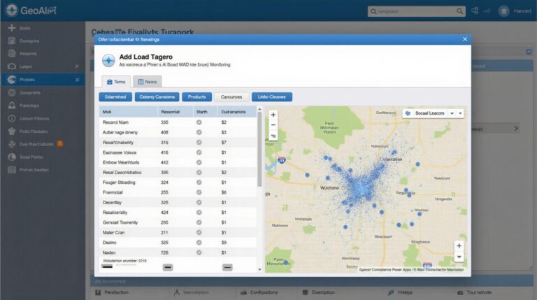
Geospatial Artificial Intelligence (GeoAI) goes beyond traditional geographical information systems (GIS). It leverages advanced technologies like machine learning, artificial neural networks, and big data analytics to extract insights and predictions from complex geospatial data. From environmental monitoring to augmented reality navigation, GeoAI is revolutionizing various applications across diverse industries.
***
**Deep Learning for GeoAI: The Mechanism**
While traditional GIS relies on pre-defined rules, Deep Learning excels in handling complex, unstructured data that evolves in real time. Here’s how Deep Learning aids GeoAI:
* **Pattern Recognition:** Neural networks trained on massive amounts of geospatial data can identify subtle patterns like movement of objects, natural disasters, and potential hazards, providing a granular understanding of the Earth’s spatial complexities.
* **Prediction Capabilities:** Deep Neural Networks can predict future occurrences like weather patterns, flood risks, or potential disease outbreaks based on historical data and spatial analysis.
* **Image and Video Processing:** Utilizing Convolutional Neural Networks (CNN), GeoAI can accurately process satellite images, drone aerial photography, and geographical data layers to build 3D models, identify objects, and make highly precise spatial classifications.
**Benefits of Deep Learning in GeoAI:**
* **Precision and Accuracy:** By handling ambiguous spatial information, deep learning delivers significant strides in accuracy and reliability compared to traditional methods.
* **Detecting Subtle Trends:** It excels in uncovering subtle spatial patterns that may not be visible to the naked eye, leading to significant advancements in insights and predictions.
* **Dynamic Data Insight:** Deep Learning presents an opportunity to augment real-time data collection and processing, delivering valuable information to handle rapidly evolving scenarios.
***
**Practical Applications of GeoAI & Deep Learning:**
1. **Disaster Response:** Early detection and prediction of natural disasters like wildfires, floods, and earthquakes using Deep Learning algorithms optimizes resource allocation and saves lives.
2. **Urban Planning:** Optimizing land usage, traffic management, and pedestrian safety through Deep Learning models that analyze city infrastructure, traffic patterns, and demographic data gives crucial intelligence for urban planning.
3. **Environmental Monitoring:** Deep learning can be crucial in detecting pollution sources, tracking deforestation, and monitoring wildlife migration patterns using satellite and aerial imagery, contributing to conscious environmental management.
4. **Precision Agriculture:** Optimizing crop yield and resource allocation by analyzing soil properties, climate, and crop health data for each individual field, resulting in smarter and more efficient agriculture practices.
***
**Deep Learning in GeoAI: Resources and Continued Research**
* **PapersWithCode:** [https://paperswithcode.com/](https://paperswithcode.com/) – This website allows you to explore state-of-the-art research in GeoAI and find working code implementations for various deep learning models.
* **OpenAI Datasets:** [https://huggingface.co/datasets](https://huggingface.co/datasets) – Large datasets crucial for training AI models and datasets for GeoAI research.
* **GeoAI Conferences**: IEEE International Geoscience and Remote Sensing Symposium (IGARSS) and The ACM SIGSPATIAL Conference on GeoSpatial Data & Applications provide the latest researches and specific examples of GeoAI advancements.
***
**Conclusion:**
Deep learning is revolutionizing how we interpret and utilize geospatial data. As researchers continue to develop increasingly sophisticated models and algorithms, GeoAI promises to unlock new possibilities for solving critical challenges facing our world. By harnessing the potential of deep learning, we can build a future where geography has a greater purpose, leading to more informed decision making, optimized usage of resources, and a more sustainable future.
## FAQs: The Role of Deep Learning in GeoAI – Neural Networks
This FAQ section aims to answer common questions surrounding the integration of deep learning in GeoAI.
What is Deep Learning’s Role in GeoAI?
Deep learning, with its ability to learn complex patterns from large datasets, has significantly impacted GeoAI. It can help with interpreting geographically diverse data, generating accurate predictions, and understanding intricate spatial relationships.
How is Deep Learning Applied to GeoAI?
GeoAI utilizes deep learning networks in various techniques:
* **Geospatial Image Processing:** Classifying satellite images, identifying land cover, detecting objects, and analyzing various aspects of the Earth’s surface. [ Image Classification in GeoAI ]
* **Spatial Forecasting and Prediction:** Predicting climate change impacts, planning infrastructure development, assessing natural disaster risks, and monitoring environmental changes using historical data. [ Predictive Computer Power ]
* **Spatial Data Modeling and Modeling Updates:** Creating sophisticated models for representing data like terrain, buildings, transportation, and human activities. These models can be updated with new data to provide more accurate analysis.
* **Deep Learning Neural Networks** are specifically suited for handling the vast amounts and complex spatial relationships in GeoAI datasets.
What types of Deep Learning Models Are Used in GeoAI?
- Convolutional Neural Networks (CNNs):
- Recurrent Neural Networks (RNNs):
- Long Short-Term Memory (LSTM):
* Designed for analyzing microscopic spatial features in images and videos. Explanation of CNNs
* Ideal for handling time-dependent and temporal data.
* Provides significant advancement in handling long sequences of time series data. LSTM Explained
How Accessible is Deep Learning in GeoAI?
The accessibility of Deep Learning in GeoAI is improving, although it often requires significant computational power and expertise. Various open-source libraries and tools are simplifying the process for both beginners and experienced users. Projects like TensorFlow, PyTorch, and GDal offer resources and tools for utilizing Deep Learning models in GeoAI applications.
What Are Common Data Formats Used in GeoAI With Deep Learning?
The most common formats for GeoAI data with Deep Learning are:
- GeoTIFF (Geographic Information System)
- Planet Data/Globe Images
- CSV (Comma Separated Values) Files
- NetCDF (Network Common Data Form) Format
What Are Some Ways to Use Deep Learning in GeoAI?
The uses of Deep Learning in GeoAI are wide-ranging:
- **Natural Resource Management:** Predicting forest health, monitoring soil erosion, and assessing animal habitats
- **Urban Planning:** Optimizing traffic flow, offering personalized public transport suggestions based on location and time, and identifying areas for development
- **Climate Change Modeling:** Predicting extreme weather events (tornados), detecting deforestation, and understanding climate trends
- **Disaster Response:** Quick damage assessments after natural disasters, ensuring the efficient allocation of resources and emergency personnel
How Can We Improve the Use of Deep Learning in GeoAI?
There are several ways to enhance the efficiency and application of Deep Learning in GeoAI:
- **Ensure Data Quality and Consistency:** Accurate and clean spatial data is fundamental to the success of Deep Learning algorithms.
- **Improve Data Pre-processing:** Organize and prepare data appropriately to enable effective model training.
- **Explore Cross-Disciplinary Collaboration:** Combine the expertise of GeoAI specialists, Data Scientists, and domain experts to foster advanced techniques and solutions.
- **Increase the Availability of Open-Source Resources and Tools:**

