Atlanta zip code Map

New Atlanta Zip Code Map Districts Postal Areas

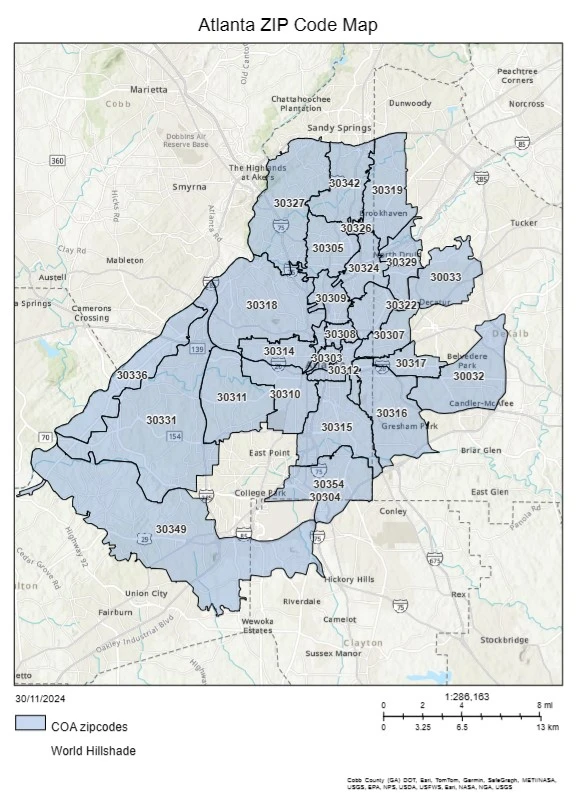
Exploring Atlanta can be tough, especially with its complex postal code system. The Atlanta zip code map is key for everyone. It shows the city’s postal areas and the different neighborhoods they cover. This article dives into Atlanta’s zip code system. We’ll look at its history, structure, and why it matters. Knowing about Atlanta’s zip…

GIS for Solid Waste Management

GIS for Solid Waste Management

In the world of urban planning and city operations, Geographic Information Systems (GIS) play a key role. They help make solid waste management more efficient and sustainable. Cities face big challenges in waste collection, disposal, and analysis. GIS technology is a powerful tool to help solve these problems. GIS offers a detailed, data-based way to…

Transportation Network Analysis with GIS

Enhancing Transportation Networks with GIS

In today’s fast-changing cities, we need better and greener ways to move around. Cities are getting bigger and facing problems like traffic jams and pollution. That’s why Geographic Information Systems (GIS) are key in making our transport systems better. GIS is a powerful tool for analyzing transport networks. It helps experts understand how we move,…

GIS for Urban Growth and Sprawl Analysis

GIS for Urban Growth and Sprawl Analysis

The world is changing fast, with cities growing quickly. This makes it crucial to understand and manage city growth. Geographic Information Systems (GIS) are key tools for city planners and policymakers. They help analyze how cities grow and tackle the issues of urban sprawl. GIS technology offers a detailed, data-driven way to plan cities. It…

GIS and Green Infrastructure

Enhancing Urban Areas with GIS and Green Infrastructure

As cities grow, planners and policymakers seek new ways to make them sustainable. Geographic Information Systems (GIS) and green infrastructure are key tools in this effort. This article shows how these tools work together to make cities better places to live. GIS uses data to help planners understand their cities. It shows everything from land…