Morocco Regions Shapefile
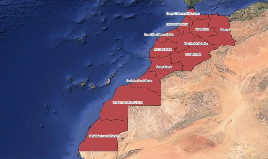
Morocco Regions shapefile and Counties shapefile available for download.
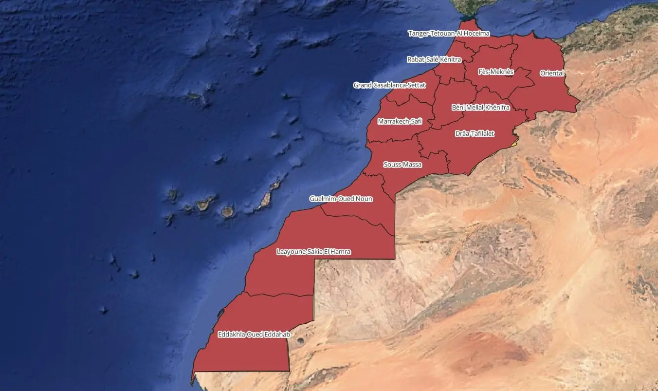
For GIS professionals and researchers, obtaining accurate Morocco regions shapefiles containing administrative divisions is essential for spatial analysis, urban planning, and geographic studies. Morocco is divided into 12 administrative regions, each with distinct boundaries, and these shapefiles can provide a detailed foundation for a variety of GIS projects.
Morocco Region Shapefile
The Morocco Region Shapefile outlines the country’s 12 regions, offering a high-level view ideal for projects focused on regional analysis. This is useful for studying economic zones, resource distribution, or general demographic insights across regions.
Regions List:
- “Tangier-Tetouan-Al Hoceima”
- “Oriental”
- “Fez-Meknes”
- “Rabat-Salé-Kenitra”
- “Béni Mellal-Khénifra”
- “Casablanca-Settat”
- “Marrakech-Safi”
- “Drâa-Tafilalet”
- “Souss-Massa”
- “Guelmim-Oued Noun”
- “Laâyoune-Sakia El Hamra”
- “Dakhla-Oued Ed-Dahab”
Find the Shapefile of the 12 Regions of Morocco from Here
Morocco Counties Shapefile
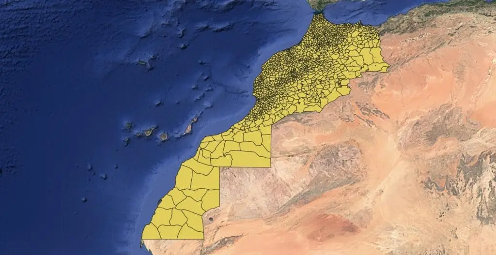
The Morocco Counties (or Provinces) Shapefile contains more localized data, representing Morocco’s numerous counties (provinces or prefectures). This file is especially suited for projects that require finer detail, such as municipal planning, local development, or environmental assessment.
Other Sources for Downloading Shapefiles
You can access these Morocco shapefiles from reliable sources such as:
- GADM (Global Administrative Areas) – Provides free geographic data for countries, including Morocco, with boundaries for regions and counties.
- DIVA-GIS – A trusted source for downloading country-level shapefiles, including those for Morocco’s regions and counties.
- DataHub.io – Hosts multiple GIS datasets, including Morocco’s administrative boundaries, in various formats.
How to Use Shapefiles
After downloading, you can open these files in GIS software like QGIS or ArcGIS to analyze and visualize Morocco’s administrative structure, from high-level regional data down to local county details. These shapefiles are versatile for mapping and spatial analysis, supporting studies from regional planning to detailed municipal development.
You can download more GIS data from here

