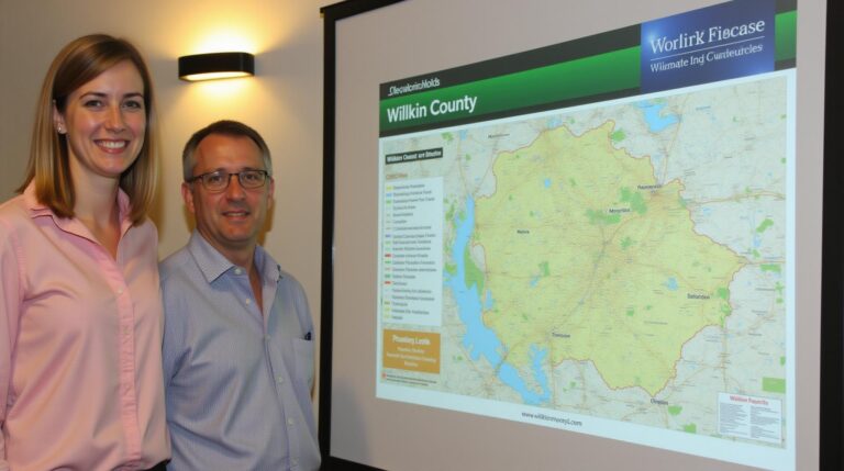
AI in Geospatial Feature Extraction – Image Processing
AI in Geospatial Feature Extraction: Image Processing.

The world is increasingly turning to Artificial Intelligence for complex analysis, and nowhere is this more clear than in geospatial data processing. Geospatial Artificial Intelligence (GeoAI) leverages powerful AI algorithms to analyze and extract valuable insights from geographical data. One crucial aspect of this revolution is **image processing**.
What is Image Processing in GeoAI?
Image processing is a cornerstone of GeoAI, enabling analysts to extract significant features from satellite imagery, aerial photographs, and even satellite-derived images. This involves manipulating and analyzing images to provide context and information about the environment.
**Key Features of GeoAI Image Processing:**
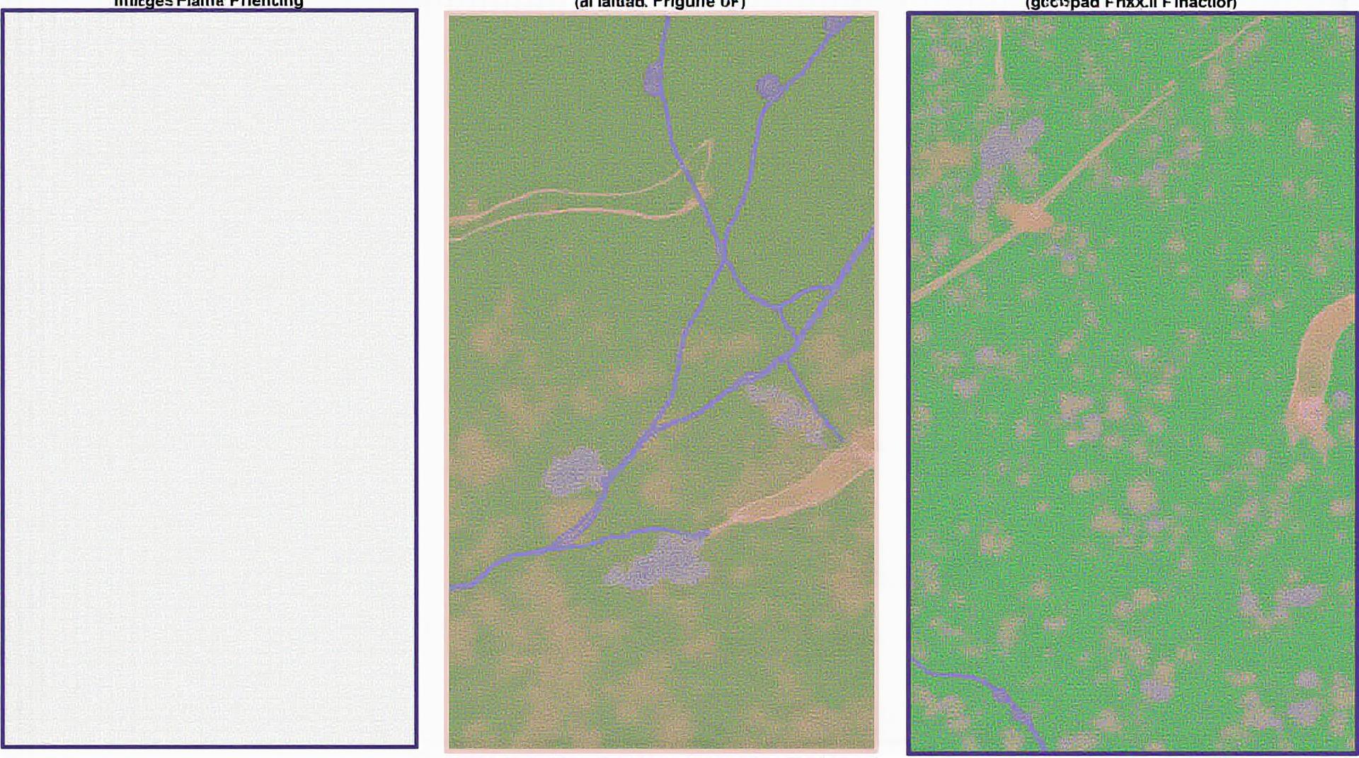
* **Object detection:** Identifying specific objects such as buildings, roadways, water bodies, and vegetation.
* **Land cover classification:** Differentiating different types of land cover such as forests, farmland, urban areas.
* **Feature extraction:** Extracting key geographic features like elevation, slope, shadows, and contours from imagery.
* **Change detection:** Monitoring changes in land cover over time, for example, detecting urbanization or deforestation.
* **Segmentation and anlaysis:** Grouping pixels based on common characteristics, crack filtering, or cropping crops.
Benefits of Using AI for GeoAI Image Processing
* **Accelerated processing:** AI can analyze vast amounts of data in a fraction of time compared to traditional methods. This allows for rapid change detection, land use mapping, and other time-sensitive applications.
* **Enhanced Accuracy:** By applying advanced algorithms to extract precise features, AI ensures improved accuracy in identifying and classifying geographic components.
* **Automated tasks:** AI automates image analysis tasks, reducing human error and saving significant time and labor.
* **New insights from older data.** AI can uncover hidden patterns and insights in older imagery previously overlooked by manual methods.
* **Improved decision-making:** Insight gleaned from geospatial feature extraction allows organizations and policymakers to make more informed decisions, optimizing resource allocation and environmental management plans.
Practical Applications of AI in GeoAI Image Processing
Here are key real-world applications, categorized for easy reference:
**1. Environmental Monitoring:**
* **Forest management:** Tracking deforestation rates, identifying areas for reforestation efforts, and monitoring wildlife habitat.
* **Natural disaster response:** Predicting areas prone to landslides, floods, and wildfires.
* **Climate change adaptation:** Understanding coastal erosion rates, quantifying sea-level rise in coastal areas.
* **Pollution mapping:** Assessing water quality, monitoring urban air quality, and identifying sources of pollution.
**2. Agricultural Management:**
* **Precision agriculture:** Precise mapping of soil properties, identifying ideal planting zones, and optimizing fertilizer and water application techniques.
* **Crop monitoring:** Detecting plant diseases, assessing crop health, and providing early warnings of potential pest outbreaks.
**3. Urban Planning & Infrastructure Management:**
* **Traffic management:** Optimizing traffic flow, identifying congestion hotspots, and developing intelligent transportation systems.
* **Infrastructure maintenance:** Detecting infrastructure deficiencies, allocating essential resources efficiently, and planning repairs.
* **Housing development:** Evaluating the suitability and sustainability of land for housing development.
**4. Security & Land Management:**
* **Border security:** Monitoring borders, detecting illegal activity, and tracking illicit trafficking of goods.
* **Security patrols:** Identifying potential threats and locations of high traffic activity.
* **Land surveying:** Accurate mapping of property lines, identifying discrepancies, and facilitating legal processes.
**Resources for Learning More:**
* **Online Courses:**
* **Google AI Platform:** Offers a specialization on geospatial AI and data science.
* **Coursera courses:** Explore courses in deep learning and image processing that are applicable to GeoAI.
* **Udacity Nanodegrees:** Deepen expertise in GoogleCloud Vision API or computer vision courses.
* **Research Papers:**
* The International Geoscience and Remote Sensing Symposium (IGARSS):
* **Open Source Libraries:**
* **OpenCV:** A computer vision library providing powerful image processing functionalities.
* **Mask Region-based Convolutional Networks (MaskRCNN):** A deep learning model for object detection and segmentation.
* **TensorFlow:** Offers excellent tools for building and training machine learning models in a scalable and convenient way.
Let me know if you’d like to explore a specific application in more detail!
## AI-Geospatial Feature Extraction and Image Processing: FAQs
**What is AI-Geospatial Feature Extraction and Image Processing?**
AI-geospatial feature extraction combines the power of artificial intelligence (AI) with geospatial image processing to automate identifying, classifying, and analyzing geographical features from images. This technology uses advanced algorithms to extract key information from satellite images, aerial photos, and other geospatial data for tasks like:
* ** Landslide mapping**
* **Urban planning**
* **Agricultural analysis**
* **Resource management**
* **Environmental monitoring**
**Where can I find this technology?**
Several platforms and services offer AI-geospatial feature extraction and image processing:
* **Provider 1:** Provider 1 Service
* **Provider 2:** Provider 2 Solutions
* **Open-source options:** Open-source datasets
**What formats are used in AI-geospatial feature extraction?**
A common image format used in AI-geospatial extraction is GeoTIFF (Geographic Tagged Image File Format). Other formats like JPEG, PNG, and shape files are also commonly processed.
**I want to work with geospatial data, but I don’t have any prior technical expertise. How can I get started?**
There are resources available to learn and explore this technology:
* Introduction to Geospatial Image Processing with Machine Learning
* Remote Sensing Specialization
* Image Processing and Feature Extraction in Python
**How can I customize my applications based on my specific goals? **
Many platforms offer customization options:
* **Modifying Models:** Implement custom models to suit specific needs, even creating training data specific to your use case.
* **Fine-tuning APIs:** Adjust existing algorithms for optimized feature extraction.
* **Parameter Optimization:** Tailor model parameters to suit your data and desired outcomes.
**What is the main advantage of using AI-geospatial feature extraction for image processing?**
AI-geospatial feature extraction offers numerous advantages over traditional methods:
* **Faster processing**: It significantly speeds up the feature extraction process.
* **Increased accuracy**: AI can achieve higher precision compared to manual methods.
* **Automation**: Reduces manual effort and increases efficiency.
**Is this technology suitable for big data analysis?**
Yes, AI-geospatial feature extraction can be scaled to handle large amounts of data. Platforms utilizing cloud computing and distributed computing can efficiently manage and process voluminous geospatial data.
**Ultimately, what can I expect from AI-geospatial feature extraction and image processing in specific areas? **
* **Landslide Detection:** Pinpoint problem areas, analyze landslide patterns, and predict future hazards.
* Learn More about Landslide Modeling
* **Farming Management:** Identify areas of growth potential, automate irrigation, and optimize fertilizer application.
* Explore Agricultural Data Analytics
* **Infrastructure Development:** Analyze traffic patterns, locate infrastructure requirements, and predict potential hazards.
**Think of the transformative potential of this technology!**
AI-geospatial feature extraction and image processing are shaping the future of numerous industries and contributing to significant advancements in spatial information management, environmental protection, and urban planning. By leveraging the power of AI, we can gain deeper insights into our world, make informed decisions, and build a better future.
Let me know if you have anymore questions or would like me to elaborate further on any specific aspect!