AI in Geospatial Feature Extraction – Image Processing
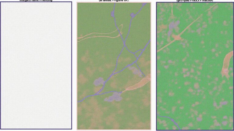
AI in Geospatial Feature Extraction: Image Processing. The world is increasingly turning to Artificial Intelligence for complex analysis, and nowhere is this more clear than in geospatial data processing. Geospatial Artificial Intelligence (GeoAI) leverages powerful AI algorithms to analyze and extract valuable insights from geographical data. One crucial aspect of this revolution is **image processing**….