geoai-wildlife-migration

GeoAI for Wildlife Migration Tracking – Animal Movement

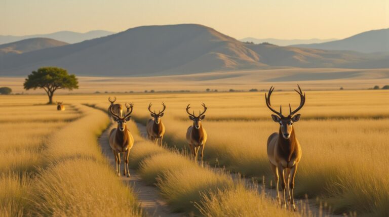
GeoAI for Wildlife Migration Tracking – Animal Movement Wildlife migration is an awe-inspiring natural phenomenon – a biological masterpiece with profound ecological implications. Traditional tracking methods prove time-consuming, imprecise, and often fall short for understanding the journey’s complexities. Enter GeoAI, a revolutionary tool now at the forefront of wildlife movement research, promising a new era…

geoai-land-cover-classification

AI in Geospatial Data Classification – Land Cover Mapping

AI in Geospatial Data Classification: Unlocking Insights through Land Cover Mapping The Power of AI in Land Cover Mapping Traditional land cover mapping relies heavily on visual inspection, laborious data collection, and manual interpretation. However, with the advent of artificial intelligence (AI), a new era of accurate and efficient land cover classification is unfolding. This…

geoai-water-management

GeoAI for Smart Water Management – Resource Allocation

GeoAI for Smart Water Management – Resource Allocation In the face of mounting water scarcity, inefficient water allocation represents a significant challenge. GeoAI emerges as a promising solution, enabling enhanced resource allocation practices across diverse settings. From detecting anomalies to optimizing water distribution, GeoAI is revolutionizing water management. This blog post dives into key features,…

geoai-weather-forecasting

AI-Driven Geospatial Forecasting for Weather Patterns

AI-Driven Geospatial Forecasting: Unraveling Weather Patterns As our world becomes increasingly reliant on high-resolution weather predictions, the role of artificial intelligence (AI) in geospatial forecasting is becoming more critical than ever. Combining powerful algorithms with vast amounts of geographical data, AI is ushering in an era of unprecedented accuracy and precision in weather forecasting, allowing…

geoai-air-quality

GeoAI for Urban Air Quality Monitoring – Pollution Mapping

GeoAI for Urban Air Quality Monitoring – Pollution Mapping Urban air quality has become a critical concern, and understanding its patterns is essential for maintaining public health and environmental well-being. GeoAI, the marriage of geo-data with artificial intelligence (AI), is revolutionizing air quality monitoring by providing valuable insights and improving pollution mapping capabilities. This article…

geoai-data-security

AI for Geospatial Data Security – Privacy Protection

AI for Geospatial Data Security – Privacy Protection The world of geospatial data, rich with location information for a vast array of applications, requires robust security against threats like unauthorized access and data breaches. Thankfully, Artificial Intelligence (AI) is emerging as a vital tool in safeguarding this invaluable information. AI for geospatial data security offers…

geoai-smart-energy-grids

GeoAI for Smart Energy Grids – Renewable Energy

GeoAI for Smart Energy Grids – Renewable Energy The future of energy is smart, decentralized, and increasingly powered by renewable resources. GeoAI, or geographic Artificial intelligence, plays a vital role in harnessing the full potential of this transition. What is GeoAI? GeoAI leverages the power of algorithms and machine learning to analyze geographical data. By…

geoai-data-integration

AI in Geospatial Data Integration – Multi-Source Data

AI in Geospatial Data Integration: Unlocking the Power of Multi-Source Data The world of geospatial data is a vast and interconnected network, containing information about our planet’s physical features, human activity, and vast resources. However, realizing the full potential of this information requires seamless integration of data from various sources, a process that has historically…

geoai-coastal-erosion

GeoAI for Coastal Erosion Prediction – Shoreline Monitoring

GeoAI for Coastal Erosion Prediction: Shoreline Monitoring in the Era of Big Data Our coastlines are constantly evolving, subjected to the relentless forces of wind, rain, and the relentless march of the sea. This is particularly true in today’s world, where climate change, rising sea levels, and increased storm intensity are contributing to more severe…

geoai-3d-mapping

AI-Powered Geospatial Data Visualization – 3D Mapping

AI-Powered Geoospatial Data Visualization – 3D Mapping Modern society relies on quick, clear, and effective ways to understand and engage with large amounts of spatial data. Emerging trends in geospatial data visualization leverage the power of Artificial Intelligence (AI) to translate complex datasets into dynamic and impactful 3D maps. This blog post explores the exciting…