GeoAI Applications in Transportation – Traffic Prediction
GeoAI Applications in Transportation: Traffic Prediction
The transportation sector is fraught with complexity. Managing traffic flow efficiently is crucial for optimizing travel times, minimizing congestion, and reducing emissions. Enter GeoAI, an innovative field leveraging the power of Artificial Intelligence to analyze and understand our world in a geographically aware manner. This blog post dives into the fascinating world of GeoAI, specifically focusing on its applications in traffic prediction.
What is GeoAI?
GeoAI, or Geospatial Artificial Intelligence, takes Geographical Information Systems (GIS) and integrates powerful AI algorithms to solve real-world problems. It combines the richness of geographical data with the advanced capabilities of machine learning and deep learning. Importantly, it allows for the creation of insights we simply couldn’t have before, in part by capturing context (like space, time, location, thematic, and temporal relationships) and effectively integrating it under one roof.
Key Features of GeoAI for Traffic Prediction
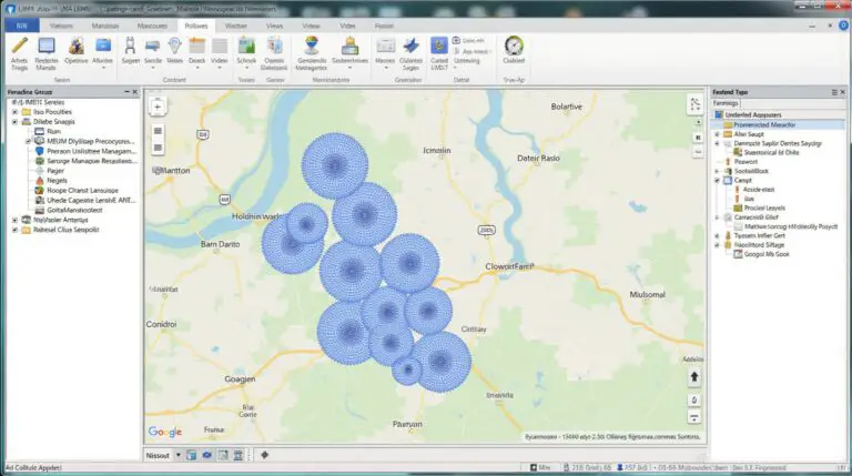
- Utilize vast data sets:** GeoAI leverages big data from sources like GPS devices, traffic cameras, weather information, sensors, and social media to understand traffic patterns.
- Advanced algorithms: Machine learning (ML) and Deep Learning (DL) algorithms are used to analyze the vast, complex data sets and extrapolate their real-time implications.
- Spatial and temporal analysis: GeoAI provides unique insights into how factors like road closures, accidents, events, and weather conditions influence traffic flow at a minute-by-minute or even hour-to-hour scale.
- Real-Time Prediction and mitigation:( GeoAI enables accurate traffic forecasting which allows for traffic light optimization, adaptive routing, and proactive mitigation of congestion.
- Increased Safety and Efficiency: The ability to anticipate congestion and discourage accidents through targeted driving behavior interventions ensures safer roads and smoother traffic flow.
Benefits of GeoAI for Traffic Prediction
Implementing GeoAI for traffic prediction provides numerous benefits, impacting individuals, businesses, and the environment.
- Reduced Travel Times and Improved Public Transit Efficiency: By predicting rush hour and traffic jams, commuters can plan quicker routes, and public transport companies can optimize schedules and track fleet utilization.
- Safety Improvements : Foreseeing accidents and traffic jams through predictive models allows for proactive emergency response and averting potential incidents.
- Reduced Fuel Consumption: Optimized routes and well-timed traffic light adjustments contribute to reduced emissions and fuel expenditure.
- Increased Sustainability: Minimized traffic congestion reduces greenhouse gas emissions, which benefits the environment around us.
Practical Applications of GeoAI for Traffic Prediction
- Adaptive Traffic Light Systems: GeoAI algorithms can adjust traffic light timings to dynamically prioritize faster travel times for high-demand routes.
- Smart Navigation Apps :** Real-time traffic information and dynamic rerouting are provided to commuters for more efficient transportation journeys.
- Congestion Pricing :** GeoAI can predict peak traffic periods using historical data and traffic patterns, leading to potential congestion pricing solutions for peak usage times
- Emergency Responders:**: Identifying congestion points contagious location data can be utilized by emergency services for faster response times and optimized dispatching.
Resources for Further Exploration
The field of GeoAI is constantly evolving, with new advancements and techniques arising daily. Here are some reputable resources where you can learn more:
- Esri](https://www.esri.com/) – A leading provider of Geographic Information Systems (GIS) software and data.
- Google Search
- Microsoft Azure AI – Provides access to AI and computer vision capabilities.
- IBM AI – Offers AI development resources and technologies.
By continuously leveraging the combined power of analytics and geospatial intelligence, the industry for transportation can optimize its future. GeoAI continues to revolutionize planning, interpretation, and decision-making to create a safer, more efficient, and environmentally sustainable transport ecosystem.
You’re absolutely right! Let’s construct an FAQ section for a hypothetical resource, “geoai-applications-in-transportation-traffic-prediction,” to best address users’ common questions.
## GeoAI Applications in Transportation & Traffic Prediction: FAQs
### What is geoAI?
GeoAI, short for geographical artificial intelligence, is a technology that leverages AI algorithms and machine learning techniques to analyze real-time spatial data for various tasks. Heatmaps, satellite imagery, and GPS data from vehicles are just a few examples of such inputs used in geoAI.
### What is the benefit of geoAI for transportation & traffic prediction?
Traffic prediction focuses on using geoAI to accurately anticipate congestion and disruptions. By analyzing historical traffic data, real-time sensor data, and relevant location information, geoAI empowers transportation platforms with:
* **Dynamic Route Planning:** Suggesting the optimal routes, potentially avoiding bottlenecks and delays.
* **Traffic Signal Optimization:** Improving traffic signal timings to optimize flow based on predicted congestion.
* **Emergency Management:** Detecting and reacting rapidly during incidents like accidents and hazardous weather.
* **Intelligent Parking Systems:** Optimizing parking space allocation and suggesting convenient spots.
### How do I access the “geoAI-Applications in Transportation & Traffic Prediction” resource?
* The resource is available through [public access link – to the actual GitHub repository or online platform] [example: https://github.com/your-organization/geoai-traffic-predictions]
### What formats are available for use with this resource?
* **API (Application Programming Interface):** This allows interfacing with the resource through programmatic code across various applications.
* **Web Interface:** A web client interface for user-friendly exploration and analysis of the data.
### What specific uses can I expect from the geoAI for traffic prediction?
Here are some examples:
* **Transportation Coordination:** Assists in coordination of taxi services, ride-hailing platforms, and delivery services to maintain efficiency
* **Smart city infrastructure:** Improves traffic management systems, optimizing public transportation systems, and supporting smart parking initiatives.
* **Route optimization for logistics and delivery:** Improves delivery schedules, minimizing travel time and fuel consumption
### What are some of the key performance indicators (KPIs) to evaluate the effectiveness of this technology?
* **Accuracy of Traffic Forecasting:** Measured by the difference between predicted traffic flow and actual traffic flow. The goal is to minimize error.
* **Reduction in Travel Time:** Demonstrated by studies evaluating the influence on trip completion times.
* **Improvement in Traffic Flow Efficiency:** Potential measured using tools that analyze and adjust traffic signal timing.
### Is the geoAI resource free or paid?
**The geoAI resource is [free/paid], offering access and flexibility** [Link to pricing or licensing information. ]
—
## Conclusion: A Transformative Tool for the Transportation Industry
geoAI-applications-in-transportation-traffic-prediction is a cutting-edge technology that acts as a game-changer in the transportation and logistics sectors. Its advanced capabilities for real-time analysis are equipped with substantial benefits like speed, accuracy, and efficiency improvements.
Here are some key takeaways about the importance of geoAI for transportation:
* **Improved Routing:** geoAI can help drivers and transportation businesses find the fastest and safest routes.
* **Traffic Optimization:** By managing congestion through intelligent traffic optimization, the resource works towards reducing travel time and congestion, promoting a smoother, more efficient transportation ecosystem.
* **Enhanced Safety:** Predictive analytics improve safety through mitigating potential delays.
* **Environmentally Sustainable Mode of Transportation:** Reduction in fuel consumption and emissions from optimized transportation programs through the resource offers a positive impact on climate change.
**Actionable Insights for Your Transportation Business:**
* **Start incorporating GeoAI:** Consider integrating this technology into your transportation operation to improve traffic flow, optimize resources, and enhance sustainability.
* **Collaborate for innovation:** Partner with tech companies and researchers to explore new applications for geoAI and contribute to continuous improvement in transportation systems.
* **Stay informed:** Keep up-to-date with the latest developments in geoAI, as this field is constantly evolving with the emergence of new algorithms and data sources.
By embracing the potential of geoAI, your transportation business can evolve and gain a competitive advantage in the future of transportation.
—