GeoAI for Managing Natural Resources – Mining
## Managing Natural Resources: Embracing the Power of GeoAI
For centuries, we’ve relied on our understanding of the Earth’s natural resources. Mining ore from the ground, farming the land, and managing forests – these are our legacies as a species. However, facing unprecedented environmental challenges, the future needs a smarter, more precise approach to mining, farming, forestry, and natural resource management. This is where GeoAI steps in.
**What is GeoAI?**
GeoAI, short for Geospatial Artificial intelligence, utilizes Geo-spatial data and algorithmic knowledge to unlock the analytical power hidden within the earth’s vast information. This powerful technology combines traditional Earth observation data, like satellite images, with machine learning algorithms to produce maps, insights, and predictions that can optimize and safeguard global resources.
**The Hidden Power of GeoAI for Resource Management:**
GeoAI provides a platform for transforming how we manage, monitor, and use our Natural resources:
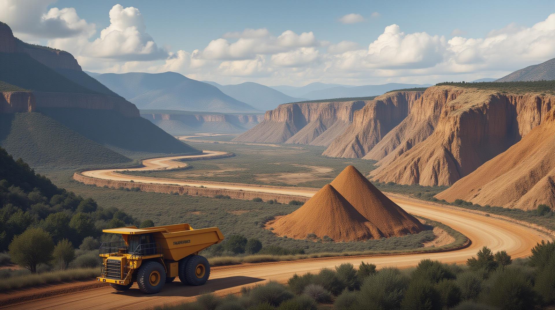
**1. Optimizing Mining:**
* **Improved Resource Allocation:** GeoAI analyzes geological data, weather patterns, and even social dynamics to identify suitable mining areas with the highest potential profit and minimal environmental impact.
* **Predictive Maintenance:** Predictive analytics can anticipate equipment failures, optimize resource allocation, and minimize downtime.
* **Reduced Footprint:** GeoAI helps minimize land disturbance and protect primary habitats by identifying critical areas with sensitive ecosystems and avoiding harsh extraction practices.
**2. Enhancing Agricultural Practices:**
* **Precision Farming:** Real-time assessments of soil health, water availability, and plant status allow farmers to apply needed fertilizers and water, reducing waste and enhancing yields.
* **Disease and Pest Prediction:** GeoAI can predict disease outbreaks and pest infestations, enabling farmers to proactively prevent outbreaks and reduce crop losses.
* **Optimized Irrigation Strategies:** GeoAI models can analyze weather patterns, soil moisture, and crop water needs to personalize irrigation practices for each field and minimize water use.
**3. Protecting Our Forests:**
* **Forest Health Monitoring:** Periodic drone and satellite imagery analysis helps identify deforestation, identify disease outbreaks, and prescribed burning areas. This early detection and mapping helps prevent forest fires and ensure sustainable forestry operations.
* **Timber Resource Management:** GeoAI helps optimize timber harvesting practices by providing accurate insights about forest density and growth projections, minimizing environmental damage and maximizing resource utilization.
* **Biodiversity Conservation:** Geospatial mapping and analysis assist in identifying critical forest areas and endangered species, allowing for more effective conservation efforts.
**4. Managing Water Resources:**
* **Predicting Droughts:** GeoAI analyzes real-time meteorological data and water availability to predict drought occurrences, enabling preparatory measures and water conservation efforts.
* **Monitoring Water Quality:** Satellite remote sensing and hydrological models allow for continuous monitoring of water quality and pollution levels in rivers, lakes, and aquifers, facilitating timely interventions to prevent contamination.
**Benefits of GeoAI in Resource Management:**
* **Enhanced Accuracy:** GeoAI utilizes machine learning to isolate noise and gather truth-filled insights, providing precise, relevant, and actionable data for resource managers.
* **Reduced Costs:** By maximizing resource utilization and controlling waste, GeoAI technology benefits from minimal resource expenditures, making it more economically viable.
* **Improved Efficiency and Speed:** GeoAI systems streamline processes and automate tasks, allowing for faster data analysis, quicker response times, and proactive resource management.
* **Sustainable Practices:** By optimizing resource use and minimizing environmental impact, GeoAI promotes sustainable and responsible practices for the future.
**The Future of GeoAI in Resource Management:**
GeoAI continues to evolve rapidly. With advancements like unmanned aerial vehicle (UAV) technologies and hybrid models that combine satellite imaging and real-time data feeds for greater accuracy and deep insights, the future looks promising.
Resources for Exploring GeoAI:
* **Natural Resources Defense Council (NRDC):** https://www.nrcdc.org/
* **OpenGeoAI:** https://opengeoai.org/
* **GeoAI Hub:** https://www.geoaihub.com/
**By harnessing the power of GeoAI, we can move toward smarter, more sustainable and responsible resource management practices for a better future.**
## GeoAI for Managing Natural Resources and Mining Water: FAQs
Here’s a comprehensive guide addressing your questions about GeoAI, its applications in natural resource management and mining, specifically focusing on water usage:
### Q: Is GeoAI for managing natural resources and mining water available?
**A**: Absolutely! GeoAI is actively being researched and developed. There are various software and frameworks available that are being used for this purpose.
**Resources:**
Geospatial Platform for Water Management Cogent Networks IBM’sGeo Data Platform `
### Q: What formats are commonly used for GeoAI applications in mining water management?
**A**: Several formats can be utilized, including:
- **Shape Files (Shape):** These are standard geographical vector data formats used to represent points, lines, and polygons. This works well for land use, watercourse locations, and mining footprints.
- **GeoJSON:** A lightweight and interoperable format increasingly popular for sharing geospatial data. It provides high-level data representation for both simple and complex objects, suitable for various modeling scenarios.
**Note**: Depending on the specifics of your data and the application, you might combine various formats for a more comprehensive solution.
### Q: What are some of the common purposes and applications of GeoAI?
**A**: GeoAI is applied widely, providing innovative tools and enhancements across multiple geographic information systems (GIS) domain:
* **Real-time Water Resource Monitoring and Assessment:** GeoAI helps monitor groundwater levels, surface water volumes, irrigation requirements, predict potential water shortages, and identify areas susceptible to floods (soil erosion assessment).
* **Hydrology Modelling and Simulations:** GeoAI analyzes and produces simulations, including simulating water flow to inform management of surface water resources and groundwater replenishment.
* **Mining Water Management:** GeoAI helps optimize water extraction methods, minimize water usage from mining operations (conserving stream flows), reduce droughts, and operate more sustainably.
### Q: How easy is it to get started with GeoAI?
**A**: GeoAI accessibility is improving!
* **Cloud-based solutions**: Cloud platforms like Amazon Web Services (AWS), Google Cloud Platform (GCP), and IBM Cloud offer powerful GeoAI tools and services, simplifying implementation and collaboration.
* **Open-source tools**: Many open-source libraries (like TensorFlow, PyTorch) and tools (like QGIS, ArcGIS) provide flexibility and customization for customized GeoAI projects.
**Suggestions To Get Started:**
* Familiarize yourself with basic concepts of space-time databases.
* Identify your project needs (water scarcity, specific mineral/rock).
* Explore available resources, tools, and tutorials.
### Conclusion
GeoAI is revolutionizing the way we manage natural resources and prioritize sustainable mining practices. By leveraging the power of artificial intelligence and geospatial data, we can develop sophisticated, timely, and comprehensive strategies for:
* **Prioritizing water conservation:** Predicting flooding, drought situations, and optimizing irrigation demands.
* **Optimizing mining water usage:** Minimizing consumption with advanced prediction models for efficient water management.
* **Protecting vulnerable ecosystems**: Minimizing environmental impact and ensuring the sustainability of mining operations.
**Take Action**:
* **Explore GeoAI resources:** Look into the resources listed above, as well as other libraries like “Earthtools” (a collection of free Python libraries to help analyze earth science Data), and open-source projects on public repositories like GitHub.
* **Join the growing community:** Engage with online communities of GeoAI hobbyists and professionals.
By embracing this powerful merger of geoinformation and AI, we will pave the way for a more sustainable, responsible, and efficient future for our planet.