AI in Geospatial Data Integration – Multi-Source Fusion
AI in Geospatial Data Integration – Multi-Source Fusion
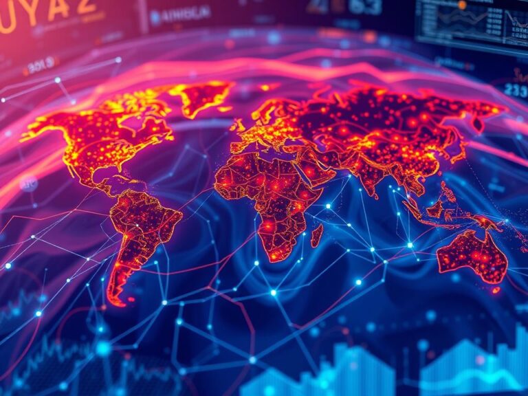
The world is awash in geospatial data, and harnessing its power to understand and analyze our planet’s complexities has become increasingly crucial. However, a major roadblock has always been integrating data from various sources, often with different formats, resolutions, and inherent errors. Enter the exciting realm of advanced artificial intelligence (AI) in geospatial data integration, specifically Multi-Source Fusion (MSF). With MSF, AI tools empower us to combine multiple geographic data sources into a coherent and enriched view, unlocking powerful insights and possibilities.
What is Multi-Source Fusion and AI in Geospatial Data Integration?
Multi-source fusion (MSF) is a data integration process that leverages the power of AI to blend multiple data sources into a unified, integrated framework. Think of it as assembling a puzzle: each individual piece represents a different source of geospatial data (images, satellite data, weather records, sensor data), and AI analyzes their individual characteristics and aligns them to build a complete picture.
This powerful technique goes beyond simple data aggregation. AI-powered MSF approaches constantly learn from each new data point, identifying patterns and correlations that humans might miss, leading to insightful and accurate spatial understanding.
Key Features of AI-Driven MSF:
- Automated Data Handling: AI algorithms take the drama out of messy data collection and perform automated pre-processing, addressing contaminations, noise, and inconsistencies.
- Data Quality Enhancement: AI can spot anomalies and outliers, enhancing data accuracy and building trust in the final fusion product.
- Advanced Prediction and Analysis: By analyzing patterns, AI can forecast future events, predict natural hazards, estimate landmasses, and optimize resource usage.
- Semantic Integration: AI can bridge the gaps between seemingly disparate geospatial data by contextualizing them into a shared language accessible to geospatial intelligence applications.
- Dynamic Fusion: AI learns and adapts, continuously refining data analysis and fusion processes as new data becomes available.
Benefits of AI-based Geospatial Data Fusion:
The adoption of AI in geospatial data integration brings a range of positive outcomes:
- **Enhanced Visualization:** By intelligently blending geospatial data, AI-powered tools offer new dimensions of visual clarity for a comprehensive understanding of spatial features.
- **Real-time Insights:** AI enables rapid analysis of data streams, delivering valuable insights for immediate application, be it in disaster response, infrastructure management, or environmental monitoring.
- **Improved Decision Making:** With accurate, coordinated data from different sources, AI-driven fusion fuels more informed and effective decisions across various sectors.
Practical Applications:
The impact of AI in geospatial data integration is vast, driving innovations across numerous industries and scientific fields:
- **Urban Planning and Development:** Analysis of pedestrian movement, traffic flow patterns, and housing demand.
- **Disaster Response:** Rapid assessment of affected areas, accurate evacuation routes, resource allocation.
- **Environmental Monitoring:** Predicting weather patterns, identifying deforestation, detecting pollution patterns.
- **Defense and Security:** Analyzing aerial imagery, tracking movements of military assets, identifying potential threats.
- **Infrastructure Management:** Optimizing maintenance schedules, detecting infrastructure failures, and managing site construction projects.
Resources for Further Exploration:
Beyond this introductory exploration, here are some valuable resources to delve deeper into AI in geospatial data integration:
- **U.S. Geological Survey (USGS):** https://www.usgs.gov/
- **NASA Earthdata Search:** https://search.earthdata.nasa.gov/
- **Geospatial Open Source Labs:** https://geospatialopensourcelabs.com/
By harnessing the power of AI and multi-source fusion, we are rapidly ushering in a new era of geospatial intelligence, equipped to tackle complex challenges and unlock unprecedented possibilities in understanding and managing our world.
Check similar topics:
FAQs about GeoAI-Multi-Source Fusion
Get answers to common questions about our GeoAI-Multi-Source Fusion platform and how it can unlock valuable insights for your organization.
What is GeoAI-Multi-Source Fusion?
GeoAI-Multi-Source Fusion is a powerful technology that combines multiple data sources—including satellite imagery, lidar, traditional geospatial maps, and social media data—to create a richer, more complete understanding of the world. It leverages artificial intelligence and advanced machine learning algorithms to analyze and understand these diverse datasets, delivering valuable insights otherwise inaccessible.
What types of data does GeoAI-Multi-Source Fusion process?
- Satellite imagery
- Lidar data
- Traditional geospatial maps
- Social media data
How is it different from single-source geospatial data analysis?
Single-source analysis provides insights based on a limited data perspective. GeoAI-Multi-Source Fusion leverages a multitude of data sources, allowing for a more comprehensive understanding of the landscape. This leads to richer analysis, more accuracy, and more accurate predictive outputs.
What software packages or tools does it utilize?
Our GeoAI-Multi-Source Fusion utilizes the latest proprietary software and open-source libraries built on a robust framework, enabling flexible and powerful processing.
What are the available formats for GeoAI-Multi-Source Fusion data?
We offer various formats, including GeoTIFF, shapefiles, JSON (for data sharing and integration), and other custom formats as needed. Learn more about our dataset options.
How can I use GeoAI-Multi-Source Fusion?
Our platform offers intuitive interfaces and API workflows for different use cases ranging from website maps and feature development to large scale analysis and forecasting.
Why is GeoAI-Multi-Source Fusion Important?
GeoAI-Multi-Source Fusion is transforming how we perceive the world and utilize data. Here’s why it’s crucial:
* **Increased Accuracy:** Combine multiple data sources eliminates bias and provides a more accurate understanding of real-world situations.
* **Greater Insights:** Overcomes limitations of single-source data and reveals hidden connections, fractures, and trends.
* **Proactive Decision Making:** Use predictive analytics from real-time data to foresee issues, optimize operations, and plan for the future.
* **Enhanced Collaboration:** Share insights from diverse data sources with colleagues and stakeholders in a user-friendly format.
Learn More and Get Started Today
Ready to unlock data’s full potential? Visit our website or contact our team to learn more about how GeoAI-Multi-Source Fusion can benefit your organization. www.techgeo.org


