How GeoAI Optimizes Emergency Response – Search & Rescue
How GeoAI Optimizes Emergency Response – Search & Rescue
The global focus on collaborative and efficient emergency response has grown immensely, driving a sharp rise in the demand for innovative technology solutions. GeoAI, with its ability to seamlessly analyze massive amounts of geospatial data, is proving to be a game-changer in emergency management, particularly in search and rescue missions. This cutting-edge technology is revolutionizing the way we tackle complex crises and saving lives.
Understanding GeoAI
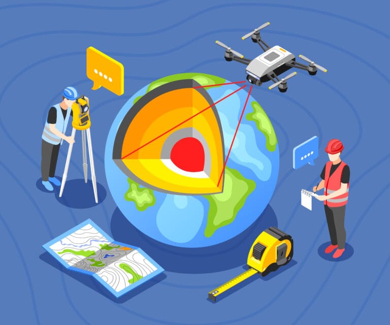
GeoAI leverages artificial intelligence (AI) to analyze and interpret geographic information. This data can range from satellite imagery, images from drones, sensors, and even historical data from different agencies. For search and rescue operations, GeoAI works by:
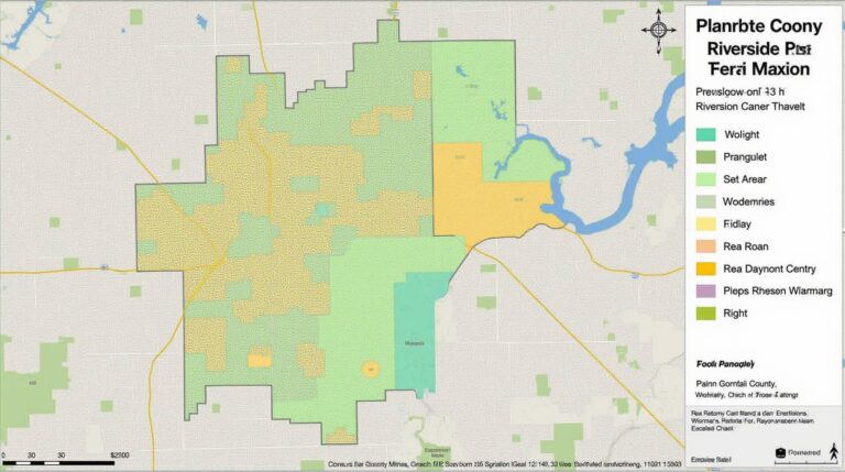
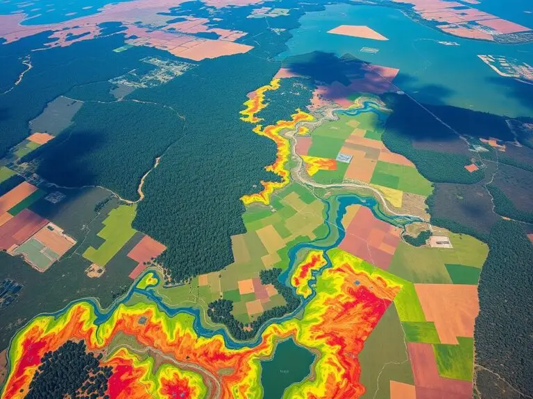
- **Visualizing & analyzing complex terrain:** Maps and satellite imagery reveal challenging obstacles, dense vegetation, and inaccessible areas, which are crucial for guiding search operations in complex environments.
- **Identifying potential hazards:** GeoAI detects hazardous conditions like flooding, landslides, or other natural disasters, providing real-time warnings and proactive safety measures.
- **Optimizing resource deployment:** GeoAI analyzes location data from numerous responders, identifying the optimal routes for accessing disaster zones and predicting where the need for aid will be greatest.
### Benefits of GeoAI for Search & RescueEfforts
GeoAI’s integration into search and rescue operations delivers significant advantages over traditional methods:
- **Improved Response Speed & Efficiency:** Faster decision-making and optimized resource allocation contribute to quicker and more effective response times.
- **Enhanced Situational Awareness:** Real-time access to critical data in various formats ensures complete awareness of the ever-changing incident scenario.
- **Precise Search Targeting:** Identify individuals in need through crowd density analysis and location prediction within disaster areas.
- **Proactive Risk Mitigation:** Identifying and addressing potential hazards through predictive models, minimizing future risks.
- **Enhanced Coordination & Collaboration:** GeoAI fosters collaboration across different agencies, creating a unified front to tackle challenges.
Practical Applications of GeoAI
Here are real-world examples of how GeoAI is being utilized in search & rescue operations:
- **Hurricane Katrina (2005):** Extensive use of satellite imagery for damage assessment and location tracking of missing persons that revolutionized disaster response and resource allocation.
- **The Nepal Earthquake (2015):** Real-time mapping of damaged infrastructure, geolocation of victims, and coordination of rescue efforts critical for maximizing efficiency and minimizing casualties.
- **Wildfires:** GeoAI software effectively monitors fire spread patterns and analyzes real-time weather data to predict future fire hotspots, enabling proactive evacuations and controlled burns.
- **Pandemics:** GeoAI analyzes locations of infected individuals, traffic patterns, and movement data to optimize public health measures and resource distribution.
Choosing the Right GeoAI Solution for your Needs
Selecting the right GeoAI platform for your specific search and rescue scenarios requires careful consideration. Key factors include:
- **Platform accessibility:** Choose a platform that can integrate seamlessly with existing infrastructure and data sources.
- **Integration capabilities:** Ensure the platform can flawlessly integrate with existing geographic information systems (GIS).
- **Training and support:** Select a provider that offers robust training programs and
dedicated ongoing support to ensure your team can extract maximum value. - **Scalability:** Evaluate the platform’s ability to adapt to evolving response tasks as they grow in complexity.
The geoAI landscape is evolving rapidly, with new tools and technologies being continuously developed. Staying updated with best practices and adopting these developments can be crucial for your organization to stay ahead in the race for effective emergency interventions.
Resources and Further Learning
To stay informed about the latest innovations and best practices in GeoAI:
- **The Data & Analytics Initiative at Geographic Information Systems Association of Australia**: https://gisnsw.org/resource/geoai-for-disaster-response/
- **The International Geospatial Data Committee (UN/FAO)**: https://www.fao.org/geospatial/geoai-for-sustainable-development/
Getting Started with GeoAI
While GeoAI holds enormous potential for improving emergency response, implementing it might seem daunting. Here’s a starting point for embracing the technology:
- **Assess your organization’s data landscape:** Identify the core datasets your GeoAI system will leverage.
- **Define clear use cases:** Specify how GeoAI will be integrated with existing workflows.
- **Collaborate with experts:** Seek advice from GeoAI experts in your area.
GeoAI’s ability to process data more effectively and faster than traditional methods, makes it a powerful tool that can help save lives and minimize damage in emergency situations. Be an advocate for its adoption and join the movement for a safer and more resilient future.
## GeoAI Optimizes Emergency Response Search & Rescue FAQs
This FAQ section aims to address common queries about geoAI-optimizes-emergency-response-search-rescue.
What is GeoAI-Optimizes Emergency Response Search & Rescue?
GeoAI-Optimizes-Emergency-Response-Search-Rescue refers to a geo-spatial artificial intelligence system that leverages the power of geographic information systems (GIS) and artificial intelligence (AI) to enhance and optimize emergency response search & rescue (SAR) operations.
What is it capable of?
GeoAI systems offer several capabilities to optimize SAR efforts:
- Enhanced Situational Awareness: Provides real-time visualization of incident data through interactive maps and analytics, enabling better understanding of the environment and potential risks.
- Automated Resource Allocation: Optimizes resource deployment based on real-time situational data, leading to faster and more efficient response.
- Forecasting and Prediction: Uses predictive analytics to forecast the potential spread of hazardous situations, aiding in proactive resource allocation.
- Tracking and Coordination: Facilitates real-time communication and coordination between responders, enhancing collaboration and ensuring timely interventions.
- Individual Safety and Relief: Automates location-based alerts, raises awareness of potential dangers, and facilitates faster relief patrols.
What formats are supported by GeoAI-Optimizes Emergency Response Search & Rescue?
GeoAI systems can process and integrate various data formats, including:
- On-Scene Data: Satellite imagery, drone footage, motion sensors, and text stroke data from first responders
- Public Datasets: Reports from citizens, weather data, and demographic information from official sources
- Predictive Modeling: Climate modeling, social media sentiment analysis, and historical incident data
How does GeoAI optimize Emergency Response Search & Rescue Operations?
GeoAI achieves optimization by leveraging technologies like machine learning algorithms and computer vision to correlate, analyze, and interpret spatial and temporal information to:
- Analyze missing person reports and instantly display the risk and potential locations for searches.
- Predict possible evacuation routes for large populations.
- Detect and eliminate false alarms by analyzing real-time data comparisons.
Where can I learn more about GeoAI-Optimizes Emergency Response Search & Rescue?
Visit our website today to explore detailed information and case studies of how we are leveraging GeoAI for improved emergency response.
Conclusion
Hoever, temporal adjustability becomes crucial for making the GeoAI-Optimizes Emergency Response Search & Rescue system adaptable and impactful in a wide range of emergencies, such as floods, earthquakes, wildfire etc.
With its accuracy, efficiency, and adaptability, the future of SAR and PA relies heavily on integrating advanced technologies like geoAI into our existing systems.
By implementing geoAI in search and rescue operations, we can equip first responders with the appropriate tools to respond more efficiently and effectively during emergencies.
This understanding will encourage rapid development and widespread adoption, maximizing the efficiency and cost-effectiveness of emergency response efforts, saving lives.