The Role of GeoAI in Smart Water Management – Aquatic Resources
The Role of GeoAI in Smart Water Management – Aquatic Resources
Introduction
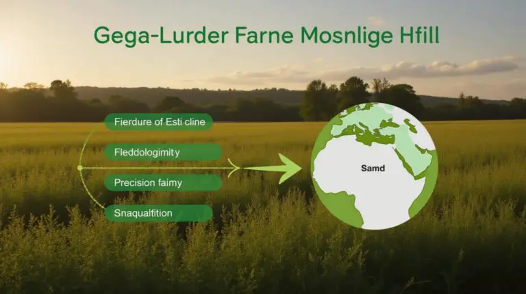
Managing aquatic resources effectively requires comprehensive data analysis and insightful predictions. Credit for this shift goes to GeoAI (Geospatial Artificial Intelligence), a burgeoning technology that is reshaping our understanding and management of our aquatic ecosystems. In this blog post, we will delve into the intricacies of GeoAI, identify its key features, outline key benefits, and explore practical applications for improving smart water management.
### What is GeoAI?
GeoAI is essentially the application of artificial intelligence (AI) techniques to geographic data. Traditional geographic information systems (GIS) relied on static, visual representations of data. GeoAI extends this by leveraging AI algorithms to analyze, interpret, and predict patterns in spatial data. This enables us to extract meaningful insights from vast datasets that previously remained unfiltered.
### Key Features of GeoAI:
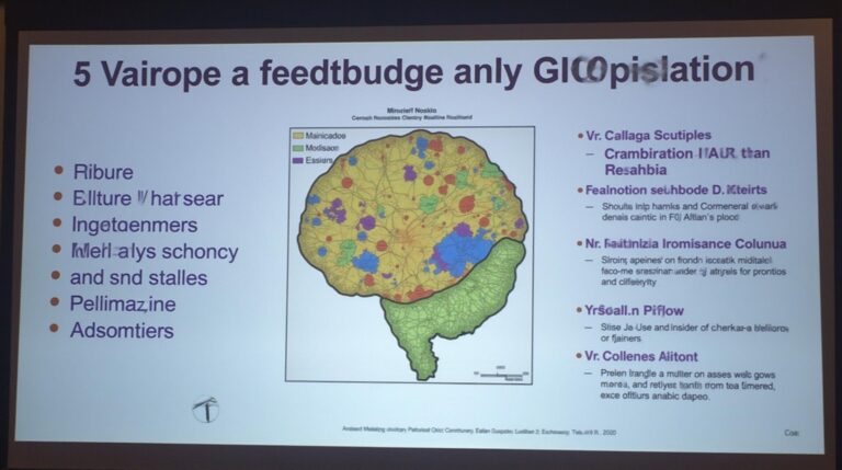
* **Data Processing:** GeoAI excels at processing massive datasets generated from remote sensing instruments, water discharge sensors, weather stations, and citizen science platforms.
* **Predictive Modeling:** GeoAI identifies trends, analyzes changes, and predicts future water use patterns, allowing for proactive water resource management. This includes forecasting aquifer depletion, flood risk, and water quality degradation.
* **Automation and Efficiency:** GeoAI automates tasks such as water quality monitoring, pollution detection, and field data collection, reducing human effort and providing real-time insights.
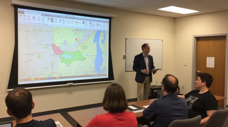
* **Visualization and Interpretation:** GeoAI makes intricate spatial data accessible and understandable through interactive maps, charts, and algorithms. This facilitates visual identification of critical water quality issues, distribution, and usage patterns.
### Benefits of GeoAI in Aquatic Resources Management:
* **Improved Resource Allocation:** GeoAI helps optimize water distribution networks and target water treatment infrastructure to specific needs, conserving water resources.
* **Early Warning Systems:** By forecasting and modeling drought or flood situations, GeoAI can be used to issue timely alerts, reducing disruption and loss.
* **Enhanced Environmental Monitoring:** GeoAI technology enables real-time monitoring of water quality and pollution levels across aquatic environments, allowing for prompt identification and management of harmful events.
* **Optimal Aquaculture Practices:** GeoAI helps improve aquaculture efficiency by providing detailed insights into the fish population and water quality, leading to healthier fish and optimized resource utilization.
### Practical Applications: Smart Water Management
* **Aquifer Management:** GeoAI analyses groundwater flow patterns, identifies potential leaks, and predicts recharge rates, promoting efficient resource management.
* **River & Estuary Management:** Realizing benefits of drone data, GeoAI helps monitor river flows, pollutant concentrations, and changing salinity levels, facilitating better restoration and conservation plans.
* **Water quality monitoring:** GeoAI can map water treatment plants, identify contaminants in various water sources, and track human activities impacting river hydrology and water quality.
### Resources to Explore:
* **Data Platforms:**
* Google Earth Engine
* USGS Earth Explorer
* NASA Earthdata
* **AI & GIS Software:**
* ArcGIS Pro
* QGIS
* CARTO
* Planet Labs
* **Academic Research:**
* Journal of Water Resources Planning and Management
* Journal of Environmental Management
* IEEE Transactions on Geoscience and Remote Sensing
### Conclusion
The application of GeoAI in smart water management presents a powerful solution to address current and future challenges in aquatic resources management. By combining geographic context with AI processing, GeoAI not only provides a deeper understanding of our aquatic ecosystems but also offers robust tools and insightful predictions to improve decision-making and promote sustainable and effective water resource stewardship.
Let us know your thoughts and experiences with GeoAI in the comments section below!
## GeoAI for Smart Water Management – FAQs
This section provides answers to frequently asked questions about geoAI solutions for smart water management and aquatic resources.
### **What is geoAI for Smart Water Management?**
GeoAI refers to the application of artificial intelligence (AI) and geospatial technologies to optimize water management. GeoAI helps capture real-time information about water resources and infrastructure, predict potential issues, and plan efficient strategies for water conservation, allocation, and distribution.
### **Availability of GeoAI Tools:**
* Various software tools and platforms offer geoAI capabilities, including:
* Predictive water allocation solutions – Youtube video demonstrating the application of geoAI for water distribution planning.
* Ostalo.ai – an AI platform providing predictive insights and solutions for water management problems.
* AquaCalc – specializes in database aggregation and analytics for data-driven water management.
### **Data Formats:**
Essential data for geoAI can come in various formats, including:
* **Geospatial Data (e.g., satellite images, LiDAR, GIS):** Provides topographical information, vegetation patterns, and other asset locations.
* **Sensor Data (e.g., IoT, remote sensing):** Collects real-time information on water levels, flowrates, and other water quality parameters.
* **Climate Data (e.g., weather data, climate models):** Influences water availability and helps detect seasonal fluctuations.
### **How to Use GeoAI for Smart Water Management:**
GeoAI tools enable various applications:
* **Resource Allocation and Distribution:** Optimizing water distribution based on demand and real-time water availability.
* **Leak Detection and Repair:** Real-time monitoring of pipelines and infrastructure to detect leaks and prioritize repairs.
* **Pollution Control and Management:** Identifying pollution incidents and implementing targeted remediation strategies.
* **Groundwater Resource Management:** Monitoring aquifers, predicting recharge rates, and optimizing water abstraction.
* **Climate Change Adaptation:** Understanding long-term impacts of climate change on water resources and developing adaptation strategies.
### **Why is GeoAI for Smart Water Management Important?**
GeoAI solutions for smart water management offer significant benefits:
* **Water Conservation:** Optimize resource allocation for effective water conservation. Unveiling the link between geoAI and the UN SDGs
* **Resource Planning:** Enhance infrastructure planning and resource management to ensure sustainable resource accessibility. Explore Circle of Power’s resource management designs
* **Cost Effectiveness:** Integrate geoAI data across operations for reduced resource expenditures and efficient decision-making.
* **Sustainability and Resilience:** Enhance infrastructure resilience against climate change effects and promote sustainable water practices.
**Actionable insights:**
* Invest in upgrading aging water infrastructure to maximize efficiency and reduce leakage.
* Leverage geoAI for early leak detection and rapid repair measures to minimize the environmental impact.
* Foster collaboration and knowledge sharing among water resources stakeholders.
* Promote public awareness of the benefits of smart water management to encourage public engagement and support.
* Incorporate geoAI into local and national water governance policies for comprehensive and sustainable water management.
By implementing geoAI, we can significantly accelerate the transition towards a water-secure future.