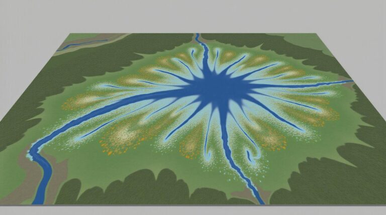
GeoAI in Wildlife Conservation – Habitat Mapping
GeoAI in Wildlife Conservation – Habitat Mapping
The future of wildlife conservation often hinges on data – a vast ocean of information about animal locations, breeding habits, and the changing landscapes they inhabit. Enter geospatial artificial intelligence (GeoAI), a powerful tool revolutionizing how we manage our planet’s biodiversity. Specifically, GeoAI plays a crucial role in habitat mapping – providing a comprehensive roadmap for protecting and managing vital ecosystems.
What is GeoAI and How Does It Work?
GeoAI combines the power of geographic information systems (GIS) with artificial intelligence algorithms. GIS traditionally handles data like satellite images, GPS data, and maps, while AI leverages complex machine learning techniques to analyze and decipher patterns, predict trends, and gain deeper insights. These two disciplines combine to offer a robust approach to habitat mapping.
Benefits of GeoAI for Habitat Mapping
The use of GeoAI for habitat mapping generates numerous benefits, including:
- **Enhanced Accuracy:** Traditional methods of habitat mapping can be time-consuming and require extensive field data collection. GeoAI drastically reduces these time and resource demands, resulting in much more detailed and accurate maps.
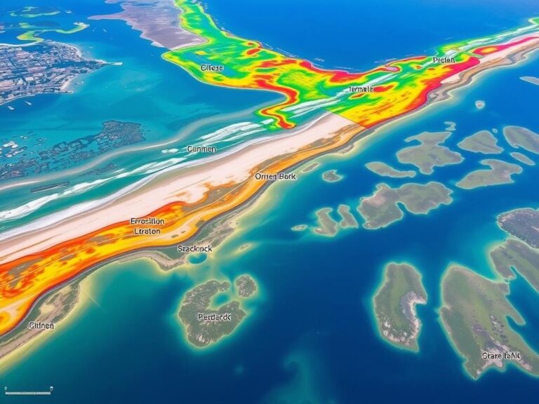
- **Greater Precision:** GeoAI identifies complex patterns and features not easily discernible by the human eye, especially in vast and remote environments like jungles or vast wetlands. This allows for finer categorization of habitat types.
- **Dynamic Monitoring:** GeoAI integrates real-time data stream from IoT sensors, drones, and other sources to give a constantly updated view of habitat change over time. This allows for agile responses to threats and changes in animal populations.
- **Predictive Modeling:** With historical data and real-time observations, GeoAI allows researchers to make predictions about future habitat distribution and habitat change, aiding conservation planning ahead of potential threats.
- **Cost-Effectiveness:** By replacing expensive and time-consuming field surveys, GeoAI streamlines conservation efforts and lowers the overall cost of habitat mapping.
Practical Applications of GeoAI in Wildlife Conservation
The powerful insights from GeoAI enhance almost every facet of wildlife conservation. Here are just a few examples:
- **Identifying and Protecting Crucial Habitats:** GeoAI software can precisely delineate critical habitats for endangered species, lands suitable for reintroduction programs, and areas needing habitat regeneration.
- **Monitoring Poaching and Illegal Activities:** By tracking animal movements and habitat changes, GeoAI can quickly identify patterns linked to poaching and illegal logging.
- **Predicting and Managing Disease Outbreaks:** AI-driven models can identify areas suitable for disease vectors, thereby facilitating early intervention and containment.
- **Estimating Population Sizes:** Using imagery and ground truth data, GeoAI can create models for estimating the size of animal populations and identifying suitable areas for conservation efforts.
- **Curating Protected Areas:** AI helps prioritize areas for conservation, considering ecological, social, and economic factors.
Explore Resources for Implementing GeoAI
Want to learn more about GeoAI and its potential for wildlife conservation? Look no further.
- **World Resources Institute (WRI):** https://www.wri.org/ – WRI is a leading organization dedicated to conservation research and advocates particularly for the application of GeoAI and other technological innovations in protecting wildlife and their habitats.
- **Conservation Science Alliance: ** http://www.conservationcalliance.org – Offers a dedicated program focusing on using data and technology to scale conservation efforts, including those involving AI.
- **Google Earth Engine: ** https://earthengine.google.com/ – A cloud-based platform offering tools for analyzing and visualizing large-scale satellite imagery and other Earth observation data
Conclusion: GeoAI’s Future in Wildlife Conservation
As we move toward a future with even greater technological advancements, GeoAI promises to be a game-changing tool in wildlife conservation. By improving our understanding of ecosystems, helping researchers detect and mitigate threats, and enabling more accurate habitat mapping, GeoAI offers hope for a future where humans and wildlife co-exist in harmony. Understanding and embracing these benefits marks a crucial step forward in the advancement of our understanding and protection of the Earth’s precious biodiversity.
## Geoai-Wildlife-Conservation-Habitat-Species-Tracking: FAQs
**Here are some frequently asked questions about geoai-wildlife-conservation-habitat-species-tracking:**
What is geoai-wildlife-conservation-habitat-species-tracking?
Geoai-wildlife-conservation-habitat-species-tracking refers to the application of Geo-AI (Geographic Artificial Intelligence) techniques to enhance wildlife conservation efforts. It uses a combination of advanced spatial data analysis, machine learning, and geospatial imagery to track animals and gather valuable data on their habitat use, breeding patterns, migratory routes, and interactions with potential threats.
### What is the overall aim?
This technology seeks to monitor wildlife populations and habitats, allowing researchers and conservationists to:
* **Develop better conservation strategies:** By understanding animal movements and habitat use, interventions can be targeted more effectively for protection.
* **Track animal populations:** This helps assess the health and stability of a specific species.
* **Identify and mitigate threats:** Geoai allows for early detection of encroachment, poaching, habitat destruction, and other threats, enabling timely interventions.
* **Navigate complex challenges:** Large-scale conservation efforts become more efficient and data-driven due to the integration of spatial data.
### Who can benefit from this technology?
* **Researchers:** Geoai provides a powerful tool for collecting and analyzing rich datasets.
* **Conservationists:** This technology supports on-the-ground monitoring programs and raises the efficiency of conservation efforts.
* **Government agencies:** This data feeds into national and international conservation plans and policy decisions.
* **Researchers and enthusiasts:** Anyone interested in understanding animal movements and habitat changes will benefit from this approach.
How do I access geoai-wildlife-conservation-habitat-species-tracking data & resources?
Data and resources available through geoai-wildlife-conservation-habitat-species-tracking project can be found at: NOAA Sustainable Management
The website hosts resources, publications, and information related to how NOAA is utilizing GeoAI in its ongoing conservation efforts.
### What formats are available?
Data presented through geoai-wildlife-conservation-habitat-species-tracking often come in formats like:
* **Maps:** Visualization of species distribution, animal movements, and habitats.
* **Modeling outputs:** Predictive models specifying animal presence and habitat suitability.
* **Data repositories:** Online databases for access and sharing.
* **Analysis platforms:** User-friendly tools for visualizing and assessing spatial data.
### What kind of equipment is needed for people to use this technology?
The technology can be implemented to diverse levels through:
1. **Simple smartphone app:** While an advanced analysis framework might require significant timestamps and computing power, basic applications with camera and GPS capabilities can gather rudimentary tracking data with limited technical requirements.
2. **Location Sensing and Tracking Microphones:** Placement withinwhraging environments allows species’ voices to be listened to and potentially turn into data by automated analysis.
3. **Novel Sensors and Infrastructure:** New sensor technology and tracking systems are being developed that are becoming essential in the modern era of GeoAI.
### Can Geoai-Wildlife-Conservation-Habitat-Species-Tracking be used for species restoration?
Yes, by using GeoAI to understand species dynamics, we can implement interventions and create guidelines for areas that need restoration. For example:
* **Defining habitat connectivity:** GeoAI can identify areas that need to be preserved or restored for species movement and connectivity.
* **Predicting species reintroduction:** Adopting this technology allows scientists to anticipate viable areas for reintroduction of threatened plant and animal species.
* **Monitoring restoration projects:** Tracking animal movements after reintroduction helps assess the effectiveness of conservation efforts.
## Conclusion
The adoption of Geoai-wildlife-conservation-habitat-species-tracking technology promises to revolutionize conservation efforts across the globe.
By providing an unprecedented level of detail on vegetation, wildlife, and environmental changes, its application can significantly contribute to protecting our planet’s biodiversity.
Geoai-wildlife-conservation-habitat-species-tracking highlights the immense potential of this technology, but it demands good governance to ensure its responsible implementation. This can include standardizing data, safeguarding privacy, and addressing broader societal issues surrounding wildlife conservation.
We need to act collectively to ensure that all creatures on our planet have the chance to thrive in healthy environments for all generations.