The Role of Machine Learning in GeoAI – Predictive Models
The Role of Machine Learning in GeoAI – Predictive Models
Unveiling the Power of Location Intelligence
The world is overflowing with data, and its location matters. This is where **Geospatial Artificial Intelligence (GeoAI)** comes into play. GeoAI is like geospatial AI, offering a cutting-edge fusion of data science, GIS technology, and advanced algorithms to analyze and glean meaning from geographically-rich information. This new frontier enables us to understand, predict, and influence the world around us with remarkable accuracy. At the heart of GeoAI lies the power of **Machine Learning (ML)**, transforming how we understand and leverage geographical data.
Diving into GeoAI: Key Features and Concepts
Below, we delve into the key features, benefits, and applications of GeoAI, highlighting the vital role of ML in its success:
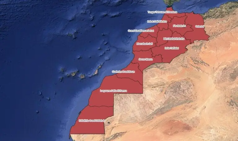
* **Precise Data Aggregation:** GeoAI can effectively analyze and manage vast amounts of structured and unstructured geographical data from diverse sources, like satellite imagery, sensor networks, and crowdsourced data.
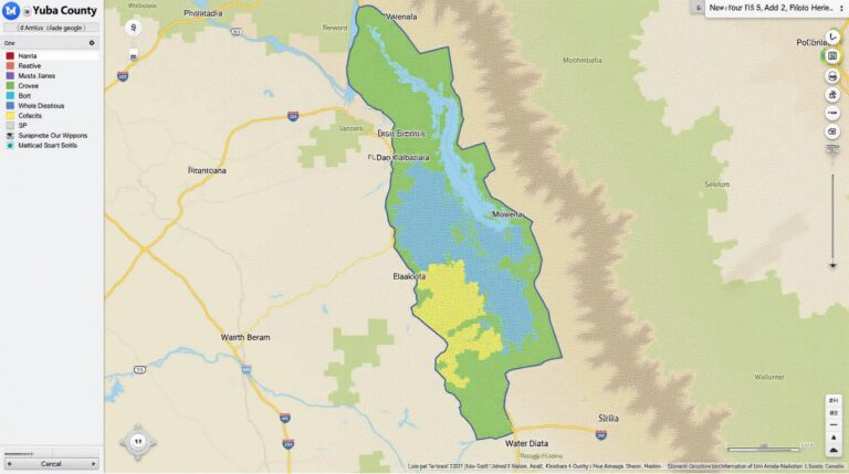
* **Dynamic Data Visualization:** GeoAI empowers us to visualize data in a dynamic and interactive way, revealing correlations and patterns that might otherwise remain hidden. These visuals range from custom maps to 3D representations of terrain and infrastructure.
* **Predictive Analytics:** ML-powered algorithms, exceptionally well suited for geoAI, predict future trends and outcomes based on past patterns and historical data. This opens up opportunities in demographics, traffic flow, weather forecasting, environmental analysis, and business intelligence.
How Machine Learning Fuels GeoAI’s Predictive Power
Machine learning provides the engine of prediction and analysis in GeoAI. Here’s how:
* **Pattern Recognition:** ML algorithms excel at identifying subtle patterns and relationships within geographically-based data. They can learn from historic information, recognizing complex interactions like seasonal trends or changes in population density.
* **Classification:** ML techniques can categorize similar locations and objects, effectively classifying areas as agricultural land, urban centers, or natural disaster zones with impressive accuracy.
* **Data Clustering:** This process groups similar data points together, allowing us to identify clusters of values with specific characteristics, revealing insights vital for understanding regional trends or demographics.
Practical Applications Across Industries
The power of GeoAI and its ML components have revolutionized industries in a surprising number of ways:
* **Agriculture:** ML models can predict crop yields, optimize fertilizer usage, minimize risks of disease outbreaks, and enhance overall agricultural productivity using real-time weather and soil data analysis.
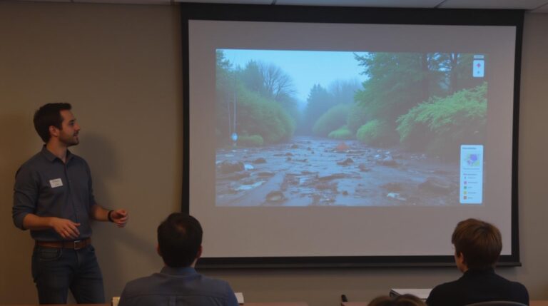
* **Disaster Risk Management:** GeoAI, aided by ML, allows for the prediction and prevention of natural disasters and their impact. It’s a game-changer in forecasting flood risks, view areas prone to wildfires, and enabling rapid response efforts.
* **Transportation & Logistics:** By analyzing traffic flow data and integrating it with GPS data, ML models predict traffic patterns, optimize routing, improve delivery schedules, and estimate traffic congestion.
* **Retail and Marketing:** ML can identify shopping patterns, analyze customer demographics, and target promotions based on location-specific preferences, offering hyper-personalized experiences.
Tools and Resources for Exploring GeoAI and ML
**Software Tools:**
* **ArcGIS Pro:** A powerful GIS software suite with extensive machine learning capabilities
* **Google Earth Engine:** Provides access to a massive dataset for analysis and allows for custom ML model development
* **QGIS (with ML extensions):** A popular open-source GIS software that includes advanced ML plugins
* **Carreau.com:** Provides online datasets, ML APIs, and open-source GeoAI resources.
* **OpenGeoML:** Online resources and platforms for developers interested in particular Geospatial ML models.
**Educational resources and online communities:**
* **GeoSpatial World:** Offers online training, certifications, and a vast library of GeoAI resources
* **Towards Data Science:** A popular data science publication featuring articles about GeoAI and its predictive capabilities.
**Note: **The field of GeoAI and ML is constantly evolving, and new tools and techniques emerge frequently. This blog post offers a snapshot of its current state while highlighting relevant resources for ongoing exploration.
Ready to Embrace the Future of Location Intelligence?
By leveraging the power of machine learning within its intelligent framework, GeoAI promises to unlock a future of precise understanding and intuitive decision-making for a host of challenges and opportunities. As its capabilities mature, we can expect even more innovative applications, transforming the way we interact with the world and shape the future with location-based insights.
## Machine Learning in GeoAI Predictive Models: FAQs
**What are Machine Learning in GeoAI Predictive Models?**
Machine learning in GeoAI predictive models utilizes algorithms and machine learning techniques applied to spatial data to predict future events, patterns, and trends. They transform vast complex datasets like weather, population demographics, physical features, and sensor readings into valuable insights and actionable knowledge.
**
**What are the main formats used to integrate machine learning in geoai predictive models?**
Several formats are used for geoAI datasets, including:
* **Raster:** Geo-spatial data represented as grid-like structures (images, satellite data, environmental maps).
* **Point:** Single location data points like geological structures, infrastructure locations, ground truth data.
* **Vector:** Geometrically defined data points. Datasets are structured in paths, lines, and polygons (e.g., street networks).
* **Time Series:** Sequence of data points or measurements at specific times (e.g., stock market, weather tracking, traffic patterns).
**What are some common applications for these machine learning models?**
* **Weather Forecasting:** Predicting precipitation, temperature, wind speed & direction, flooding, wildfires with increased precision.
* **Traffic Management:** Optimizing traffic flow, predicting congestion, optimizing routes, identifying accident hotspots.
* **Agriculture:** Estimating crop yields, predicting disease risks, optimizing planting times, managing water use more efficiently.
* **Urban Planning:** Predicting future population growth, planning for housing needs, identifying infrastructure development bottlenecks, assessing environmental hazards (flooding, disaster zones, land degradation).
* **Energy Sector:** Optimizing renewable energy integration, predicting solar and wind resource availability.
**
**Where can I learn more about Machine Learning in GeoAI Predictive Models?**
To deepen your understanding, here are some insightful resources:
* **GeoAI Software Libraries** – [https://www.gdal.org/](https://www.gdal.org/)
* **Data Science Platforms with Geospatial Capabilities** – [https://www.arcgis.com/](https://www.arcgis.com/)
* **Environment Data Resources:** – [https://www.usgs.gov](https://www.usgs.gov)
**How do I access or implement these machine learning driven geoAI predictive models?**
Many tools and platforms offer machine learning in geoAI implementation possibilities.
* **Commercial Cloud Services:** AWS, Azure, and GCP offer platforms built for geoAI.
* **Open Source Libraries:** Packages like scikit-learn, pandas, dask, and rasterio allow for customization of models for specific needs.
* **Specialized GeoAI Software:** offerings from universities and research institutions (e.g., Bing Maps, Google Maps APIs), and startups offer pre-built models and functionalities.
## Conclusion: The Value in Machine Learning in Geospatial Datasets
Machine learning in GeoAI predictive models have the potential to revolutionize how we understand and interact with our environment.
By enabling a deeper understanding of geographic information, they offer exciting possibilities, including:**
* **Making more informed decisions** for resource allocation, urban planning, disaster preparedness.
* **Enabling proactive solutions** to environmental issues, climate change problems and resource management challenges.
* **Designing smarter technologies** which contribute to smarter cities, more efficient infrastructure and improved economic activity.
—
**Terms of Service:**
Please note that the information provided above is a general overview of machine learning in geoAI predictive models. Refer to specific tool documentation and available resources to explore the best tools and technologies based on your individual needs.