Exploring Machine Learning in GIS – Spatial Data
Exploring Machine Learning in GIS – Spatial Data
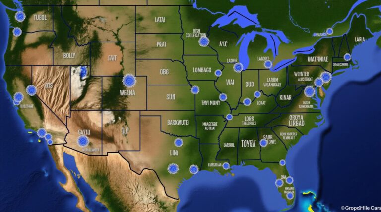
The landscape of geospatial data is ever evolving. Amidst the vast sea of information, The fusion of Artificial Intelligence (AI) and Geographic Information Systems (GIS) has emerged as a potent technology, revolutionising the way we analyze, understand, and interact with space and its intricacies.
This burgeoning field, known as GeoAI (Geospatial Artificial Intelligence), empowers us to leverage the power of machine learning algorithms to extract knowledge from spatial data. From predicting urban development patterns to managing water resources more efficiently, GeoAI is poised to unlock new levels of analytical and informational precision.
What is GeoAI?
GeoAI is a specialized domain within AI that extracts actionable insights from geographic data using machine learning (ML) algorithms. It involves integrating both traditional GIS data analysis techniques and the power of ML models, allowing users to accomplish a range of tasks, including:
- Prediction and Forecasting: Predicting future phenomena like land-use changes, wildfire spread, or crime hotspots.
- Spatial Pattern Recognition: Identifying spatial relationships, clusters, and anomalies within the data.
- Classification and Segmentation: Automatically labeling and segmenting geospatial data based on various factors.
- Object Detection and Tracking: Recognizing and tracking specific objects or features in images or videos.
- Automated Data Cleaning and Quality Control: Identifying and handling outliers or errors in vast datasets.
Benefits of Implementing GeoAI in GIS
The benefits of integrating GeoAI into GIS applications are abundant. Here are a few key advantages that make it a desirable technology for our global landscape:
- Efficient Data Analysis: ML’s ability to process large and complex datasets far quicker than traditional GIS methods, allowing for faster paced, more efficient analysis.
- Improved Accuracy and Precision: Advanced algorithms in ML can provide more accurate predictions and decision-making, leading to better informed strategies.
- Pattern Identification and Discovery: Unveiling hidden spatial patterns and trends within data, often missed by traditional methods.
- Automation of Routine Tasks: Automated quality control, data pre-processing, and even routing functionalities can boost productivity and save valuable manpower.
- Integration with Other Technologies: Seamlessly integrates with various other technologies like internet of things (IoT) data and web platforms, expanding data capacity.
Practical Applications of GeoAI
GeoAI is finding its way into diverse contexts, contributing towards various practical applications. Some noteworthy examples include:
- Urban Planning: Predicting future housing demands, optimizing traffic flow, and designing resilient infrastructure.
- Disaster Management: Predicting disaster-prone areas, optimizing evacuation routes, and supporting response efforts.
- Environmental Monitoring: Tracking animal migration patterns, predicting pollution levels, and managing natural resource challenges.
- Agriculture: Optimizing crop yields, predicting disease outbreaks, and assisting in precision farming practices.
- Finance: Identifying fraudulent transactions, assessing mortgage risks, and optimizing loan portfolios.
Exploring GeoAI Resources and Tools
Embarking on your GeoAI exploration requires a clear roadmap. Here are some resources that can guide your journey.
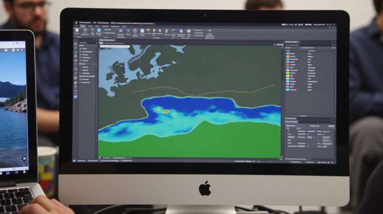
- Machine Learning Libraries: Scikit-learn, TensorFlow, and PyTorch offer comprehensive libraries for training and deploying ML algorithms.
- GIS Software with Built-in ML Tools: QGIS, ArcGIS, and MapInfo integrate ML features to streamline geospatial data analysis.
- Online Courses and Training Programs: Coursera, Udacity, and Google AI offer courses and certifications in GeoAI.
**Concluding Thoughts**
The era of GeoAI is upon us, offering unparalleled opportunities to uncover the untapped potential within our vast globe of spatial data. As this technology matures, we can expect even more advanced applications and breakthroughs.
So, explore, experiment, and join the movement! Embrace the power of GeoAI to unlock new insights and empower smarter decision-making in every aspect of our global life.
## Machine Learning in GIS and Spatial Data: Frequently Asked Questions
Machine learning (ML) has revolutionized various fields, including Geographic Information Systems (GIS). Now, ML is being applied to address complex challenges in spatial data analysis, prediction, and management. This growing field brings numerous benefits and opportunities, but understanding its fundamentals, applications, and limitations is crucial.
This FAQ section aims to clarify common queries and offer valuable insights into ML’s potential in GIS.
### What are Machine Learning (ML) and Machine Learning models in GIS?
ML revolutionizes GIS by automating image analysis, predicting future conditions, and extracting valuable insights from vast datasets. Essentially, instead of manually designing algorithms for analyzing spatial patterns, ML empowers systems to learn from data without explicit programming. Different ML models, ranging from simple algorithms to complex neural networks, can be trained on massive volumes of geospatial data. Their strengths lie in discovering complex relationships and identifying emerging trends within the data that traditional approaches miss.
Here are examples of common ML models commonly used in GIS:
* **Image Classification:** Identifying different categories within an image, such as identifying land cover types or mapping vegetation patterns.
* **Change Detection:** Identifying variations in landforms or spatial features over time, assisting in disaster management and environmental monitoring.
* **Damage Assessment:** Assessing the extent of damage caused by events like natural disasters or infrastructure failures.
* **Demand Forecasting:** Predicting future trends in population movements, retail demand, or traffic patterns.
Learn More About Common Machine Learning Techniques in GIS
### What formats of spatial data can I leverage with ML in GIS?
Various data formats can be used for training and deploying ML algorithms, including:
* **Raster data:** Frequently utilized in remote sensing and topographic data.
* **Vector data:** Contains geographic points, lines, and polygons useful for defining boundaries and tracking features.
Each format presents unique advantages and challenges, so selecting the most appropriate format for your dataset depends on factors like data complexity, resolution, and the specific ML algorithm being employed.
### How do I acquire ML models for GIS work?
Input data, or features, are crucial for machine learning. Every model builds upon a unique training dataset, and these datasets can be pre-trained or built specifically for the task or domain. You need to gather information on the types of models that work well. This requires knowledge of different ML algorithms and their appropriate applications in GIS. Here you can find more information on specific ML algorithms and tools for GIS applications
### Which resources are available to learn about and deploy Machine Learning models in GIS?
The GIS community readily promotes ML within the field. There are plenty of relevant resources available, including:
* **Platforms:** Cloud services like Google Earth Engine and Amazon Machine Learning offer pre-built models and frameworks relevant to GIS applications.
* **Software:** Packages like Rasterio, GDAL, Scikit-learn, and TensorFlown provide integrations between GIS software and ML algorithms, combining the power of these applications.
* **Courses and Certifications:** Numerous online courses from major educational institutions provide detailed theoretical as well as practical guidance on how to utilize ML in GIS. See here for a list of online courses
## Key Takeaways & Actionable Insights
Machine learning offers a powerful way to unlock new insights and improve decision-making within the field of GIS. From forecasting next trend, and analyzing changing patterns in areas like deforestation, it empowers professionals to tackle complex challenges with confidence.
Here’s how to actionable insights you can make from this information:
* **Explore Different ML Models:** Familiarize yourself with prominent GIS-specific ML models and select the one best suited for your purpose.
* **Embrace Open Source Tools:** Familiarize yourself with the range of software packages and platforms within open-source offerings for traditional and modern GIS.
* **Start Small & Experiment:** Apply ML understanding to your initial projects. Given its versatility, experiment with different models to discover what works best for you.