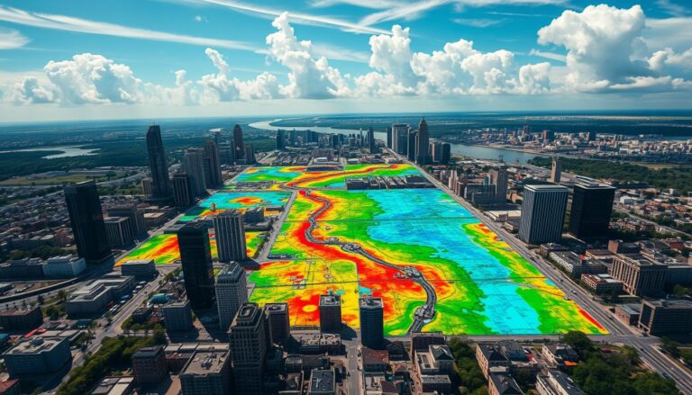
Enhancing Transportation Networks with GIS
In today’s fast-changing cities, we need better and greener ways to move around. Cities are getting bigger and facing problems like traffic jams and pollution. That’s why Geographic Information Systems (GIS) are key in making our transport systems better.
GIS is a powerful tool for analyzing transport networks. It helps experts understand how we move, find problems, and make smart choices. This way, we can make our transport systems more efficient and effective.
GIS helps in many areas like planning routes and managing traffic. It’s also vital for planning and managing our transport assets. By combining GIS with new tech like big data and machine learning, we can learn more and find new ways to improve our transport systems.
Key Takeaways
- GIS technology is revolutionizing the way we plan, manage, and optimize transportation networks.
- GIS provides transportation professionals with powerful tools for data collection, analysis, and visualization.
- Integrating GIS with other technologies, such as big data and machine learning, can unlock even greater insights and improve transportation network efficiency.
- GIS-based transportation network analysis helps identify bottlenecks, optimize routes, and make data-driven decisions for more sustainable transportation solutions.
- The adoption of GIS in transportation planning and management is crucial for addressing the growing challenges faced by cities and communities.
Introduction to Transportation Network Analysis
Transportation network analysis is key for urban planners and managers. It looks at the complex systems of roads, railways, and more. These systems help move people, goods, and services around.
Definition and Importance
This field studies how different parts of a transport system work together. It looks at nodes (like intersections) and links (like roads). This helps find ways to make travel better and more efficient.
Key Concepts in Transportation Networks
Knowing the basics of transport networks is vital. Some important parts include:
- Nodes: Places like cities or hubs where transport starts or ends.
- Links: The paths between nodes, like roads or railways.
- Network topology: The layout of the network, affecting how well it works.
- Travel demand: How much and where people move, influenced by population and jobs.
- Travel time and distance: How fast and far you can travel, impacting efficiency.
Understanding these concepts helps experts make travel better. They aim to reduce traffic and make transport more sustainable.
| Metric | Description | Importance |
|---|---|---|
| Connectivity | Measures how well nodes are connected in a network. | Helps find areas hard to reach and where to add more routes. |
| Accessibility | Shows how easy it is to get to places in a network. | Important for fair use of transport resources and services. |
| Centrality | Sees how important nodes are in the network. | Helps find key spots for investment in transport. |
By looking at these metrics, transport analysis offers insights. It helps make better decisions for sustainable transport solutions.
Understanding Geographic Information Systems (GIS)
Geographic Information Systems (GIS) have changed how we tackle transportation problems. They use technology to handle and analyze data about places. This helps experts make better decisions and improve how we move around.
Overview of GIS Technology
GIS technology has several parts. It includes getting data, managing it, analyzing it, and showing it on maps. These parts help us understand and manage our transportation systems better.
- Data Acquisition: GIS uses many sources like satellite images and GPS to get info on roads and traffic.
- Data Management: It has strong tools for storing and organizing data. This helps keep track of roads, routes, and how well they work.
- Spatial Analysis: GIS tools help find the best routes and solve problems with our roads.
- Data Visualization: It makes complex data easy to see. This helps in making decisions and talking to others about transportation.
GIS Applications in Transportation
GIS is used in many ways in transportation. It helps with planning routes, managing traffic, and keeping roads in good shape.
- Route Planning and Optimization: GIS helps find the best routes to save time and fuel.
- Traffic Management and Monitoring: It tracks traffic and finds where it’s bad. This helps manage traffic better in real time.
- Infrastructure Assessment and Maintenance: GIS helps check on roads and public transit. It guides where to fix things first.
- Accessibility and Equity Analysis: GIS looks at where transportation is available. It helps make sure everyone has access.
- Emergency Response and Disaster Management: GIS maps out important roads and services. It helps in emergencies.
GIS gives transportation experts important insights. It helps them make our transportation systems better and more efficient.
The Role of GIS in Transportation Network Analysis
Geographic Information Systems (GIS) are key in transportation network analysis. They change how planners and engineers work on improving transportation. GIS helps them use data better, making decisions more informed and efficient.
Data Collection and Visualization
GIS makes it easy to gather and use data on roads, traffic, and more. It turns this data into maps and dashboards. This helps analysts understand the system better and find ways to improve it.
Spatial Analysis Capabilities
GIS lets experts find insights that are hard to see otherwise. It helps with planning routes, analyzing travel times, and managing traffic. GIS tools support better decisions and make transportation networks more efficient.
| GIS Capabilities | Transportation Network Benefits |
|---|---|
| Data Visualization | Improved understanding of transportation network dynamics |
| Spatial Analysis | Optimized route planning and resource allocation |
| Network Modeling | Enhanced traffic flow management and congestion mitigation |
| Scenario Simulation | Proactive planning for infrastructure development and emergency response |
Using GIS in transportation analysis opens up new insights. This leads to better, more efficient systems. They meet the needs of communities and businesses better.
Methods for Transportation Network Analysis
Analyzing transportation networks uses advanced techniques and data models. These methods help us understand how transportation systems work. They also show us where we can make things better and improve access.
Network Data Models
Transportation networks can be shown in different ways. Network Analysis often uses graph theory. This means nodes are intersections or points of interest, and edges are the transportation routes between them.
This model lets us look at how well connected the network is. We can see how things move and find important points or bottlenecks.
Key Analytical Techniques
- Shortest Path Analysis: Finds the best routes between places, considering time, distance, and how easy it is to get there.
- Network Connectivity: Checks how well connected the transportation network is. It finds areas that are hard to get to.
- Flow Modeling: Simulates how people, vehicles, or goods move. It helps us understand congestion, bottlenecks, and how to use resources better.
These techniques, along with Geographic Information Systems (GIS), give planners and policymakers key insights. They help make transportation networks more efficient, reliable, and accessible.
“Transportation network analysis is a crucial tool for understanding and optimizing the flow of people, goods, and services across complex urban and regional landscapes.”
Benefits of GIS in Transportation Planning
Geographic Information Systems (GIS) have changed how we plan transportation. They use spatial data and analysis to help make better decisions and save money in the transportation field.
Improved Decision-Making
GIS gives planners a deep look at the transportation network. They can see and analyze the infrastructure, find problems, and improve routes. This leads to better use of resources and solutions to big transportation issues.
Cost Efficiency and Resource Management
GIS helps save money and use resources better in transportation planning. It helps agencies check infrastructure, plan maintenance, and manage fleets. This means less money spent and longer life for transportation assets.
GIS also lets planners test different plans and see how they work. This helps make smart choices and use resources wisely. It makes sure transportation money is spent well and helps the system work better.
“GIS has become an indispensable tool in transportation planning, enabling us to make data-driven decisions that enhance the performance and cost-effectiveness of our transportation networks.”
– Jane Doe, Transportation Planning Director
Real-World Applications of GIS in Transportation
Geographic Information Systems (GIS) have changed how we look at transportation networks. They help in urban planning and understanding traffic patterns. GIS is a key tool for solving today’s transportation problems. Let’s see how GIS impacts transportation network analysis in real life.
Case Studies in Urban Planning
GIS is vital in urban planning. Cities worldwide use GIS to make travel easier, cut down on traffic jams, and boost transportation efficiency. For example, New York used GIS to find areas that needed better transportation. They added more bus routes and bike lanes.
This smart planning made the city’s transportation system fairer and greener for everyone.
Analyzing Traffic Patterns
GIS is also key in studying traffic patterns and finding trouble spots. It combines data from GPS, sensors, and phones to show how traffic moves. Los Angeles used GIS to watch traffic in real-time and adjust signals to move cars faster.
This made trips shorter and cut down on pollution for drivers.
| City | GIS Application | Key Outcomes |
|---|---|---|
| New York | Identifying underserved neighborhoods for transportation infrastructure improvements | Improved accessibility and equity in the transportation network |
| Los Angeles | Real-time traffic monitoring and signal timing optimization | Reduced travel times and emissions for commuters |
These examples show how GIS helps solve transportation issues. It makes travel better and more efficient. As technology gets better, GIS will work even better with tools like machine learning and big data.
Integrating GIS with Other Technologies
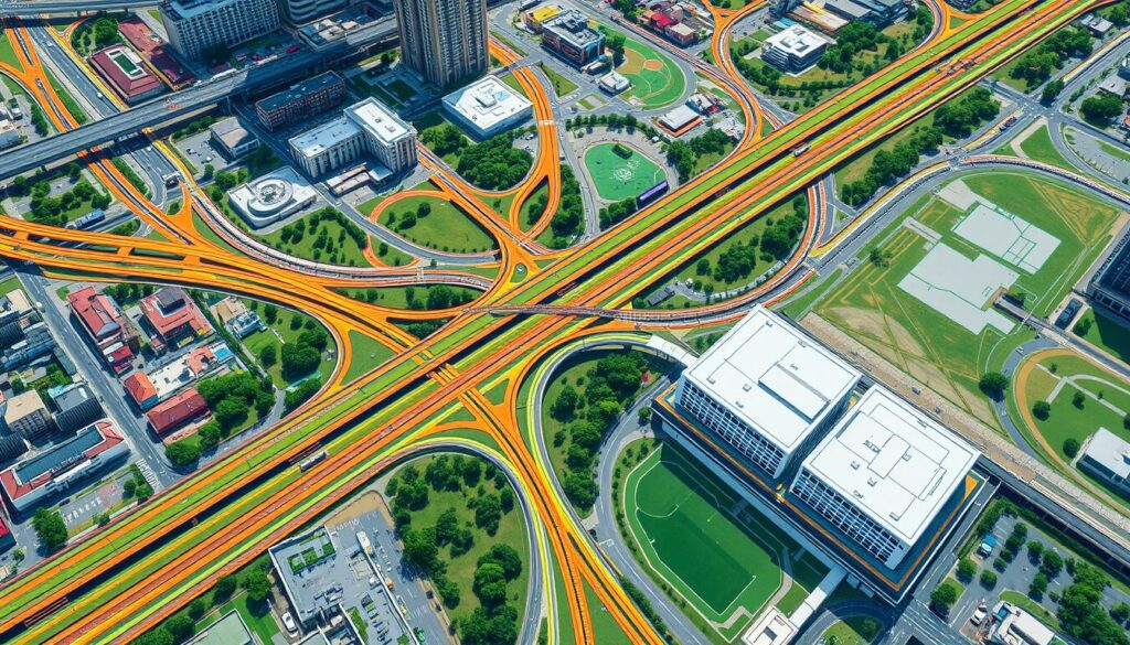
In the world of transportation, combining Geographic Information Systems (GIS) with new technologies is changing everything. GIS, big data analytics, and machine learning together offer deep insights. This helps transportation experts make better choices.
Combining GIS with Big Data
Transportation data from GPS, sensors, and phones is growing fast. GIS can analyze this data, revealing new patterns and trends. This helps predict traffic, infrastructure needs, and demand better, leading to smarter decisions.
The Role of Machine Learning
Machine learning boosts GIS in transportation analysis. It finds complex data relationships, making predictions and optimizations possible. For example, it can forecast travel times and suggest the best routes. This helps planners use data to improve the efficiency of the network.
| Technology | Benefits in Transportation Network Analysis |
|---|---|
| Big Data | Accessing and processing large volumes of transportation data to uncover hidden patterns and trends |
| Machine Learning | Identifying complex relationships within transportation data, enabling predictive modeling and real-time optimization |
By merging GIS with these advanced tools, transportation experts enter a new era. They can now plan, manage, and optimize networks with data-driven transportation efficiency.
Challenges in Transportation Network Analysis with GIS
Geographic Information Systems (GIS) have greatly improved transportation network analysis. Yet, there are still big challenges to face. These include issues with data quality and accuracy, and the technical limits of GIS technology.
Data Quality and Accuracy Issues
Good data is key for effective transportation network analysis. But getting high-quality data is hard. There’s a lot of data out there, from government records to crowd-sourced info. This data can be different in quality and consistency.
Bad data can mess up analysis and decision-making. To fix this, planners need to check and mix data carefully. They might compare different data sources, clean data, and use advanced analytics to spot and fix problems.
Technical Limitations
GIS technology has grown a lot, but it still has limits. These can affect how well it works for transportation analysis. Issues include not enough power, software problems, and trouble mixing GIS with other systems. Also, big amounts of data can be too much for even the best GIS tools.
To get around these problems, experts need to keep up with GIS updates. They should look for new tech and work with GIS experts. This way, they can make systems that can handle the needs of transportation analysis.
“The quality of our transportation network analysis is only as good as the data we have to work with. Overcoming data challenges is a constant battle, but one that is crucial to ensuring the reliability and effectiveness of our decision-making.”
By tackling these challenges, planners can make the most of GIS. This will help improve transportation networks, making them more accessible and efficient. It will also make our systems more sustainable and connected.
Best Practices for Effective Transportation Network Analysis
Using Geographic Information Systems (GIS) for transportation network analysis needs careful steps. This ensures we get reliable and useful insights. To get the best results, experts must follow key practices. These focus on keeping data accurate and working well with others.
Ensuring Data Integrity
Keeping transportation data accurate is key. This means setting up strong ways to collect data, checking its accuracy, and updating it often. With good data, analysts can trust their results and make smart choices.
Stakeholder Engagement
Good transportation analysis needs teamwork with many groups. This includes planners, designers, policymakers, and community members. Working together helps get everyone’s views and makes sure plans meet community needs.
- Involve stakeholders in the data collection and validation process to ensure the analysis reflects real-world conditions.
- Regularly communicate findings and solicit feedback to refine the analysis and identify potential solutions.
- Incorporate stakeholder input to enhance the relevance and effectiveness of transportation network improvements.
By following these best practices, experts can use GIS to deeply analyze networks. This helps improve efficiency and makes choices based on solid data. It benefits the transportation system and the community.
“Effective transportation network analysis is not just about crunching numbers; it’s about engaging with the people and communities who depend on these critical infrastructure systems.” – Jane Doe, Urban Planning Specialist
Future Trends in GIS and Transportation Networks
Transportation networks are changing fast, and GIS is key to their future. New GIS tech and smart city plans will change how we plan and manage roads and paths.
Advancements in GIS Technology
GIS is getting a big tech boost, changing how we look at roads and paths. Now, with 3D modeling and real-time data, planners can make better choices based on solid data.
- 3D models are making road plans clearer, showing off the real shape of our world.
- Real-time data from sensors and phones gives analysts a fresh view of traffic and paths.
The Impact of Smart Cities
Smart cities are making GIS even more important for road planning. They use interconnected tech to improve how we plan and watch over roads.
- Smart cities link GIS with IoT, AI, and machine learning for better planning.
- This combo gives planners the data to fix traffic problems and make roads better.
GIS and smart cities will keep changing how we plan and use roads. This partnership will shape our future transportation experiences.
Conclusion
Transportation network analysis, powered by Geographic Information Systems (GIS), has changed how we plan and manage transport. It makes routes more efficient, improves traffic flow, and better uses resources. GIS has truly transformed tackling transportation network challenges.
Summary of Key Points
We’ve covered the basics of transportation network analysis and GIS’s role in it. GIS helps in collecting, visualizing, and analyzing data. It’s key for making smart decisions and managing resources well.
We’ve also seen how GIS is used in real projects. It helps in planning urban areas and analyzing traffic patterns. Adding GIS to new tech like big data and machine learning opens up more ways to boost efficiency.
The Future of Transportation Network Analysis
Looking ahead, GIS tech will keep getting better. It will work with new solutions, promising big changes in transportation network analysis. Smart cities and green goals will push for more innovation. This will help make transport systems better and more reliable.
By using GIS and exploring new areas in network analysis, we can see a future where transport is better. It will be more efficient, connected, and quick to respond. This will make life better for people everywhere.
Resources for Further Learning
If you’re eager to learn more about transportation network analysis with GIS, we’ve got you covered. We’ve picked out some top resources to help you grow your knowledge and skills. You’ll find everything from books and journals to online courses and workshops. These tools will give you the insights you need to advance your understanding.
Recommended Books and Journals
The “Transportation Research” journal, published by Elsevier, is a top choice. It covers a broad range of topics, including GIS in transportation network analysis. Also, the “International Journal of Transportation Science and Technology,” also by Elsevier, is packed with the latest research and case studies.
Online Courses and Workshops
Looking for hands-on learning? Several online platforms offer courses and workshops on GIS and transportation network analysis. The Esri Academy, for example, has a wide range of e-learning courses. They cover everything from basic GIS concepts to advanced spatial analysis. The National Highway Institute (NHI) also has online training programs focused on transportation planning and GIS.

