Kenton County GIS: Mapping the Region
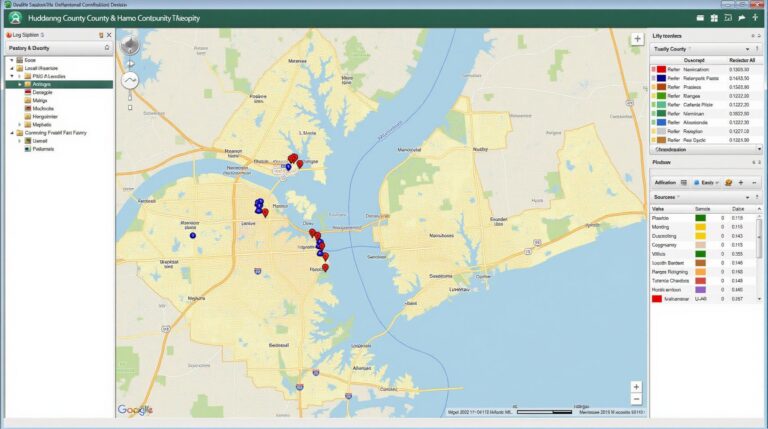
Kenton County GIS: Mapping the Region Welcome to the fascinating world of geographic information systems (GIS)! Kenton County, Kentucky, offers a treasure trove of spatial data, empowering its residents, businesses, researchers, and government agencies to understand and interact with the region in intricate ways. This blog post will explore Kenton County’s GIS resources and reveal…