geoai-disaster-preparedness

GeoAI for Smart Disaster Preparedness – Risk Mapping

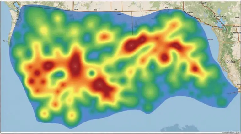
## GeoAI-Powered Risk Mapping: A Game-Changer for Smart Disaster Preparedness The world faces an ever-increasing number of natural disasters with devastating consequences. From earthquakes and hurricanes to floods and wildfires, these events often bring unprecedented challenges for communities and institutions. Fortunately, advanced technology, including GeoAI, is evolving to help us navigate these risks and build…

geoai-interactive-maps

AI in Geospatial Data Visualization – Interactive Maps

# AI in Geospatial Data Visualization: Interactive Maps Unlocking the Power of GeoAI for Engaging Maps What is Geospatial Data Visualization? Geospatial data is data that is linked to geographic context. These data sets are rich in information and can be used to gain insights into the world around us. Geospatial data visualization uses maps…

geoai-yield-prediction

GeoAI for Smart Agriculture – Yield Prediction

GeoAI for Smart Agriculture: Yield Prediction In a world grappling with the challenges of a booming population and increasing environmental stresses on natural resources, agriculture needs innovative tools to sustain its future. GeoAI, a marrying of Geographic Information Science and Artificial Intelligence, is reshaping the field by offering powerful predictive capabilities for key agricultural benchmarks…

geoai-data-compression

AI for Geospatial Data Compression – Efficient Storage

AI for Geospatial Data Compression – Efficient Storage Geospatial data, with its complex and varied forms, is crucial to understanding our planet and its changing dynamics. However, managing and storing this vast amount of information can become a significant challenge. Enter AI for geospatial data compression – a powerful solution leveraging cutting-edge technology to dramatically…

geoai-water-conservation

GeoAI for Smart Water Conservation – Resource Management

GeoAI for Smart Water Conservation — Resource Management The global water supply is facing increasing strain under the pressure of a growing population, climate change, and unsustainable consumption practices. GeoAI, a powerful technology with the ability to harness geographical information and artificial intelligence, presents a revolutionary approach to managing this precious resource. By providing insights…

geoai-spatial-prediction

AI in Geospatial Data Interpolation – Spatial Prediction

AI in Geospatial Data Interpolation – Spatial Prediction In the age of vast geospatial data, understanding and predicting patterns in remote sensing, satellite imagery, and geographic maps is crucial. Geospatial data interpolation provides this crucial gap by filling in missing data using advanced algorithms. Artificial Intelligence (AI)** is revolutionizing this field, leading to faster, more…

geoai-energy-distribution

GeoAI for Smart Energy Distribution – Grid Management

GeoAI for Smart Energy Distribution – Grid Management The burgeoning field of GeoArtificial Intelligence is blossoming across various industries, revolutionizing operations and propelling innovation. Within the dynamic realm of energy management, GeoAI is proving to be a disruptive force, empowering smart grids and optimizing energy distribution. GeoAI expertly harnesses the power of geographic information systems…

geoai-data-filtering

AI for Geospatial Data Filtering – Noise Removal

AI for Geospatial Data Filtering – Noise Removal In the realm of geospatial research, analyzing data efficiently is critical for meaningful interpretations and insights. Often, data acquisition from remote sensing satellites, aerial photography, and field surveys yields valuable information, but it also contains a natural noise burden surrounding it. These noise features, such as cloud…

geoai-urban-zoning

GeoAI for Smart Urban Planning – Zoning Optimization

GeoAI for Smart Urban Planning: Zoning Optimization Urbanization presents us with multifaceted challenges, from housing demands and economic development to environmental concerns. Overcoming these hurdles requires innovative solutions. GeoAI, short for geographic artificial Intelligence, is pushing the boundaries of smart urban planning by offering a powerful and efficient toolkit for optimizing zoning processes. What is…

geoai-data-sampling

AI in Geospatial Data Sampling – Efficient Analysis

AI in Geospatial Data Sampling: Efficient Analysis The era of Big Data has revolutionized various sectors, and geospatial data, with its rich insights into location-based information, is no exception. But analyzing vast amounts of geospatial data can be a daunting task. That’s where Artificial Intelligence (AI) comes in, offering valuable tools for efficient data sampling…