GIS for Solid Waste Management
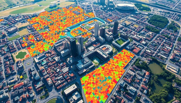
In the world of urban planning and city operations, Geographic Information Systems (GIS) play a key role. They help make solid waste management more efficient and sustainable. Cities face big challenges in waste collection, disposal, and analysis. GIS technology is a powerful tool to help solve these problems.
GIS offers a detailed, data-based way to manage solid waste. It helps urban planners, waste experts, and policymakers make better decisions. These decisions can save money, improve efficiency, and reduce waste’s harm to the environment. GIS uses spatial data, analysis, and real-time monitoring to help cities manage waste better.
This article explores how GIS changes solid waste management. It shows how this technology is making a big difference in how cities handle waste. From learning about GIS basics to seeing how it works in waste management, this guide will help you understand GIS’s role in a more sustainable waste system.
Key Takeaways
- GIS technology provides a comprehensive, data-driven approach to optimizing solid waste management processes.
- GIS enables municipalities to streamline waste collection routes, forecast waste generation patterns, and implement innovative strategies for waste reduction and recycling.
- The integration of spatial data, analytical capabilities, and real-time monitoring through GIS empowers urban planners and waste management professionals to make informed decisions.
- GIS-powered waste management solutions can lead to significant cost savings, enhanced operational efficiency, and reduced environmental impact.
- Understanding the core principles and practical applications of GIS is crucial for municipalities seeking to modernize their solid waste management systems.
Understanding GIS Technology
Geographic Information Systems (GIS) are powerful tools that change how we handle and analyze data. They mix different types of data, like location, people, and environment, to make interactive maps. This helps us make better decisions about waste management.
Definition of Geographic Information Systems
GIS is a computer system that handles and shows location-based data. It lets users see, change, and understand data linked to places. This helps find patterns and connections in the data.
Key Components of GIS Technology
- Spatial data: GIS uses data like satellite images and maps to understand places.
- GIS software: Tools like ArcGIS help manage and analyze this data.
- Hardware: Special computers and devices are needed to work with GIS.
- Geospatial analysis: GIS does advanced analysis to help make decisions.
GIS combines these parts to help users make smart choices based on location data.
| GIS Component | Description |
|---|---|
| Spatial Data | Geospatial information, such as satellite imagery, geographic coordinates, and vector data, that is tied to specific locations. |
| GIS Software | Specialized software platforms that provide the tools and functionality to manage, analyze, and visualize spatial data. |
| Hardware | The physical infrastructure, including servers, workstations, and mobile devices, required to capture, store, and process spatial data. |
| Geospatial Analysis | The ability to perform advanced spatial analyses, such as modeling, network analysis, and decision support, using GIS technology. |
Knowing GIS technology’s parts helps us use data better for waste management.
Role of GIS in Solid Waste Management
Geographic Information Systems (GIS) are now key in improving solid waste management. They use geographic data and analysis to boost waste collection and resource use. This makes waste management more efficient.
Benefits of Implementing GIS
GIS brings many benefits to solid waste management:
- Waste Collection Optimization: GIS helps plan the best routes for waste collection. This cuts down travel time and fuel use. It looks at roads, population, and waste patterns to optimize schedules and routes.
- Resource Allocation: GIS helps manage resources like vehicles and staff. It analyzes waste, population, and access to plan better.
- Real-time Monitoring: GIS systems track waste vehicles in real-time. This allows for quick adjustments to improve service.
How GIS Enhances Waste Collection Efficiency
GIS makes solid waste management better in many ways. It improves waste collection optimization and route planning. This results in less fuel use, lower emissions, and better resource use.
GIS also gives real-time insights. This helps managers make quick, informed decisions. They can adapt to changes more easily.
“GIS has become an indispensable tool for solid waste management, helping organizations streamline their operations and reduce their environmental impact.”
Data Collection Methods for GIS
Geospatial data collection is key for a good Geographic Information System (GIS) in solid waste management. It includes demographic info, waste patterns, and infrastructure details. To get this data, experts use tools like remote sensing and GPS tracking.
Types of Data Used in Solid Waste Management
- Demographic data: Population density, household size, income levels, and other socioeconomic factors that influence waste generation.
- Waste generation data: Quantity, composition, and characteristics of waste produced in different areas.
- Infrastructure data: Locations of waste collection points, transfer stations, and disposal facilities, as well as transportation networks.
- Environmental data: Topography, land use, and environmental factors that impact waste management operations.
Tools and Technologies for Data Collection
For solid waste management, various tools and technologies are used. These include:
- Remote Sensing: Satellite and aerial imagery help spot waste patterns, illegal dumping, and infrastructure.
- GPS Tracking: GPS on waste vehicles tracks their movement and improves routes.
- GIS Software: GIS apps combine and analyze data, making maps and visualizations for better decisions.
Using these geospatial data collection methods, experts create efficient GIS systems. These systems help in managing solid waste better, saving costs, and being more sustainable.
Geographic Analysis in Solid Waste Management
In the world of solid waste management, geographic analysis is key. It helps optimize collection routes and spot where waste is generated most. By using spatial analysis techniques, cities can make better decisions. This makes waste management more efficient and cost-effective.
Using Spatial Analysis to Optimize Routes
Geographic analysis is crucial for better waste collection routes. Spatial analysis helps professionals see where waste needs to be picked up. It also looks at road networks and other important data.
This way, they can plan the best routes. They consider traffic, road conditions, and how much waste can be carried. This makes waste collection more efficient and cuts down on fuel use and emissions.
Analyzing Waste Generation Patterns
Geographic analysis is also vital for finding waste generation hotspots. It helps understand where most waste comes from. This info lets waste teams focus their efforts better.
By using spatial analysis techniques, cities can really understand their waste management needs. They can make smart choices that improve services, save money, and support sustainable waste practices.
Developing a GIS Framework for Waste Management
Using GIS technology in waste management planning can make operations more efficient and help in making better decisions. Creating a good GIS framework needs a careful, step-by-step plan. This plan must consider the special needs and challenges of waste management.
Steps to Create an Effective GIS Framework
- First, do a detailed check of the current waste management setup and data sources.
- Then, figure out the key performance indicators and data needs for a successful GIS setup.
- Next, set up a strong system for collecting and managing data to keep GIS data reliable and accurate.
- After that, make sure there are clear rules for integrating, analyzing, and showing data in the GIS framework.
- Finally, create easy-to-use interfaces and reports to help make decisions based on data.
Best Practices for GIS Implementation
- Prioritize system integration: Make sure the GIS framework works well with other waste management software and systems for better data management.
- Emphasize data quality: Use strong quality checks to make sure GIS data is accurate and reliable.
- Foster stakeholder engagement: Get key stakeholders, like waste management staff and users, involved in making and using the GIS framework.
- Provide comprehensive training: Give detailed training to staff so they can use the GIS system well.
- Continuously optimize and evolve: Keep checking and improving the GIS framework to meet changing waste management needs and new tech.
By following these steps and best practices, organizations can build a strong and growing GIS framework. This framework will improve waste management planning, enhance system integration, and support GIS framework development. It will lead to more efficient and sustainable waste management operations.

| Key Components | Description |
|---|---|
| Data Collection and Management | Setting up a detailed system for collecting and managing GIS data to ensure it’s reliable and available for planning and decision-making in waste management. |
| Spatial Analysis and Modeling | Using GIS tools and methods to study waste generation patterns, improve collection routes, and find the best places for waste management facilities. |
| Visualization and Reporting | Creating easy-to-use dashboards and reports to share GIS insights and support data-based decision-making in waste management operations. |
| System Integration | Making the GIS framework work smoothly with other waste management software and systems, so data can be centralized and synchronized for comprehensive planning and management. |
Case Studies: Successful GIS Applications
Geographic Information Systems (GIS) have shown their power in solid waste management. Many cities and companies have used GIS to improve their waste handling. This has led to better waste management and more sustainable practices.
Municipal Case Studies
San Francisco is a leader in sustainability, thanks to its GIS-based waste system. It maps waste routes and tracks where waste comes from. This has cut down on pollution and boosted recycling.
In New York City, GIS helps manage a huge network of waste facilities. The city’s sanitation department uses GIS to find where waste is most needed. This makes waste collection more efficient.
Private Sector Innovations
- Waste Management, Inc. uses GIS to plan truck routes and monitor service. It also finds ways to reduce waste and increase recycling.
- Rubicon has created a GIS platform for tracking waste and improving collection routes. It encourages sustainable waste practices.
- Republic Services uses GIS to track its fleet in real-time. This improves service to customers.
| Organization | GIS Application | Key Benefits |
|---|---|---|
| San Francisco | Waste collection route optimization, waste generation mapping | Reduced greenhouse gas emissions, increased recycling rates |
| New York City | Spatial analysis for resource allocation and service coverage | Improved waste collection efficiency, better service delivery |
| Waste Management, Inc. | Truck routing optimization, service level monitoring | Cost savings, increased operational efficiency |
| Rubicon | GIS-powered waste data tracking and route optimization | Enhanced sustainability, improved waste reduction and recycling |
| Republic Services | Fleet management and real-time vehicle tracking | Improved service delivery, better customer satisfaction |
These examples show how GIS changes waste management. They show how cities and companies can use GIS to innovate and be more sustainable.
Challenges in GIS for Solid Waste Management
GIS has changed the solid waste management field a lot. But, it’s not easy for everyone to use it well. Knowing the problems helps groups use geospatial tech and make better choices.
Common Barriers to Adoption
Many think GIS is too hard to learn. People in solid waste management might feel they can’t handle it. Also, the cost of starting up with GIS can stop some groups from trying it.
Not having enough GIS skills is another big issue. Many workers don’t know how to use geospatial data. This makes it hard to use GIS in their work.
Solutions to Overcome GIS Implementation Challenges
Groups can start by training their staff. This helps everyone understand GIS better. Working with GIS experts can also help a lot.
Starting small with GIS can make it easier. Begin with a small project or a specific task. This shows how GIS can help and makes a good reason to invest more.
| GIS Adoption Barriers | Solutions to Overcome Challenges |
|---|---|
| Perceived complexity of GIS technology | Comprehensive training programs for staff |
| Initial investment in hardware, software, and training | Phased approach to GIS implementation |
| Lack of GIS expertise within the solid waste management workforce | Collaborative partnerships with GIS experts or service providers |
By tackling these common problems and using smart solutions, solid waste management teams can really benefit from GIS. They can make choices based on data and work towards a greener future.
Future Trends in GIS and Waste Management
The world is getting more digital, and GIS and waste management are changing fast. Two big trends are smart city tech and predictive analytics. These are making GIS and waste management work better together.
Integration with Smart City Technologies
The smart city movement is changing how cities manage their infrastructure. Waste management is a big part of this change. GIS helps by making IoT integration easier. This lets cities watch waste in real time and make it better.
Cities can use sensors to get data on waste. They learn about how much waste is made, how much is recycled, and how well it’s collected. This helps them make smarter choices for waste management.
Predictive Analytics for Waste Management
Predictive modeling is also changing waste management. GIS-based predictive analytics helps cities and waste companies see what’s coming. They can spot problems before they happen.
These models use old data and many sources to guess how much waste will be made. They find the best ways to collect it and even predict when equipment might break. This makes waste management more efficient and cheaper.
| Trend | Impact on Waste Management | Key Benefits |
|---|---|---|
| Smart City Integration | Real-time monitoring and optimization of waste collection and disposal processes | Improved efficiency, sustainability, and data-driven decision-making |
| Predictive Analytics | Forecasting waste generation volumes, optimizing collection routes, and predicting equipment failures | Enhanced operational efficiency, cost savings, and proactive problem-solving |
As we face the challenge of managing waste better, GIS and smart city tech, along with predictive analytics, are key. They promise to bring more efficient and smart solutions to waste management in the future.
The Role of Training and Education
Using GIS technology in solid waste management needs a trained team. The importance of GIS training for staff is huge. It lets them use GIS to its best. With GIS training programs, waste management teams can work better, make smarter choices, and serve people better.
Importance of GIS Training for Staff
GIS training teaches staff to understand spatial data and improve waste management. They learn to use GIS to find issues, predict waste, and solve problems. This makes the team more efficient and encourages new ideas and growth.
Resources for Learning GIS Applications
- Online GIS training programs and courses from schools and groups
- Training sessions by GIS experts or consultants
- Webinars and workshops on using GIS in waste management education and professional development
- Platforms for sharing knowledge in the waste management field
By using GIS training programs and supporting ongoing professional development, waste management teams can fully use GIS. This leads to sustainable, data-based decisions for their work.
Conclusion: The Future of GIS in Solid Waste Management
As we look ahead, GIS technology is changing solid waste management. This article shows how GIS can make waste management better and more sustainable.
Key Takeaways
GIS helps make waste collection more efficient. It optimizes routes and analyzes waste patterns. This way, cities and companies can make better choices that protect the environment.
Call to Action for Industry Stakeholders
Industry players need to use GIS to its full potential. Policymakers, waste managers, and tech providers should work together. They need to create GIS systems that fit their community’s needs.
By training staff on GIS, companies can use this technology effectively. This will help them stay updated and lead in waste management.
The future of waste management is bright with GIS. It will lead to better, more sustainable practices. The call to action is clear: let’s use GIS to make waste management more efficient and green.

