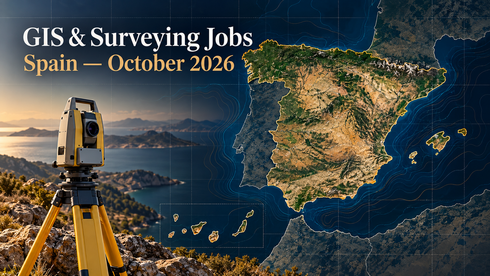
12 Current GIS, Remote Sensing & Land Surveying Jobs in Spain – October 2026
Spain’s geospatial hiring market in October 2026 combines digital infrastructure, Earth observation, GNSS, photogrammetry, Web GIS and construction surveying. This roundup brings together 12 verified vacancies in Madrid, Córdoba, Barcelona, Tarragona, Girona, Málaga and Seville, plus a Spain-based remote role. The employers are seeking profiles ranging from a paid GIS intern and a newly qualified geomatics graduate to senior product engineers, GNSS specialists and experienced road-survey leaders.
The strongest demand appears around enterprise and cloud-native GIS, spatial databases, satellite imagery, mobile mapping, utility-network digitisation and complete field-to-office survey workflows. Every vacancy below was individually reviewed and appeared open on 10 October 2026. Missing salary, deadline, visa or work-arrangement information is marked honestly rather than inferred.
Notice: Job advertisements may be changed or closed by employers without notice. Every vacancy in this article was accessible and appeared open when checked on 10 October 2026. Always verify the details on the employer’s page before applying.
Current GIS, Remote Sensing and Surveying Jobs in Spain
| Country | Job title | Employer | Location | Level/experience | Work arrangement | Posting date | Deadline | Salary | Application |
|---|---|---|---|---|---|---|---|---|---|
| Spain | GIS Digitalization Technician | Indra Group | Córdoba | 2+ years | Remote, Córdoba base | Displayed as 2 days ago | Not stated | Not disclosed | View Job & Apply |
| Spain | Senior GIS Product Engineer | Xoople | Madrid | Senior product engineer | Flexible; Spain or UK | Displayed as 3 weeks ago | Not stated | Competitive; amount not disclosed | View Job & Apply |
| Spain | Solutions Engineer – GIS | Gilytics AG | Spain | 3+ years GIS; 2+ customer-facing | Remote-first | Refreshed in current listings | Not stated | Competitive; amount not disclosed | View Job & Apply |
| Spain | Full Stack Developer – Geospatial Web Services | TPF Ingeniería | Madrid | 5+ years web development | Not specified | Displayed as 1 week ago | Not stated | Competitive; amount not disclosed | View Job & Apply |
| Spain | Software & GNSS Engineer | Capgemini Engineering | Madrid | Experienced GNSS specialist | Not specified | Displayed as 2 weeks ago | Not stated | Not disclosed | View Job & Apply |
| Spain | Product Specialist – PIX4Dcatch | Pix4D | Madrid | 2–4 years | Hybrid possible | Displayed as 2 days ago | Not stated | Not disclosed | View Job & Apply |
| Spain | GIS Department Internship | ACCIONA | Alcobendas, Madrid | Final-year degree/master’s student | On-site access required; half or full time | Displayed as 1 week ago | Not stated; January 2027 start | Paid internship; amount not disclosed | View Job & Apply |
| Spain | Surveyor – Solar Projects | Negratín Global Services | Málaga / Antequera | 3+ years | On-site / field | Displayed as 1 week ago | Not stated | Competitive according to experience | View Job & Apply |
| Spain | Senior Technical Survey Engineer – Roads | OCA Global | Figueres, Girona | 8–10 years | On-site / field, full time | Displayed as 4 days ago | Not stated | Not disclosed | View Job & Apply |
| Spain | Graduate in Geomatics and Topography | Vías y Construcciones | Tarragona | Graduate; no experience required | On-site / field | Displayed as 1 week ago | Not stated | “Interesting conditions”; amount not disclosed | View Job & Apply |
| Spain | Field Surveyor – Road Projects | CAD & BIM Services | Seville area | Intermediate | On-site / field | Displayed as 2 days ago | Not stated | Not disclosed | View Job & Apply |
| Spain | Quality Control Specialist – Defence Mapping | Airbus GeoTech | Barcelona | 0–3 years | In-office | Displayed as 4 days ago on current listing | Not stated | Not disclosed | View Job & Apply |
Detailed Vacancy Guide
1. GIS Digitalization Technician — Indra Group
Indra is recruiting a Córdoba-based technician to digitise and maintain technical information for low- and medium-voltage distribution networks. The work covers cartographic, alphanumeric and connectivity editing in corporate GIS platforms, correcting network and distribution-centre data, supporting project-to-service updates, and validating georeferenced records before large database updates. Applicants need at least two years in cartographic digitisation for electrical networks and technical education in electricity, electronics or a related discipline. QGIS, SiredWeb, AGP and GLITE are valued. This is a strong fit for someone who can combine utility-network knowledge with disciplined spatial-data quality control. Honest CV keywords include utility GIS, LV/MV networks, cartographic digitisation, connectivity, technical database maintenance, QGIS and data validation. Indra describes a remote model with Córdoba as the operational base; salary and deadline are not stated. View the vacancy and apply.
2. Senior GIS Product Engineer — Xoople
Xoople’s Madrid role sits at the intersection of Earth observation, cloud engineering and geospatial product delivery. The engineer will design access to large EO archives, operate STAC search and catalogue services, build dynamic raster and vector-tile pipelines, develop map interfaces, and maintain reliable data lineage, freshness and completeness. The advert names COG, Zarr, STAC, TiTiler, PostGIS, MapLibre GL JS, deck.gl, OpenLayers, CesiumJS, GDAL, rasterio, GeoPandas, xarray, FastAPI, Python and SQL. Candidates should already have owned GIS or geospatial data products through design, production and operation. Familiarity with OGC services, spatial indexing and cloud-native architectures is central. AI deployment or geospatial foundation-model work is a plus. The work model is flexible for Spain or the United Kingdom; salary and deadline are not published. View the vacancy and apply.
3. Solutions Engineer – GIS — Gilytics AG
Gilytics needs a Spain-based remote Solutions Engineer to translate its Pathfinder 3D infrastructure-planning platform into demonstrations, proof-of-concepts, technical offers and customer solutions. The role is unusually broad: it covers pre-sales support, public-tender responses, live technical troubleshooting, onboarding, training, product testing and triage of customer requests for the roadmap. Applicants need at least three years applying GIS to land, environmental or infrastructure management, plus two years in a customer-facing function. A geospatial, geomatics, environmental-engineering or similar education is required, and the employer expects clear technical writing and conversational English. The best CV evidence will connect GIS analysis to a client decision, successful implementation or training outcome. Useful keywords are infrastructure GIS, route planning, 3D spatial analysis, SaaS, proof-of-concept, technical tender, onboarding and customer support. View the vacancy and apply.
4. Full Stack Developer – Geospatial Web Services — TPF Ingeniería
TPF Ingeniería is building a Madrid-based monitoring service that will let users view satellite imagery, follow changes in field assets over time and receive alerts from an analytical system. The selected developer will own both backend services and APIs and the geospatial web viewer. TPF requests more than five years of web-development experience, Python and Node.js on the backend, JavaScript or TypeScript with Angular, React or Vue on the frontend, and practical use of Leaflet or Mapbox GL. The data layer includes XYZ tiles, WMS, WMTS, WFS, GeoJSON, PostGIS, raster data, coordinate systems and projections. AWS S3, API Gateway, Lambda or ECS, CloudFront and PostgreSQL RDS complete the platform. English B2 is required. Applicants should show production systems, performance decisions, secure APIs and map-user experience—not merely coursework. View the vacancy and apply.
5. Software & GNSS Engineer — Capgemini Engineering
Capgemini Engineering is seeking an experienced Madrid professional for GNSS software and international project work. The role supports ESSP’s development process through user-requirement analysis, technical specifications, solution architecture and design, validation, and preparation for Preliminary Design Review. The vacancy specifically asks for strong knowledge of ECSS software standards and substantial GNSS-sector experience, including EGNOS services, EDAS, NOTAM and common protocols and formats for GNSS data transmission. International project management is important, while procurement, supplier management, network security, communication security, data security and authentication are supporting skills. This is not a general GIS analyst post; it suits candidates with navigation-system and space-software depth. CV keywords should be precise: GNSS, EGNOS, EDAS, ECSS, requirements engineering, PDR, system architecture, validation and secure data services. The employer offers an indefinite contract but does not disclose salary. View the vacancy and apply.
6. Product Specialist – PIX4Dcatch — Pix4D
Pix4D’s Madrid Product Specialist will represent customer needs inside the team responsible for PIX4Dcatch, its mobile reality-capture application. Daily work includes resolving enterprise support cases, tracking bugs with developers, preparing release communications and documentation, coordinating beta tests, monitoring adoption, gathering product feedback and supporting complex client workflows. The employer generally expects two to four years in B2B software, technical support, customer success, product operations or associate product management. A technical bachelor’s degree with geospatial exposure is preferred, though equivalent experience is accepted. C2 English is required; GIS, RTK rover use and mobile-product lifecycle experience are advantages. Strong applications should demonstrate how technical feedback became a usable product improvement or successful customer deployment. Jira, Confluence, HubSpot, Mixpanel, RTK, mobile mapping and photogrammetry are relevant CV terms when genuinely supported by experience. Hybrid work is possible. View the vacancy and apply.
7. GIS Department Internship — ACCIONA
ACCIONA offers a paid six-month placement supporting the urban-services technology platform at its Alcobendas office. The intern will help manage platform information for containers, service sectors, routes and vehicles; build open-data catalogues; create dynamic graphic exports and 3D map outputs; improve ModelBuilder workflows; and explore remote-sensing methods for detecting green space and street trees. Applicants must be in the final year of an eligible environmental-science or geography degree or master’s programme and be able to sign a university placement agreement. QGIS or ArcGIS skills are required, while Python is valued. The placement can be half-time or full-time, with 35 hours preferred, and the stated start is January 2027. This is a practical entry route for students who can show a small portfolio using spatial data, reproducible models and clear maps. Salary amount and deadline are not stated. View the vacancy and apply.
8. Surveyor – Solar Projects — Negratín Global Services
Negratín is hiring a surveyor in Málaga for large photovoltaic projects above 50 MW. The field remit runs from topographic surveys and digital terrain models to setting-out of structures, roads, channels and trackers, checking levels and alignments, earthwork volumes, as-built plans and coordination with engineering and construction teams. Candidates need a higher vocational qualification in topography, basic 60-hour occupational-risk training and at least three years in a comparable position. The equipment and methods named include GPS, total stations, drones and LiDAR, supported by AutoCAD, ArcGIS, Civil 3D and other topographic-processing software. Experience abroad is valued. A convincing CV should state project size, personal responsibility, instruments used, control method, achieved precision and final deliverables without overstating legal authority. The employer offers immediate incorporation and competitive conditions according to experience, but no numeric salary or closing date. View the vacancy and apply.
9. Senior Technical Survey Engineer – Roads — OCA Global
OCA Global’s Figueres assignment is a senior road-construction post with responsibility for topographic execution and direction. The engineer will lead field control, protect geometric accuracy, carry out quantities and measurements for certifications, coordinate technical issues with site management and subcontractors, and help keep delivery aligned with plans, safety and programme. The employer requests a Technical Engineering in Topography qualification or a degree in Geomatic Engineering, plus eight to ten years on road works. Residence in or near Figueres is requested, and availability to join during October 2026 is explicit. The schedule is full-time Monday to Friday, normally 08:30–18:00 with flexibility according to site needs. Appropriate CV keywords include road surveying, alignment, setting-out, geometric control, quantities, certification, contractor coordination and technical leadership. Salary is not disclosed. View the vacancy and apply.
10. Graduate in Geomatics and Topography — Vías y Construcciones
Vías y Construcciones is offering a genuine graduate pathway in Tarragona through its Young Talent Programme. Candidates need a Geomatics and Topography degree completed between 2023 and 2026, motivation to build a career in construction delivery, and willingness to relocate anywhere in Spain after the current project. The successful graduate joins the permanent workforce on an infrastructure and superstructure project, supported by a training plan and a structured introduction to surveying before, during and after construction. No prior professional experience is required. Applicants should therefore emphasise field exercises, GNSS or total-station practice, levelling, CAD or GIS coursework, safety awareness, report writing and mobility rather than trying to present themselves as experienced survey managers. The advert promises career development and attractive economic conditions but gives no amount or application deadline. View the vacancy and apply.
11. Field Surveyor – Road Projects — CAD & BIM Services
CAD & BIM Services is recruiting a field surveyor for road projects around Seville. The position executes and supervises site surveying, performs surveys, setting-out and measurements, controls the geometry of embankments, cuttings, drainage, structures and affected services, and provides survey support for viaducts, overpasses, underpasses, retaining walls and drainage works. It also requires clear sketches, reports and supporting technical documentation. The listing classifies the role as full-time and intermediate level. Candidates should demonstrate a complete road-survey workflow rather than only equipment familiarity: establishing control, collecting observations, checking geometry, communicating deviations and producing records usable by construction and engineering teams. Honest CV keywords include road surveying, setting-out, geometric control, earthworks, drainage, structures, levelling, as-built documentation and technical reporting. The vacancy does not publish salary, deadline, specific equipment brands or remote options. View the vacancy and apply.
12. Quality Control Specialist – Defence Mapping — Airbus GeoTech
Airbus GeoTech’s Barcelona opening focuses on quality assurance for security and defence vector-mapping products. The specialist will validate schemas, metadata and attribute dictionaries; assess positional accuracy, topology and completeness; cross-check vector content against very-high-resolution satellite imagery and elevation models; register non-conformities; follow corrections to acceptance; and prepare validation logs and data-quality reports. The toolset includes ArcGIS Pro, QGIS, Python and SQL checks, geodatabases, shapefiles and CAD formats. Applicants may hold a bachelor’s or master’s in geomatics, GIS, geography, remote sensing, cartography, topography or geoinformatics, with zero to three years in mapping, EO or geospatial quality control. Experience with defence mapping, topographic databases or satellite-image interpretation is advantageous. Use keywords such as spatial QA/QC, topology, metadata, VHR imagery, DEM and schema compliance only where evidenced. View the vacancy and apply.
Skills in Demand Across Spain’s Geospatial Vacancies
GIS platforms, databases and spatial quality
ArcGIS, QGIS and spatial databases recur across utility, infrastructure and mapping roles, but employers want operational competence rather than software familiarity alone. Indra needs connected electrical-network data maintained accurately; Airbus needs repeatable validation of geometry, schemas and metadata; Gilytics expects client-ready analysis and demonstrations. PostGIS, SQL, geodatabases, coordinate-reference systems and documented QA/QC are therefore valuable across several career levels. A portfolio should explain data sources, transformations, validation rules, errors found and how the final dataset was used.
Cloud-native GIS, Web GIS and Earth observation
Xoople and TPF show strong demand for engineers who can make spatial data usable at scale. STAC, COG, Zarr, raster and vector tiling, OGC services, GeoJSON, PostGIS and interactive web mapping sit alongside Python, SQL, TypeScript and cloud infrastructure. The most persuasive evidence is a deployed system: an EO catalogue, performant map, monitored API or reproducible processing pipeline. Candidates should be ready to explain caching, coordinate handling, access control, observability, data lineage and cost—not just list frameworks.
GNSS, photogrammetry and mobile capture
Capgemini’s GNSS role requires specialised navigation knowledge around EGNOS, EDAS, ECSS and secure data services. Pix4D’s product position approaches geospatial capture from the customer and product side, valuing mobile workflows, RTK and technical communication. The survey jobs add GPS/GNSS, total stations, drones, LiDAR, Civil 3D and as-built documentation. Applicants should separate real-time positioning, image-based reconstruction, field control and GIS data management clearly; these are connected disciplines, not interchangeable labels.
Infrastructure and field delivery
The openings at Negratín, OCA Global, Vías y Construcciones and CAD & BIM Services confirm steady demand for complete field-to-office surveying. Employers value setting-out, levelling, earthwork quantities, alignment checks, digital terrain models, construction coordination and clear technical records. Senior posts add certifications, cost awareness, subcontractor communication and decision-making under programme pressure. Graduate applicants should show safe instrument practice and accurate coursework; experienced candidates should quantify project type and responsibility without disclosing confidential information.
How to Apply for Geospatial Jobs in Spain
Match the application language to the vacancy. Most infrastructure and utility adverts are written in Spanish, while Xoople, Gilytics and Pix4D operate extensively in English. A concise Spanish CV plus an English version is useful when the employer is international. Put your discipline and strongest evidence in the first lines: for example, “GIS developer with production PostGIS and OGC services,” “GNSS engineer experienced with EGNOS/EDAS,” or “construction surveyor with road setting-out and Civil 3D.”
For digital roles, link to a small, functioning portfolio and describe architecture, data volumes, validation and users. For field roles, state project type, instruments, software, safety training, geographic mobility and the exact outputs you produced. Students should use assessed projects and placements honestly rather than inflating experience. Most adverts do not disclose salary, visa sponsorship, relocation or professional-recognition requirements. Candidates who need work authorisation or degree recognition should ask the employer directly before investing heavily in the process; a job’s location does not prove sponsorship.
Submit promptly when no deadline is stated. Save a copy of the advert and tailor technical keywords only where your experience supports them. For comparison, review TechGeo’s October France geospatial jobs, October United Kingdom roundup, October United States GIS jobs and the previous Spain market snapshot.
Frequently Asked Questions
Are there entry-level GIS or surveying jobs in this Spain list?
Yes. ACCIONA’s paid GIS placement targets final-year students, Vías y Construcciones accepts recent geomatics graduates without experience, and Airbus states zero to three years for its mapping quality-control role. Each still has specific education, mobility, language or technical requirements.
Which technologies appear most often?
ArcGIS, QGIS, PostGIS, SQL and spatial-quality workflows recur most broadly. Web roles add Python, JavaScript or TypeScript, OGC services, GeoJSON, raster/vector tiles and AWS. Surveying roles add GNSS/GPS, total stations, drones, LiDAR, AutoCAD and Civil 3D.
Are remote geospatial jobs available in Spain?
Yes, but they are a minority in this set. Indra describes remote work with Córdoba as its operational base, and Gilytics is remote-first. Xoople offers a flexible model depending on location. Field surveying, mapping quality control and the ACCIONA placement require substantial location-specific presence.
Do these employers offer visa sponsorship?
None of the reviewed vacancy pages explicitly confirms visa sponsorship or relocation. That does not prove assistance is unavailable. Candidates who do not already have the necessary right to work in Spain should ask the employer before proceeding and should not infer sponsorship from an international company name.
How current are these vacancies?
All 12 individual pages were accessible and displayed an application action when rechecked on 10 October 2026. Most were shown as posted or refreshed within the previous two weeks; the Xoople role remained active at roughly three weeks. Employers can close listings at any time, so verify and apply promptly.
Build a Focused Spain Geospatial Application
Spain’s current opportunities reward a clear professional identity. Choose the path that matches your real evidence—spatial software, utility GIS, Earth-observation quality, GNSS engineering, photogrammetry products or construction surveying—and make every CV claim traceable to a project, tool and outcome. Follow TechGeo Geo-News for the next regional careers update and fresh GIS, remote-sensing and land-surveying vacancies.