10 Current GIS, Remote Sensing & Land Surveying Jobs in the United States – October 2026
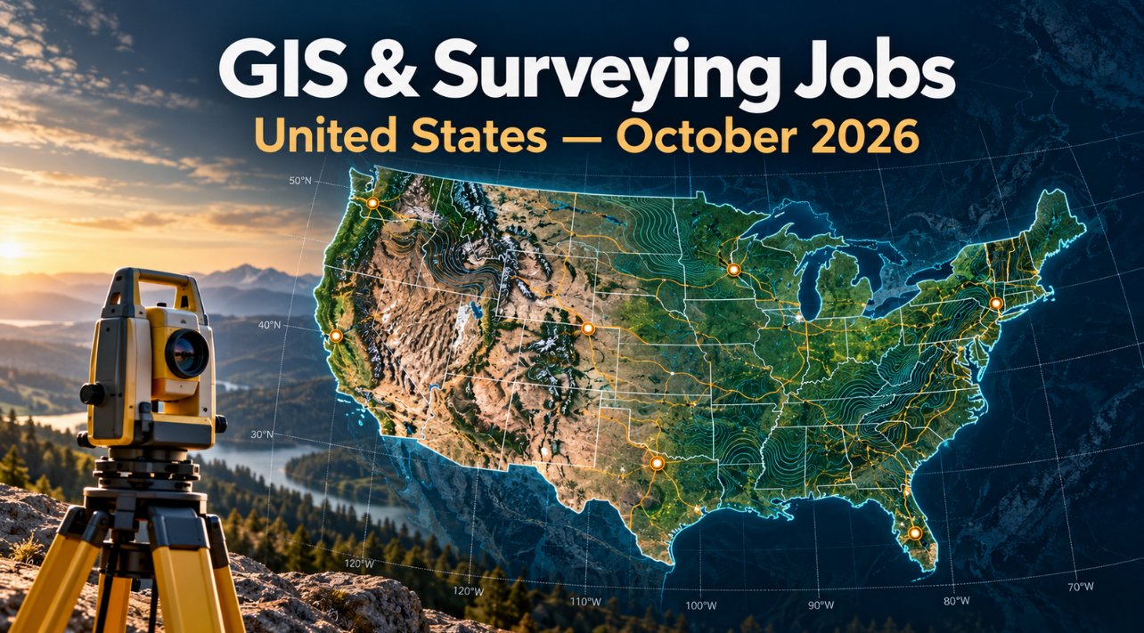
Looking for GIS jobs in United States October 2026? This edition brings together 10 current vacancies checked on October 1, 2026. They span municipal GIS, county parcel and addressing data, transport enterprise systems, professional land surveying and federal geospatial operations. California, Colorado, Florida, Georgia and Washington are represented. The listings include entry-level and experienced positions, with several sharply limited by licensure, residency or federal hiring pathway.
We selected individual employer application pages, checked the stated deadlines and compared the vacancies with TechGeo’s recent U.S. roundups.
Application notice. Job advertisements may be changed or closed by employers without notice. Every vacancy in this article was accessible and appeared open when checked on October 1, 2026. Always verify the details on the employer’s page before applying.
United States GIS and surveying jobs at a glance
The table is designed as labelled cards on phones. “Not stated” means that the employer page did not give a reliable value in the checked listing; it is not a promise of flexibility, sponsorship or any other condition.
| Country | Job title | Employer | Location | Level/experience | Work arrangement | Posting date | Deadline | Salary | Application |
|---|---|---|---|---|---|---|---|---|---|
| United States | Geographic Information Systems (GIS) Analyst | City of Yuba City | Yuba City, California | 3 years GIS experience | Full-time; arrangement not stated | 21 Sep 2026 | 5 Oct 2026, 3 p.m. PT | $85,800–$104,268/year | View Job & Apply |
| United States | Extra Help Geographic Information Systems Analyst I | County of Tulare | Visalia, California | Entry-level; extra help | Extra help; hours vary | 26 Sep 2026 | 6 Oct 2026, 11:59 p.m. PT | $35.20/hour | View Job & Apply |
| United States | Information Technology Analyst I/II – GIS | City of Thousand Oaks | Thousand Oaks, California | Analyst I or II | On-site; telework possible after probation | 24 Sep 2026 | 22 Oct 2026, 11:59 p.m. PT | $90,750.40–$157,830.40/year | View Job & Apply |
| United States | Geospatial Systems Analyst I | Fulton County | Atlanta, Georgia | Entry-level professional | Full-time; arrangement not stated | 29 Sep 2026 | 5 Oct 2026, 11:59 p.m. ET | $55,674–$103,553/year | View Job & Apply |
| United States | Professional Land Surveyor I – Grand Junction | Colorado Department of Transportation | Grand Junction, Colorado | Licensed PLS | Full-time; on-site address listed | 21 Sep 2026 | 5 Oct 2026, 11:59 p.m. MT | $86,544–$88,572/year | View Job & Apply |
| United States | Professional Land Surveyor II – Greeley | Colorado Department of Transportation | Greeley, Colorado | Advanced licensed PLS | Full-time; on-site address listed | 14 Sep 2026 | 1 Nov 2026, 11:59 p.m. MT | $93,432–$102,756/year | View Job & Apply |
| United States | Geographic Applications Specialist – Denver | Colorado Department of Transportation | Denver, Colorado | Scientific Programmer/Analyst III | Full-time; arrangement not stated | 29 Sep 2026 | 13 Oct 2026, 11:59 p.m. MT | $59,460–$68,376/year | View Job & Apply |
| United States | GIS Analyst Addressing Specialist | City of North Port | North Port, Florida | GIS analyst | Full-time; arrangement not stated | 29 Sep 2026 | 13 Oct 2026, 5 p.m. ET | $60,131.20–$95,806.24/year | View Job & Apply |
| United States | GIS & Roadway Data Office Manager (WMS3) | Washington State Department of Transportation | Olympia, Washington | Senior management | Full-time; flexible/hybrid | 17 Sep 2026 | 5 Oct 2026, 11:59 p.m. PT | $116,400–$142,464/year | View Job & Apply |
| United States | Management and Program Analyst (Geospatial Data Analyst) | U.S. Fish and Wildlife Service | Denver, Colorado | GS-13; restricted eligibility | Full-time; telework eligible, not remote | Not stated | 5 Oct 2026, 11:59 p.m. ET | $118,675–$154,280/year | View Job & Apply |
Current vacancies: role-by-role details
1. Geographic Information Systems (GIS) Analyst — City of Yuba City
The City of Yuba City seeks a GIS analyst to coordinate its mapping projects and help departments use reliable geographic information. The work spans data maintenance, analysis, map production, web GIS, field data collection, database work, and staff support. The announcement calls for education in GIS, geography, cartography, engineering, planning, computer science, information systems, or a related field, together with three years of recent full-time GIS experience. A valid California driver's license is required. In a CV, show concrete examples of spatial data quality, departmental collaboration, map applications, and training. The salary and deadline are stated in the city announcement. Read the supplemental application instructions carefully: the city says a résumé does not replace the completed online application.
Location: Yuba City, California · Deadline: 5 Oct 2026, 3 p.m. PT. View the official vacancy and apply.
2. Extra Help Geographic Information Systems Analyst I — County of Tulare
Tulare County's Resource Management Agency is recruiting an extra-help GIS Analyst I for public works and planning support. The role involves maintaining spatial databases, building digital maps from survey records, assessor parcel maps and deeds, bringing outside map data into county systems, and documenting attributes and metadata. It is an entry-level class, but the employment arrangement deserves attention: hours and assignment length vary, extra-help appointments have an annual hours limit, and the announcement says these appointments do not carry benefits. Candidates with parcel mapping, database editing, metadata and careful source documentation should demonstrate those projects in their application. Check the county's complete classification and eligibility requirements before applying.
Location: Visalia, California · Deadline: 6 Oct 2026, 11:59 p.m. PT. View the official vacancy and apply.
3. Information Technology Analyst I/II – GIS — City of Thousand Oaks
Thousand Oaks is expanding its enterprise GIS work within the Information Technology department. The analyst will maintain spatial and tabular data, create applications and services, script and automate workflows, validate data, support staff, and connect GIS to city business systems. The vacancy can be filled at Analyst I or II depending on qualifications. The posting describes an on-site job with telework opportunities only after successful probation, so it should not be read as a fully remote position. Applicants should connect specific ArcGIS, data quality, automation and stakeholder-support experience to the city's needs. The listing also requires a supplemental questionnaire and says recruitment may close earlier after its first review.
Location: Thousand Oaks, California · Deadline: 22 Oct 2026, 11:59 p.m. PT. View the official vacancy and apply.
4. Geospatial Systems Analyst I — Fulton County
Fulton County's Information Technology department lists an entry-level professional geospatial role supporting county assets and services. It covers managing and maintaining enterprise geospatial data, making maps and visualizations, analyzing geographic information, and providing users with accurate data. The degree requirement accepts GIS and related technology fields; several other disciplines can qualify with relevant GIS coursework or a certificate. Previous experience is preferred, and a valid Georgia driver's license is required. GISP is listed as preferred rather than mandatory. Applicants should describe data stewardship, error checking, analysis and communication with nontechnical users. The county emphasizes fully completed applications and documentation of qualifications.
Location: Atlanta, Georgia · Deadline: 5 Oct 2026, 11:59 p.m. ET. View the official vacancy and apply.
5. Professional Land Surveyor I – Grand Junction — Colorado Department of Transportation
CDOT's Grand Junction surveyor opening is for a licensed professional who can support transportation projects and survey deliverables. The announcement requires a current Professional Land Surveyor license in Colorado or another U.S. state; an out-of-state license holder must obtain Colorado licensure within twelve months after starting. This particular posting permits both Colorado residents and nonresidents because of its location near the state border. Candidates should review the full duties and document relevant land-survey, right-of-way, plan review and legal-description experience only where they have it. A résumé and cover letter are required attachments. The position is full-time and the announcement gives a firm October 5 closing time.
Location: Grand Junction, Colorado · Deadline: 5 Oct 2026, 11:59 p.m. MT. View the official vacancy and apply.
6. Professional Land Surveyor II – Greeley — Colorado Department of Transportation
CDOT's Greeley vacancy is a senior survey role overseeing land surveys used in transportation design and right-of-way development. The successful applicant will be responsible for plans and legal descriptions prepared by the unit or consultants and for compliance with CDOT standards and Colorado land-survey rules. The announcement is explicit that this position is open only to Colorado state residents, a crucial distinction from the Grand Junction vacancy above. It lists a November 1 deadline but says applications are considered as received, so early review is possible. Experienced licensed surveyors should foreground project oversight, quality assurance, boundary and right-of-way documentation, consultant coordination and familiarity with applicable standards in their materials.
Location: Greeley, Colorado · Deadline: 1 Nov 2026, 11:59 p.m. MT. View the official vacancy and apply.
7. Geographic Applications Specialist – Denver — Colorado Department of Transportation
CDOT seeks a Geographic Applications Specialist in the Office of Transportation Analytics. The team maintains statewide roadway datasets used by state staff, federal agencies, metropolitan planning organizations, local governments and the public. This is a strong fit for applicants who can demonstrate spatial data management, application support, roadway-network understanding and disciplined data maintenance. The official announcement identifies the classification as Scientific Programmer/Analyst III and lists the Denver office address. It is open only to Colorado state residents, so applicants should check that condition before spending time on the application. Use examples of interoperable data, GIS workflows and clear technical documentation where supported by your experience.
Location: Denver, Colorado · Deadline: 13 Oct 2026, 11:59 p.m. MT. View the official vacancy and apply.
8. GIS Analyst Addressing Specialist — City of North Port
North Port's GIS Analyst Addressing Specialist maintains address information and databases that support permitting, emergency response and community development. The role works with planning, IT, fire and EMS, utilities, postal services and other departments to keep land and addressing data dependable. Duties include GIS database standards, web map services, complex analysis, maps and reports, cross-agency information sharing and project coordination. Applicants with addressing, parcel and public-safety GIS experience can make a particularly direct case. Describe how you resolved data discrepancies, maintained authoritative records and served operational users. The listing states the salary band and an October 13 application deadline; consult the full employer page for detailed qualifications.
Location: North Port, Florida · Deadline: 13 Oct 2026, 5 p.m. ET. View the official vacancy and apply.
9. GIS & Roadway Data Office Manager (WMS3) — Washington State Department of Transportation
WSDOT is recruiting a manager for its GIS and roadway data office. This leadership role covers enterprise GIS services, roadway datasets and reporting, including linear referencing, HPMS and MIRE data. The manager directs five teams and a group of nineteen professionals across GIS data, services, application development, project management and highway performance monitoring. It combines geospatial governance, data quality, application delivery and cooperation with agencies and tribes. The listing identifies flexible or hybrid employment but should be read for any location and schedule conditions. Experienced candidates should quantify program leadership, roadway data stewardship, federal reporting, enterprise GIS modernization and cross-organization coordination. The close date is October 5.
Location: Olympia, Washington · Deadline: 5 Oct 2026, 11:59 p.m. PT. View the official vacancy and apply.
10. Management and Program Analyst (Geospatial Data Analyst) — U.S. Fish and Wildlife Service
This federal geospatial data analyst role supports the Fish and Wildlife Service's enterprise GIS work. Duties include managing ArcGIS Online, developing geospatial workflows with stakeholders, automating tasks across web and desktop systems, consulting on geoprocessing and database design, and helping users troubleshoot enterprise deployments. FME, SharePoint and Power Platform are named among the tools. The job is telework eligible under agency policy, but explicitly not a remote job. Most importantly, this is a merit-promotion announcement with limited eligibility, including specified Department of the Interior employees and career-transition pathways; it is not a general public vacancy. Eligible candidates should read the hiring paths and required documents closely, including the two-page résumé limit, before applying.
Location: Denver, Colorado · Deadline: 5 Oct 2026, 11:59 p.m. ET. View the official vacancy and apply.
Skills these employers are asking for
Across this selection, recurring themes are trusted spatial data, cross-department support and the ability to translate a GIS system into decisions that colleagues can use. Yuba City, Tulare County and North Port emphasize maps, data maintenance and public-service workflows. Thousand Oaks adds automation and integration of GIS with business systems. CDOT and WSDOT put roadway data, survey quality, right-of-way plans, linear referencing and governance in the foreground. The federal analyst role explicitly mentions ArcGIS Online, FME and enterprise support. These are observations from the ten listings here, not a claim about every U.S. geospatial employer.
Tailor your CV to the actual vacancy: name the GIS platforms and data models you used, the quality checks you performed, the users you supported and the measurable result. A map portfolio can show cartographic judgment, but a short case study explaining data sources, coordinate systems, validation and delivery is often more informative. For surveyor roles, distinguish your own licensed responsibilities from work completed under supervision. For management roles, quantify teams, datasets, service reliability and stakeholder outcomes.
Applying in the United States: practical checks
Start with the exact employer page linked in the table and confirm it still says applications are accepted. Watch the time zone on the deadline: the listings here use Pacific, Mountain and Eastern times. Submit before the stated time rather than assuming that an application page will remain available through midnight in your location. Some employers close a recruitment early or begin reviewing candidates before the final date.
Check eligibility before tailoring a lengthy application. The Colorado Greeley surveyor and Denver Geographic Applications Specialist roles specify Colorado residency; the Grand Junction surveyor announcement expressly allows nonresidents. The Fish and Wildlife Service job is a restricted merit-promotion announcement. A title or salary alone is not enough to establish eligibility. Professional land-survey licensing and the validity of a driver’s license are role-specific requirements, not blanket rules for all GIS jobs.
For public-sector applications, complete every required form and supplemental question. The Yuba City listing warns that a résumé cannot substitute for its application fields. CDOT’s Grand Junction announcement requires both résumé and cover letter. USAJOBS requires hiring-path evidence and limits the résumé for its listed federal opening. Never assume visa sponsorship or relocation assistance when the vacancy does not state it.
Frequently asked questions
Are any of these jobs fully remote?
None of the ten employer pages checked here was confirmed as a fully remote role. WSDOT lists flexible/hybrid work, Thousand Oaks describes possible telework after probation, and the federal listing allows telework under agency policy while explicitly saying it is not remote.
Is the Tulare County position a permanent full-time job?
No. It is an extra-help listing with variable assignments and hours. Read its limits and benefits statement before applying.
Can an out-of-state surveyor apply for the Colorado roles?
The Grand Junction announcement accepts residents and nonresidents and describes a route for an out-of-state PLS license holder to obtain Colorado licensure within twelve months. The Greeley announcement is limited to Colorado residents. Check each posting directly.
Can anyone apply for the federal geospatial role?
No. The USAJOBS page is a merit-promotion announcement with specific hiring paths. Review its “This job is open to” section and required documents before applying.
Keep exploring geospatial careers
Compare this list with TechGeo’s September U.S. roundup, browse the Geo-News archive, and use the GIS interview guide to prepare examples from your own work. The geospatial careers guide explains how several of these specializations differ. Watch Geo-News for the next regional update.