TechGeo Topo: Online Land Surveying & Topographic WebGIS Tools
Looking for online land surveying software that combines topographic calculations, interactive mapping and professional plan preparation? TechGeo Topo is a browser-based WebGIS workspace designed around the everyday tasks of surveyors, geomatics technicians, GIS specialists and surveying students.
Instead of switching between a scientific calculator, spreadsheets, CAD utilities and several mapping tools, users can organise coordinates, perform surveying calculations, inspect spatial information and prepare mapping outputs from a unified project-oriented interface.
Explore the TechGeo Topo WebGIS platform
Try its topographic calculation modules, project map and available plan-generation tools in your browser.
What is TechGeo Topo?
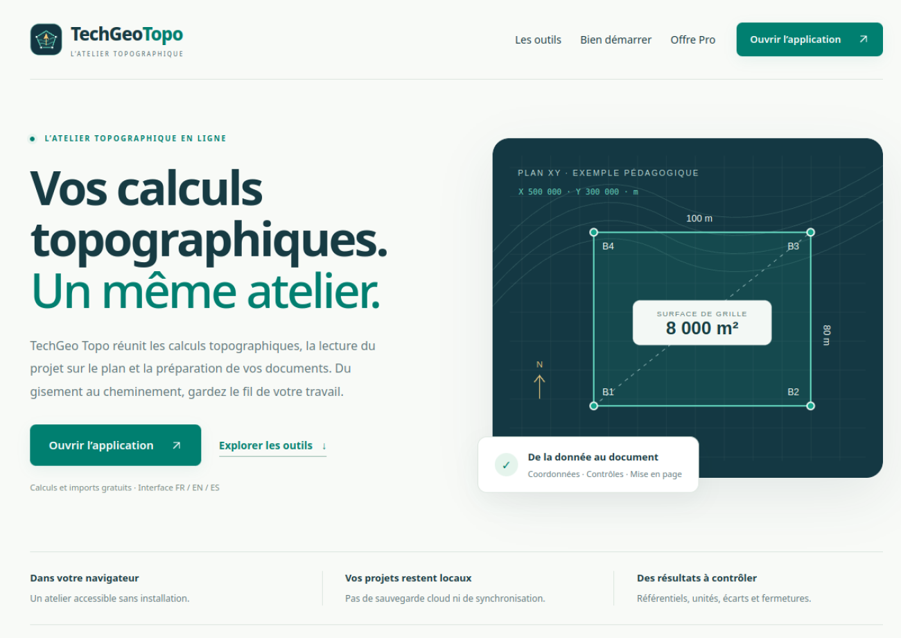
TechGeo Topo is a web-based surveying and geospatial application accessible at topo.techgeo.org. Its purpose is to connect coordinate geometry (COGO), field-survey computations, project visualisation, GIS data exchange and technical drawing workflows in one practical environment. It is built for common land surveying tasks, from calculating bearings and distances to preparing parcel-related plans and reports.
The platform is especially relevant to French-speaking surveying workflows, while also aiming to serve an international community of geomatics professionals and learners.
Online land surveying calculations: key modules
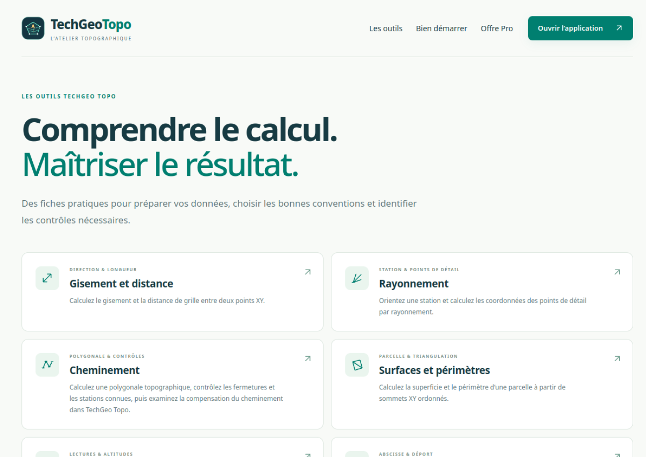
1. Gisement & distance — bearing and distance calculations
Given known coordinates, surveyors frequently need to calculate the direction and distance between points. The gisement and distance workflow supports coordinate-based orientation checks and computations that are fundamental to total-station surveys, cadastral work and parcel verification.
2. Rayonnement — radial surveying
The rayonnement workflow centres on a survey station and an orientation reference. It is intended for calculating or inspecting target-point coordinates from survey observations. Such calculations help connect field observations to a consistent project coordinate system.
3. Cheminement — traverse surveying
Traverse calculations are important when surveyors establish a sequence of connected stations. The cheminement module focuses on start and arrival references, successive observations and resulting coordinates. Independent closure checks and appropriate field control remain essential before using results professionally.
4. Nivellement, surface and alignement
Additional workflows cover levelling (nivellement), area computations, point alignment and coordinate-related checks. For parcel surveying, computing areas in the correct projected coordinate system—and understanding any required local correction—matters as much as drawing the boundary itself.
From survey observations to an interactive project map
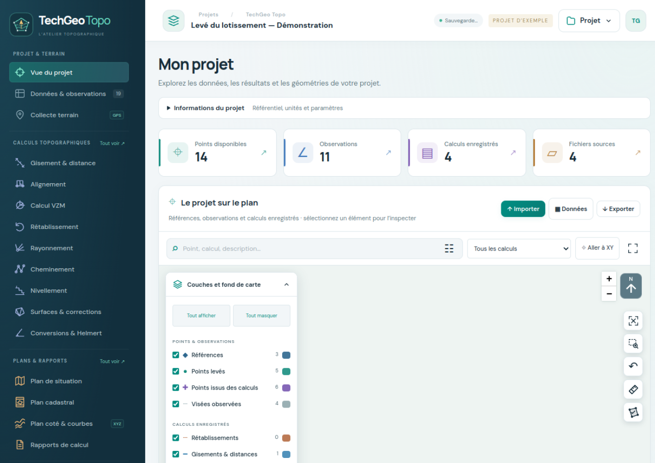
A key advantage of WebGIS-based topographic software is the connection between numeric results and map-based interpretation. TechGeo Topo brings project coordinates and related layers into a project view so that surveyors can inspect point positions, parcel outlines and spatial relationships visually.
For practical project organisation, the platform’s workflows encompass reference coordinates, observed or computed points, map layers and the selection of relevant points for calculations. Map viewing and calculation results complement one another; they are not a substitute for field verification.
Topographic plans, cadastral documents and technical reports
Beyond numerical calculations, technical surveying often requires structured deliverables. TechGeo Topo includes workflows oriented around:
- Plan topographique de situation: a location or site plan with mapping context, coordinates, scale and parcel boundaries.
- Plan coté: a surveyed plan showing point elevations and, where the required inputs are available, contour information.
- Plan cadastral: cadastral-style plan preparation, including formats familiar to Moroccan workflows such as ST25/ST26.
- Calculation reports: structured outputs for bearings, distances, traverse operations, levelling and parcel area calculations.
Depending on the selected module and available inputs, project workflows can involve PDF or DXF outputs. Always review generated documents, map scale, coordinate reference system, orientation, boundary geometry and local administrative requirements before official submission.
GIS file conversion and spatial data exchange
Surveying is rarely isolated from GIS. A boundary may arrive as a CAD drawing, a KML file, a shapefile or a coordinate table. TechGeo Topo includes GIS-oriented import, export and conversion workflows involving formats such as SHP, KML, DXF and DAT, helping users move project information between surveying and mapping environments.
Coordinate reference systems (CRS) are especially important here. Incorrect CRS assignments or transformations can shift points or distort computed areas. Before exchanging data, confirm the source CRS, the intended output CRS, the units and the transformation method.
Designed for topographic surveying in Morocco and beyond
TechGeo Topo places particular emphasis on workflows relevant to topographic surveying in Morocco. That includes French terminology familiar to local practitioners, parcel documentation and support for Moroccan projected coordinate-system workflows such as Merchich Nord Maroc / Zone 1. International projects still require users to verify and select an appropriate local CRS.
For those searching in French, the application is relevant to topics such as calcul de gisement et distance en ligne, rayonnement topographique, calcul de cheminement, nivellement, calcul de surface parcellaire, plan de situation topographique and conversion SHP KML DXF.
Example workflow: preparing a simple parcel project
- Start a project: identify the working area and select the correct coordinate reference system.
- Enter or import known coordinates: establish reference points, observations and parcel vertices.
- Run calculations: use the relevant bearing, traverse, radial or area tools and check closure and units.
- Inspect the project view: review points, labels, parcel geometry and surrounding mapping context.
- Prepare the required deliverable: use the appropriate plan or calculation-report workflow, then review the exported result.
This approach keeps the relationship between survey observations, computed coordinates and the final map easier to follow.
Who can benefit from TechGeo Topo?
- Professional land surveyors looking for a convenient way to organise and check standard calculations.
- Geomatics and GIS technicians who need to connect coordinate data, map layers and CAD/GIS formats.
- Civil engineering and land administration teams working with parcel boundaries and site documentation.
- Students and educators learning COGO, radial surveying, traverse computations and topographic plan preparation.
Frequently asked questions about TechGeo Topo
Is TechGeo Topo an online surveying tool?
Yes. It is designed as a browser-based WebGIS environment for surveying calculations and mapping workflows. Specific modules and availability may change as the application evolves.
Can I calculate parcel areas and survey bearings?
The platform includes workflows for bearings and distances, parcel areas and related surveying calculations. Check the coordinate reference system, units and calculation assumptions before relying on any output.
Does TechGeo Topo work with GIS and CAD files?
It includes file-management and conversion workflows for common geospatial formats such as SHP, KML, DXF and coordinate-based data. Format support may vary by tool and file structure.
Can the application replace professional survey validation?
No. Software can assist with calculation, visualisation and document preparation, but surveyors remain responsible for checking field measurements, control points, legal requirements and the suitability of outputs for their intended purpose.
Explore TechGeo Topo
If you work with topographic calculations, land surveying, parcel geometry or GIS data exchange, visit TechGeo Topo — Online Topographic Surveying & WebGIS Tools and explore the workflows that match your projects.
For additional background on coordinate computations and GIS workflows, see our guides to scientific calculators for surveyors and calculating polygon area in ArcGIS Pro.
Professional note: independently verify all measurements, coordinate transformations, geometries, calculations and exported plans before contractual, cadastral or official use. Features and formats may evolve as the platform is updated.