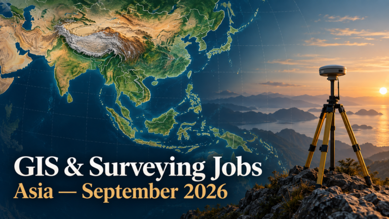
5 Current GIS, Remote Sensing & Land Surveying Jobs in Asia – October 2026
Asia’s current geospatial hiring spans forest monitoring in Indonesia, conservation mapping in India and research data engineering in Singapore. These five distinct openings were checked on 28 October 2026. Their themes include satellite image analysis, GIS quality assurance, spatial data pipelines, digital twins and geospatial AI. This selection includes full-time roles and one FAO national project appointment; it does not claim to represent every Asian country.
Job advertisements may be changed or closed by employers without notice. Every vacancy in this article was accessible and appeared open when checked on 28 October 2026. Always verify the details on the employer’s page before applying.
For context, compare our September Asia careers roundup, explore forest monitoring with remote sensing, and prepare with GIS interview questions.
Current GIS, remote sensing and surveying jobs in Asia
| Country | Job title | Employer | Location | Level/experience | Work arrangement | Posting date | Deadline | Salary | Application |
|---|---|---|---|---|---|---|---|---|---|
| Indonesia | GIS/Remote Sensing and MRV Specialist | FAO | Jakarta | Bachelor’s degree; 5+ years | National Project Personnel; location Jakarta | 26 Oct 2026 | 10 Nov 2026 (display varies by device time zone) | Not disclosed | View Job & Apply |
| India | Research Associate – Remote Sensing and GIS | Iora Ecological Solutions | New Delhi | Recent graduate or 1–2 years | Full-time; fieldwork possible | Not stated | Open until filled | Not disclosed | View Job & Apply |
| Singapore | Data Engineer (Geospatial and Agricultural Data Platform) | Illinois ARCS | CREATE Tower, Singapore | Bachelor’s degree; 3+ years | Full-time; occasional cross-time-zone meetings | 15 Oct 2026 | Until filled | Not disclosed | View Job & Apply |
| Singapore | Research Scientist (Remote Sensing and Knowledge-Guided AI) | Illinois ARCS | CREATE Tower, Singapore | PhD; extensive remote sensing and ML experience | Full-time; occasional field travel | 15 Oct 2026 | Until filled | Not disclosed | View Job & Apply |
| Singapore | Research Scientist (Geospatial AI and Regional Agroecosystem Modelling) | Illinois ARCS | CREATE Tower, Singapore | PhD; environmental modelling and ML | Full-time | 15 Oct 2026 | Until filled | Not disclosed | View Job & Apply |
Indonesia
1. GIS/Remote Sensing and MRV Specialist — FAO
FAO’s Indonesia office is recruiting a GIS and remote sensing specialist for the MERANTI forest-monitoring work. The assignment supports the National Forest Inventory, the National Forest Monitoring System and measurement, reporting and verification of forest outcomes. Work includes satellite image analysis, land-cover and forest-change assessment, integrating field plots with remotely sensed data, spatial quality control and technical support to partner institutions. The official call names SEPAL and Google Earth Engine among useful platforms. Applicants need a relevant bachelor’s degree, at least five years of experience in GIS, remote sensing, spatial data or forest monitoring, working English and Bahasa Indonesia, and Indonesian nationality. The advertised term is twelve months with a three-month probation period. FAO classifies this as National Project Personnel, not a permanent staff appointment. No pay figure is published. The closing time on the official page is device-time-zone dependent, so verify it on the application system. View the official vacancy and apply.
India
2. Research Associate – Remote Sensing and GIS — Iora Ecological Solutions
Iora Ecological Solutions lists two Research Associate openings in its remote sensing and GIS team in New Delhi. The work supports forestry, biodiversity and ecological restoration projects through satellite image processing, thematic mapping, data cleaning, land-use classification and change detection. The employer seeks recent graduates or candidates with one to two years of relevant experience in GIS, geoinformatics, geography, forestry or environmental science. Its tool list includes ArcGIS, QGIS, ERDAS Imagine, ENVI and SNAP; Google Earth Engine, Python or R familiarity is useful. Fieldwork in difficult terrain may be required. A candidate could show an accurately documented land-cover workflow and an example of map or database quality control. The official page provides an email application route and explicitly says applications remain open until the position is filled. It gives neither a publication date nor salary. View the official vacancy and apply.
Singapore
3. Data Engineer (Geospatial and Agricultural Data Platform) — Illinois ARCS
Illinois Advanced Research Center at Singapore seeks a data engineer for its agricultural digital-twin programme. The position connects field observations, sensors, satellite imagery and model outputs into analysis-ready geospatial data stores, then makes results available through APIs, portals and dashboards. The role also covers orchestration, testing, documentation and support for cloud or high-performance computing workflows. A relevant bachelor’s degree and at least three years building production pipelines and databases for large scientific or geospatial datasets are required, along with Python and SQL. The employer lists PostgreSQL/PostGIS, geospatial raster and vector formats, Docker and CI/CD as preferred experience. This is a full-time Singapore appointment, with applications considered until filled. The exact salary is not stated. Applicants are asked for a CV, cover letter, undergraduate transcripts and three professional referees through the call’s application process. View the official vacancy and apply.
4. Research Scientist (Remote Sensing and Knowledge-Guided AI) — Illinois ARCS
This Illinois ARCS scientist will lead Earth observation and geospatial AI research for crop digital twins across Southeast Asia. The post combines satellite, drone, field and IoT observations to map crops, environmental conditions and management practices. Outputs must feed process models and decision tools, so model-data fusion and reliable analysis-ready datasets matter as much as prediction accuracy. The official call requires a PhD in a relevant field, substantial satellite remote sensing and machine-learning experience evidenced by first-author publications, Python and a deep-learning framework. Google Earth Engine, multi-sensor fusion and radiative-transfer modelling are listed as useful experience. The base is Singapore, with occasional travel to Vietnam, Indonesia and the United States. It is a full-time role considered until filled; salary is not stated. Tailor the application around peer-reviewed research and reproducible Earth observation pipelines. View the official vacancy and apply.
5. Research Scientist (Geospatial AI and Regional Agroecosystem Modelling) — Illinois ARCS
Illinois ARCS also advertises a separate scientist role focused on scaling field-level crop digital twins to regional estimates across heterogeneous farms. The researcher will combine process-based environmental models, spatiotemporal machine learning and geospatial datasets to estimate yields and greenhouse-gas outcomes with quantified uncertainty. Responsibilities include developing surrogate models, model-data fusion and high-performance computing workflows, while collaborating with remote sensing and decision-support teams. The call requires a PhD in Earth or environmental science, hydrology, ecosystem modelling, computer science or a related field; extensive experience joining process models with machine learning; and strong Python and PyTorch skills. Experience with agricultural systems, data assimilation and regional geospatial analysis is preferred. This full-time post is based in Singapore and considered until filled. The employer does not publish a salary. Evidence of robust modelling and scientific communication will be especially relevant. View the official vacancy and apply.
Skills visible across these openings
These specific calls point to three clusters: satellite and field-data integration for forest and crop monitoring; dependable GIS data cleaning, classification and map production; and engineering for large geospatial datasets, APIs and reproducible models. Python appears in the Singapore roles and as a useful skill for the India role. Google Earth Engine appears in the FAO and scientist descriptions, while PostGIS is preferred for the Singapore data engineering position. Tailor a portfolio to the actual responsibilities of each employer rather than sending the same software list to all five.
How to apply across the region
For FAO Indonesia, check the nationality and language requirements on its official call before preparing an application. For Iora, connect a concise land-cover or conservation-mapping sample to its stated duties and use the email route given by the employer. For Illinois ARCS, show reproducible research or data systems, and prepare the requested transcripts, cover letter and referee details. Work authorisation and relocation support are not stated for the Singapore and India roles; ask the employer rather than assuming eligibility. Deadlines marked “until filled” can end without a fixed date.
Frequently asked questions
Are all five vacancies still accepting applications?
They appeared open on 28 October 2026, but employers can close a call at any time. Check each official page before submitting.
Are salaries available?
No salary figure was disclosed in the five checked calls. Ask the employer when appropriate.
Do I need a PhD?
The two Research Scientist calls require one. The FAO specialist, Iora associate and Illinois ARCS data engineer have different stated degree and experience requirements.
Can applicants from any country apply?
FAO explicitly requires Indonesian nationality for its national project post. The other call pages do not establish universal eligibility or visa support.
Next steps
Choose the role matching your experience, verify its live terms, and apply through its exact official page. Follow TechGeo Geo-News for the next regional careers update.