8 Current GIS, Remote Sensing & Land Surveying Jobs in the Arabian Gulf – October 2026
GIS jobs in the Arabian Gulf October 2026 are concentrated in enterprise GIS, satellite-data operations, infrastructure surveying, digital handover and spatially informed planning. This edition contains eight vacancies individually checked on 22 October 2026: five in the United Arab Emirates and three in Saudi Arabia, covering Al Ain, Dubai and Riyadh.
The strongest demand is for practitioners who connect spatial data with operational systems. ArcGIS Enterprise, geodatabases, Python, REST APIs, CAD/BIM integration, GNSS, total stations, remote-sensing imagery and data quality recur across the selected adverts. Experience requirements range from a bachelor’s-level satellite-data role to principal planning and senior enterprise-GIS positions.
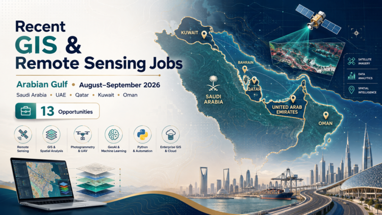
Qatar, Kuwait, Oman and Bahrain were searched, but no vacancy from those countries passed every freshness, relevance, open-status and duplicate check on the verification date. No role was added simply to create country coverage. For comparison, see the September Arabian Gulf roundup, the current Canada geospatial jobs edition and TechGeo’s GIS interview preparation guide.
Job advertisements may be changed or closed by employers without notice. Every vacancy in this article was accessible and appeared open when checked on 22 October 2026. Always verify the details on the employer’s page before applying.
Current Arabian Gulf GIS and Surveying Vacancies
On phones, every vacancy becomes a labelled card with a full-width application button. “Not stated” means the checked employer page supplied no value.
| Country | Job title | Employer | Location | Level/experience | Work arrangement | Posting date | Deadline | Salary | Application |
|---|---|---|---|---|---|---|---|---|---|
| United Arab Emirates | Satellite Data Specialist | United Arab Emirates University | Al Ain | Bachelor’s in data science, remote sensing, geospatial science or related field | Not stated | Not stated | 31 Dec 2026 | Not disclosed | View Job & Apply |
| United Arab Emirates | Platform Administrator (GIS) | AtkinsRéalis | Dubai | Bachelor’s; minimum 8 years in database, security and systems administration | Full-time; workplace arrangement not stated | Not stated | Not stated | Not disclosed | View Job & Apply |
| United Arab Emirates | Principal Urban Planner | AtkinsRéalis | Dubai | Bachelor’s; master’s preferred; minimum 15 years | Full-time; workplace arrangement not stated | 27 Sep 2026 | 26 Dec 2026 | Not disclosed | View Job & Apply |
| United Arab Emirates | Land Surveyor – Infrastructure Project | AECOM | Dubai | Minimum 8 years; at least 5 years in stormwater, wastewater or treatment-plant projects | On-site contract | 8 Oct 2026 | Not stated | Not disclosed | View Job & Apply |
| United Arab Emirates | Land Surveyor | AECOM | Al Ain | Diploma; minimum 7 years in infrastructure and civil works | On-site contract | 15 Oct 2026 | Not stated | Not disclosed | View Job & Apply |
| Saudi Arabia | GIS Specialist | Parsons | Riyadh | Bachelor’s; minimum 8 years in GIS or geospatial information management | Office-based, full-time | Portal displayed “posted 26 days ago” on 22 Oct 2026 | Not stated | Not disclosed | View Job & Apply |
| Saudi Arabia | GIS Developer | Devoteam | Riyadh | Mid-senior; enterprise GIS development experience | On-site, full-time; travel may be required | 6 Oct 2026 | Not stated | Not disclosed | View Job & Apply |
| Saudi Arabia | Landscape Architect | AECOM | Riyadh | Minimum 3 years; at least 1 year in Saudi Arabia or the Gulf | On-site, full-time | 14 Oct 2026 | Not stated | Not disclosed | View Job & Apply |
United Arab Emirates: Detailed Vacancy Profiles
1. Satellite Data Specialist — United Arab Emirates University
United Arab Emirates University is recruiting in Al Ain for a specialist who can turn raw satellite payload data into accurate, useful imagery and analysis. The work covers image-processing algorithms, data storage and distribution, mission planning, satellite-pass imaging, quality monitoring, visualisation and troubleshooting. A bachelor’s degree in data science, remote sensing, geospatial science or a related field is the minimum qualification. The preferred profile has basic knowledge of satellite data, GIS and mission planning, plus familiarity with Python or a comparable analytical language. This is a good fit for an early-career Earth-observation practitioner able to discuss reproducible processing and data-quality checks. Honest CV keywords include satellite imagery, image processing, remote sensing, Python, mission planning and data pipelines. The employer does not disclose salary or work arrangement. Applications are already open and the stated deadline is 31 December 2026. View Job & Apply.
2. Platform Administrator (GIS) — AtkinsRéalis
AtkinsRéalis needs a senior administrator in Dubai to maintain the data, systems and security foundations behind its Digital GIS services. Responsibilities include SQL Server administration, backup and recovery, database tuning, validation, Azure services, system hardening, virtualised servers, networks, user permissions and support for GIS deployments. The advert requests a related bachelor’s degree and at least eight years of hands-on database, information-security and systems-administration experience. It also names PowerShell or Bash, GeoPandas, Shapely, Rasterio, Fiona, Pandas, NumPy, SciPy, PySpark, Kubernetes and Esri solution installation among useful capabilities. This is infrastructure engineering for enterprise GIS, not a desktop cartography role. Honest CV keywords include SQL Server, ArcGIS Enterprise, Azure, ISO 27001, backup recovery and performance tuning. The role is full-time; a numeric salary, exact posting date and deadline are not stated. The employer page provides an active Apply now route. View Job & Apply.
3. Principal Urban Planner — AtkinsRéalis
AtkinsRéalis is seeking a principal urban planner to lead complex urban-development work in Dubai and across the UAE. The position combines planning strategy, land-use analysis, feasibility studies, policy submissions, multidisciplinary leadership and client management. GIS is required as a planning-analysis tool alongside broader industry software, so candidates should show how spatial evidence shaped a master plan or development decision rather than presenting GIS as an isolated skill. Applicants need a bachelor’s degree in urban or regional planning, urban design, architecture or a related field; a master’s is preferred. The advert asks for at least 15 years of professional experience and strong knowledge of UAE planning frameworks. Honest CV keywords include land-use planning, GIS analysis, master planning, feasibility, stakeholder coordination and UAE approvals. The full-time vacancy was posted on 27 September and its structured employer data shows 26 December 2026 as the closing date. Salary is not disclosed. View Job & Apply.
4. Land Surveyor – Infrastructure Project — AECOM
AECOM’s Dubai contract vacancy focuses on accurate surveying for sewerage-treatment and related infrastructure projects. The surveyor will lead site assessments, operate modern survey equipment, analyse measurements, prepare technical reports and plans, and coordinate a surveying team. AutoCAD, GIS and survey-data analysis are expressly named. The experience threshold is at least eight years overall, including five years on stormwater, wastewater or sewerage-treatment work; prior Dubai Municipality approval is preferred. This is a distinct project-specific role, not a repeat of the generic Dubai survey adverts used in the previous Gulf edition. A suitable application should document control and setting-out work, instrument checks, coordinate management and finished deliverables. Honest CV keywords include treatment plant, topographic survey, AutoCAD, GIS, survey QA/QC and technical documentation. The posting is dated 8 October 2026. No salary or closing date is disclosed, and the role is listed as an on-site contract. View Job & Apply.
5. Land Surveyor — AECOM
AECOM is hiring an Al Ain land surveyor for roads, utilities, pipelines, drainage, sewerage, structures and landscaping works. Core duties include maintaining control points and benchmarks, reviewing construction drawings, verifying horizontal and vertical alignments, checking excavation and pipe-invert levels, inspecting contractor setting-out and producing accurate records. The advert requests a diploma in civil engineering, survey engineering or land surveying and a minimum of seven years of relevant infrastructure experience. Candidates should be proficient with total stations, GPS/GNSS and digital levels and understand control networks, profiles, as-built surveys and survey QA/QC. UAE or wider Gulf experience is preferred, not stated as mandatory. Honest CV keywords include GNSS, total station, benchmarks, utility setting-out, as-built verification and infrastructure survey. The job was posted on 15 October 2026 and is an on-site contract. Salary and application deadline are not disclosed; the employer’s application control was active when checked. View Job & Apply.
Saudi Arabia: Detailed Vacancy Profiles
6. GIS Specialist — Parsons
Parsons’ Riyadh GIS Specialist will lead geospatial delivery for a major airport and infrastructure programme. The work spans enterprise and project geodatabases, utilities and asset layers, survey/CAD/BIM integration, coordinate systems, spatial conflict checks, dashboards, construction logistics and digital handover. Applicants need a relevant bachelor’s degree and at least eight years in GIS, geospatial information management, infrastructure mapping or digital engineering. ArcGIS Pro, Online and Enterprise are central; AutoCAD or Civil 3D, Python, FME and SQL are desirable. Airport, airfield and underground-utility experience is especially valuable. Honest CV keywords include airport GIS, ArcGIS Enterprise, geodatabase, BIM–GIS integration, asset information, metadata and spatial QA. The official portal displayed the vacancy as posted 26 days earlier when checked on 22 October; it remains within the accepted 30-day window. It is full-time and office-based. Salary and deadline are not stated. View Job & Apply.
7. GIS Developer — Devoteam
Devoteam’s Riyadh developer role is for a mid-senior practitioner who can build and integrate enterprise GIS rather than only configure maps. Responsibilities include web applications, executive dashboards, ArcGIS Maps SDK for JavaScript, Experience Builder, Python and ArcPy automation, REST APIs and integration with business systems such as Microsoft Dynamics 365. The developer will also configure and secure ArcGIS Enterprise, Portal, Server and enterprise geodatabases while troubleshooting services and data flows. A bachelor’s degree in computer science, computer engineering, GIS, geomatics, engineering or a related field is requested in the detailed criteria. This suits someone who can explain architecture decisions and production support as clearly as code. Honest CV keywords include ArcGIS Enterprise, JavaScript SDK, REST API, ArcPy, enterprise geodatabase and systems integration. The full-time role was posted on 6 October 2026, is based on-site and may involve project travel. Salary and deadline are not disclosed. View Job & Apply.
8. Landscape Architect — AECOM
AECOM’s Riyadh landscape-architecture role includes substantial spatial planning and environmental analysis, making it relevant to GIS practitioners with a design portfolio. The employee will develop landscape concepts and master plans, assess sites, communicate proposals through 3D and digital mapping, and integrate sustainability across Gulf projects. Required tools include GIS and digital mapping for environmental analysis, plus SketchUp, Revit or comparable BIM and visualisation platforms and Adobe Creative Suite. The advert requests at least three years of professional landscape-architecture experience and one year in Saudi Arabia or the wider Gulf. Applicants should show site analysis and mapping within a real design process, not claim that GIS alone substitutes for landscape training. Honest CV keywords include site suitability, environmental mapping, spatial planning, GIS, BIM, arid-climate design and sustainability. The full-time on-site job was posted on 14 October 2026. Salary and deadline are not disclosed. View Job & Apply.
Skills in Demand Across These Arabian Gulf Vacancies
The eight adverts point to a market where GIS is tightly linked to infrastructure delivery, authoritative data and operational decision-making. The mix is not limited to conventional map production: it includes satellite mission support, enterprise platform administration, airport asset information, web development, field surveying, urban planning and environmental design.
Enterprise GIS, databases and integration
Parsons, Devoteam and AtkinsRéalis all need people who understand the systems behind spatial services. ArcGIS Enterprise, Portal, Server, SQL databases, user access, REST APIs and performance or security controls appear across their requirements. A strong portfolio should explain data flow, permissions, validation and operational support. If you automated work with Python, ArcPy, FME or PowerShell, show the input, checks, output and measurable effect. Avoid listing enterprise products without being able to describe deployment, service publication, troubleshooting or governance.
CAD, BIM, survey and asset handover
The Parsons airport role and both AECOM survey vacancies show how field measurements and engineering records enter a final information environment. Employers value coordinate-system knowledge, benchmarks, topographic and as-built surveys, utilities, CAD conversion and BIM–GIS alignment. Survey applicants should name only instruments and methods they have actually used. GIS applicants should explain how geometry and attributes were checked before data entered an asset register, geodatabase or digital handover package.
Remote sensing and image-processing operations
United Arab Emirates University’s vacancy is the clearest remote-sensing role. It combines payload-data processing, imagery algorithms, satellite-pass planning and data delivery rather than treating Earth observation as occasional image interpretation. Candidates should distinguish optical or other sensor experience, programming, radiometric or geometric processing, quality checks and visualisation. Academic projects can be useful evidence if the workflow and validation are clearly documented.
Spatial planning and environmental design
The planning and landscape roles use GIS within wider professional practice. The principal planner must connect land-use evidence to policy, feasibility and master planning; the landscape architect uses mapping and site assessment inside design decisions for arid Gulf environments. Applications should therefore pair spatial analysis with planning or design outcomes. A polished map is useful, but the recruiter also needs to understand what decision it supported and which local or project constraints were considered.
Application Advice for the Arabian Gulf
Tailor the opening summary to the project type
Lead with the strongest match: airport GIS, utilities, treatment plants, satellite operations, urban planning or landscape design. State the number and type of projects you worked on only when you can substantiate them. For senior vacancies, include governance, stakeholder and delivery responsibilities alongside software. For surveying roles, identify whether your experience covers contractor setting-out, consultant verification, as-built records or field-team leadership.
Use a compact technical evidence section
Group tools by function rather than producing one long software list. For example: enterprise GIS and web services; Python or ETL automation; CAD/BIM interoperability; GNSS and field survey; remote-sensing processing; databases and security. Add one outcome beneath each relevant group. Recruiters can then see whether ArcGIS, SQL or AutoCAD was used in production, training or only academic coursework.
Describe regional experience accurately
Several roles value familiarity with UAE, Saudi or wider Gulf projects. Do not convert a short assignment into years of regional experience. Mention the authority, project standard or approval process only if it was genuinely part of your work. The AECOM treatment-plant vacancy prefers previous Dubai Municipality approval, while the Al Ain survey role says UAE or Gulf experience is preferred. These are different conditions and should not be presented as universal licensing rules.
Confirm work authorization, visa and relocation terms
The selected pages do not promise visa sponsorship or relocation. An active Apply button is not evidence of immigration support. Before accepting costs or making travel plans, ask the employer about employment eligibility, visa processing, medical checks, mobilisation, housing or transport allowances and the contractual work location. The AtkinsRéalis platform advert lists a benefits package but no numeric salary; do not treat benefits language as a guaranteed offer to every applicant.
Check deadlines and retain evidence
UAEU’s deadline extends to 31 December and the AtkinsRéalis planning page shows 26 December 2026. These next-month deadlines are included because applications were already open on 22 October. Other employers do not state closing dates and may close once a shortlist is complete. Save the requisition number, vacancy URL, submitted CV and confirmation email. Reopen the page immediately before submitting.
How This Roundup Was Verified
Individual employer pages were opened to confirm a current application control or active instructions. TechGeo posts from the previous 90 days were searched by URL and by employer, title and location. Older AECOM and Parsons adverts used in the September Gulf edition were excluded even when a similar role had a different-looking search result. The two AECOM survey vacancies retained here have new requisition IDs and clearly different locations or project scopes from the previously published adverts.
Search pages, generic career homepages, closed Dubai government listings, expired deadlines, electrical gas-insulated-switchgear roles, and postings outside the 30-day window were removed. Relative age is reproduced cautiously: Parsons displayed “posted 26 days ago” on the verification date, so the table does not invent an exact calendar date. Where the employer gave no posting date, deadline or salary, the article says “Not stated” or “Not disclosed.”
Frequently Asked Questions
Were all eight jobs accepting applications on 22 October 2026?
Yes. Each selected employer page exposed an application control or current application instructions when checked. Employers may still amend or close adverts without notice, so confirm status immediately before submitting.
Are there entry-level opportunities?
The UAEU satellite-data role lists a bachelor’s degree as its minimum and emphasises foundational satellite, GIS and Python knowledge. Most other vacancies require substantial professional experience, from three years for the landscape role to 15 years for principal planning.
Which vacancy is best for a remote-sensing specialist?
UAEU’s Satellite Data Specialist is the most direct match because it covers satellite imagery, image-processing algorithms, mission planning and payload-data operations. The other roles are primarily enterprise GIS, surveying, planning or design positions.
Do these employers sponsor work visas?
No selected advert explicitly confirms sponsorship. Candidates who need permission to work should ask the employer before making relocation commitments. Benefits or an international employer brand do not by themselves establish visa support.
Why are Qatar, Kuwait, Oman and Bahrain absent?
They were searched, but available leads were closed, older than the accepted window, irrelevant, login-only or lacked a verifiable individual application route. Accuracy took priority over forcing every country into the table.
Choose a Focused Next Step
These geospatial careers in the Arabian Gulf reward candidates who can connect reliable spatial data with infrastructure, enterprise platforms, imagery or planning decisions. Select the closest match, tailor evidence to the actual responsibilities and verify the employer page before submitting. Visit TechGeo Geo-News for the next regional update, covering North Africa.