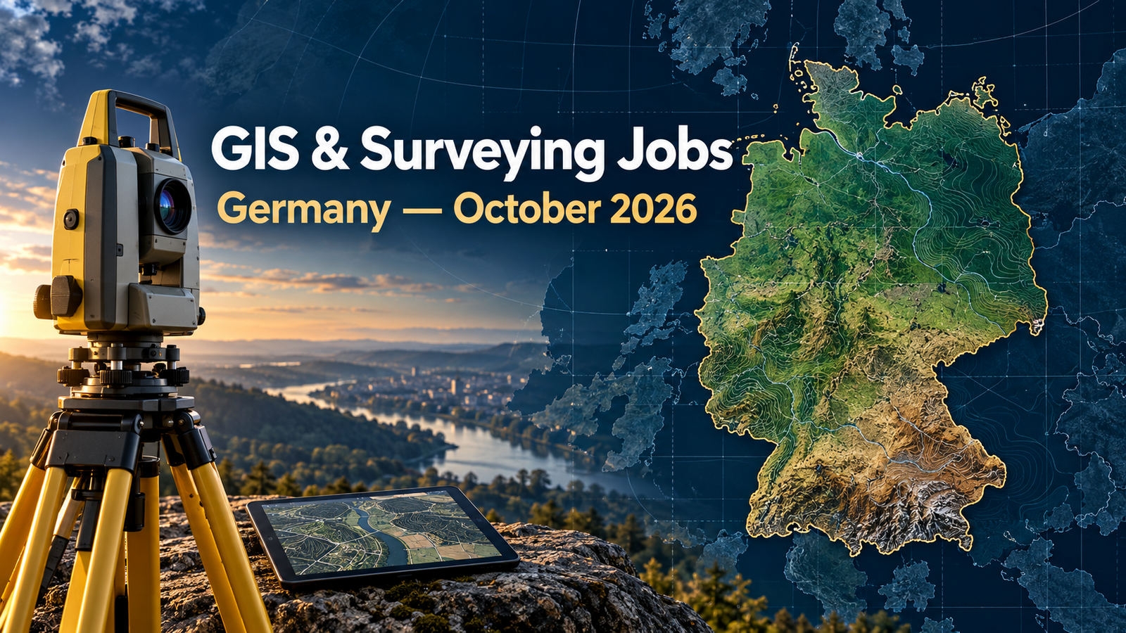
11 Current GIS, Remote Sensing & Land Surveying Jobs in Germany – October 2026
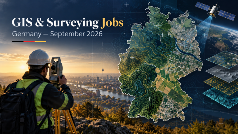
GIS jobs in Germany October 2026 cover a practical cross-section of the country’s geospatial market: federal cartography, municipal cadastre, engineering surveying, rail geometry, construction measurement and structured entry routes into geomatics. This roundup contains 11 vacancies that were individually checked on 13 October 2026. The locations represented include Euskirchen, Stuttgart, Karlsruhe, Lübeck, Höxter, Duisburg, Gelsenkirchen, Hamburg, Hannover and Hachenburg.
The strongest demand in this selection is for geodesy and surveying graduates who can connect accurate field measurement with dependable digital records. Employers mention GNSS, ALKIS, railway alignment, CAD, topographic mapping, quality assurance, GIS and point-cloud or remote-sensing workflows. The list also includes two paid education routes for applicants beginning their careers. For comparison across Europe, see TechGeo’s current roundups for the United Kingdom, France and Spain.
Job advertisements may be changed or closed by employers without notice. Every vacancy in this article was accessible and appeared open when checked on 13 October 2026. Always verify the details on the employer’s page before applying.
Current GIS and Land Surveying Jobs in Germany
The table is designed to remain readable on a phone: each desktop row becomes a labelled card at 700 pixels and below. “Not stated” means the employer did not publish the information on the checked vacancy page; it is not an estimate.
| Country | Job title | Employer | Location | Level/experience | Work arrangement | Posting date | Deadline | Salary | Application |
|---|---|---|---|---|---|---|---|---|---|
| Germany | Engineer – Geoinformation | Bundeswehr Geoinformation Centre | Euskirchen | Bachelor/Diploma FH; GIS and QA experience desired | Permanent; full-time or part-time; home office possible | 18 Sep 2026 | 15 Oct 2026 | A10–A11 BBesG or up to E10 TVöD | View Job & Apply |
| Germany | Geomatics Apprentice | LGL Baden-Württemberg | Stuttgart | Secondary-school qualification; entry level | Three-year dual vocational training | 28 Sep 2026 | 30 Oct 2026 | €1,356.82–€1,460.61 gross/month by training year | View Job & Apply |
| Germany | Geomatics Apprentice | LGL Baden-Württemberg | Karlsruhe | Secondary-school qualification; entry level | Three-year dual vocational training | 28 Sep 2026 | 30 Oct 2026 | €1,356.82–€1,460.61 gross/month by training year | View Job & Apply |
| Germany | Property Valuation Office Specialist | LVermGeo Schleswig-Holstein | Lübeck | Relevant Bachelor/Diploma; valuation experience | Permanent; 19.35 hours/week; flexible/mobile work | 28 Sep 2026 | 25 Oct 2026 | Up to EG 11 TV-L (technical degree) or EG 10 TV-L | View Job & Apply |
| Germany | Survey Engineer – Geobase Data | Kreis Höxter | Höxter | Bachelor/Diploma FH; graduates considered | Permanent; full-time or part-time from 50% | Not stated | Not stated; application portal active | EG 11 TVöD or A11 LBesO A NRW | View Job & Apply |
| Germany | Survey Engineer | DB InfraGO | Hamburg or Hannover | Geodesy/geomatics degree; relevant experience | Permanent; full-time or part-time | Not stated | Not stated; applications open | Not disclosed | View Job & Apply |
| Germany | Senior Survey Engineer – Railway Alignment | DB Engineering & Consulting | Duisburg | Surveying degree; at least five years in rail/alignment | Permanent; full-time | Not stated | Not stated; applications open | Not disclosed | View Job & Apply |
| Germany | Junior Survey Engineer – Track Geometry | DB InfraGO | Karlsruhe or Stuttgart | Relevant degree; graduate/direct-entry role | Permanent; full-time or part-time | Not stated | Not stated; applications open | Not disclosed | View Job & Apply |
| Germany | Survey Engineer – Civil Infrastructure | STRABAG | Hachenburg (Westerwald) | Degree, technician qualification or equivalent; experience advantageous | Permanent; full-time | Not stated | Not stated; application button active | Construction-sector collective agreement; amount not disclosed | View Job & Apply |
| Germany | Surveying Technician Apprentice | City of Duisburg | Duisburg | School-leaver entry; Hauptschulabschluss | Full-time vocational training; starts 1 Sep 2027 | Not stated | 31 Oct 2026 | €1,368.26–€1,464.02 gross/month by training year | View Job & Apply |
| Germany | Bachelor of Engineering – Surveying | City of Gelsenkirchen | Gelsenkirchen | University-entry qualification; paid degree route | Seven-semester full-time funded study programme | Not stated | 31 Oct 2026 | €1,550 gross/month stated | View Job & Apply |
Detailed Germany Vacancy Guide
1. Engineer – Geoinformation — Bundeswehr Geoinformation Centre
The Bundeswehr’s geoinformation centre in Euskirchen needs an engineer to design topographic and thematic maps for geospatial advisory products, define technical specifications, run quality assurance and lead a QA unit. Applicants need a Bachelor’s or FH diploma in cartography, surveying, geodesy, geoinformatics or a comparable geoscience subject. GIS, quality-management and project-management experience are desirable, and the notice specifies at least A2 English. The role also requires regular domestic travel and continuing training. Useful CV keywords include thematic cartography, topographic mapping, GIS, map specifications, quality assurance, project management and team leadership. The permanent post can be full-time or part-time and allows home office. Pay is stated as A10–A11 for the civil-service route or up to E10 TVöD for employees. The application deadline is 15 October, so candidates should submit complete translated and recognised qualification documents promptly where relevant. View Job & Apply.
2. Geomatics Apprentice — LGL Baden-Württemberg, Stuttgart
LGL’s Stuttgart apprenticeship is a three-year vocational route into the collection, processing, quality control and presentation of geodata. Trainees combine classroom teaching with practical work in an authority responsible for geoinformation and land development. The employer looks for a secondary-school qualification with good to satisfactory results in mathematics and geography, alongside spatial reasoning, technical understanding, accuracy and confidence with computers and digital media. Candidates with foreign qualifications are asked to provide German equivalency evidence. Appropriate application language includes digital cartography, GIS, geodata acquisition, data quality, spatial reasoning and digital-media skills—supported by school projects or genuine experience. The programme starts on 1 September 2027 and follows the TVA-L-BBiG scale, from €1,356.82 gross per month in year one to €1,460.61 in year three, plus a November special payment. Applications are due 30 October. View Job & Apply.
3. Geomatics Apprentice — LGL Baden-Württemberg, Karlsruhe
The Karlsruhe opening follows the same recognised Geomatiker training framework but provides a separate location and application reference. Trainees learn how geodata moves from acquisition through processing, qualification and delivery, building foundations for public-sector GIS, cartography and spatial-data operations. LGL requests a suitable secondary-school qualification, good to satisfactory mathematics and geography results, technical and geometric understanding, careful working habits and the ability to collaborate. Candidates should use their application to show curiosity about digital maps and evidence of reliability rather than claiming professional experience they do not yet have. The three-year programme begins on 1 September 2027, may be shortened for exceptional performance and includes flexible working hours, transport support and other public-service benefits. Training pay is €1,356.82, €1,410.96 and €1,460.61 gross per month across the three years. The closing date is 30 October. View Job & Apply.
4. Property Valuation Office Specialist — LVermGeo Schleswig-Holstein
LVermGeo Schleswig-Holstein is recruiting a permanent half-time specialist in Lübeck for the office supporting property-valuation committees. The work includes preparing site visits and committee meetings, contributing to valuation-report drafts, checking plausibility, answering enquiries and maintaining purchase-price data. Applicants need a relevant degree in geomatics, surveying, civil engineering, architecture, real estate or a comparable discipline. The advert also asks for property-valuation experience, basic knowledge of land and planning law, a Class B licence and German at C1. Honest CV keywords include property valuation, cadastral information, purchase-price databases, market analysis, land law, plausibility checking and report preparation. Mobile and flexible work are offered. Depending on the qualification route, pay can reach EG 11 TV-L for a technical degree or EG 10 TV-L for a non-technical degree. Applications close on 25 October. View Job & Apply.
5. Survey Engineer – Geobase Data — Kreis Höxter
Kreis Höxter’s geobase-data team needs a survey engineer to update ALKIS and the official base map, capture topographic objects with satellite-supported measurement methods, qualify survey results and review submitted building-survey records. A Bachelor’s or FH diploma in geodesy or surveying is required. Experience with Trimble instruments, ALKIS—particularly ibR or VertiGIS—and cadastral maintenance is advantageous, but the employer explicitly says graduates can be considered. German comparable to C1, a Class B licence and willingness to travel locally are stated. Strong CV terms include ALKIS, official base map, cadastral maintenance, GNSS, topographic survey, data qualification and survey-document review. The role is permanent and can be split into part-time arrangements from 50%, subject to service coverage. Remuneration is EG 11 TVöD or A11 LBesO A NRW. The employer page and online application route were active on the verification date; no closing date was displayed. View Job & Apply.
6. Survey Engineer — DB InfraGO
DB InfraGO is hiring in Hamburg or Hannover for railway engineering-survey projects covering track, bridges, platforms and level crossings. The engineer plans and delivers surveys, carries out geometric and dynamic alignment calculations, manages technical and commercial tasks and evaluates third-party work. A distinctive part of the role is planning and processing GNSS campaigns for the DB_REF2016 reference network. Applicants need a degree in surveying, geodesy, geoinformatics, geomatics or a comparable field, plus relevant technical experience. CAD, contemporary measurement equipment, SAP R/3, railway alignment and infrastructure-planning knowledge are useful themes for a truthful application. A Class B licence and occupational health suitability are required. The role is permanent and can be full-time or part-time. No salary or final closing date is published; the employer page explicitly stated that applications were still possible when checked. View Job & Apply.
7. Senior Survey Engineer – Railway Alignment — DB Engineering & Consulting
This senior Duisburg vacancy focuses on railway alignment and the office-based processing of engineering-survey data. Responsibilities include deriving existing and proposed track alignments, running target-versus-actual comparisons, improving methods, assuring schedule, cost and quality, preparing offers and coordinating with project teams and downstream disciplines. Applicants need a surveying degree or comparable qualification with a rail focus and at least five years of experience in railway surveying and alignment. The advert names geodetic coordinate systems, current instruments and ProVI; GL-Survey, Betan/Neptan, Verm.esn and GND-Edit are desirable. Appropriate CV keywords include railway surveying, track geometry, alignment design, ProVI, geodetic reference systems, quality control, project responsibility and commercial management. This is a permanent full-time role. Salary and deadline are not disclosed, but the official page showed an active application button on 13 October. View Job & Apply.
8. Junior Survey Engineer – Track Geometry — DB InfraGO
DB InfraGO’s junior role in Karlsruhe or Stuttgart offers a direct graduate entry into track-geometry planning. The engineer performs geometric investigations, supports infrastructure projects, manages technically correct surveying delivery, decides when to commission internal or external engineering services, checks incoming plans and keeps implemented measures documented in asset systems. Candidates need a degree in surveying, geodesy or a comparable field; the employer does not specify a fixed minimum number of years. Very good written and spoken German, reliable independent work and commercial awareness are stated, with an occupational health assessment forming part of the selection process. Relevant CV keywords include track geometry, engineering surveying, project control, quality review, asset documentation and infrastructure planning. The position is permanent and available full-time or part-time. No salary or fixed deadline is published; DB states that applications remain possible while the page is live. View Job & Apply.
9. Survey Engineer – Civil Infrastructure — STRABAG
STRABAG’s Hachenburg team is recruiting a survey engineer for earthworks, roads and civil-infrastructure delivery. Work includes control, as-built and construction surveys with GNSS and total stations; preparation of stake-out, inventory and billing plans; quantity calculations; monitoring measurements; and the set-up or supervision of machine-control systems. Applicants can qualify through a surveying or civil-engineering degree, a surveying-technician qualification or a comparable background. Experience is advantageous rather than stated as an absolute threshold. Knowledge of RIB iTWO or Arriba, CARD/1 and common surveying instruments is useful. Honest CV keywords include construction surveying, GNSS, total station, stake-out, quantities, CAD plans, machine control and infrastructure projects. The role is full-time, and the employer refers to the construction-sector collective agreement without publishing a euro figure. The exact job page and application button were active when checked. View Job & Apply.
10. Surveying Technician Apprentice — City of Duisburg
The City of Duisburg is offering vocational training for future surveying technicians beginning 1 September 2027. The role introduces the measurement and geodata workflows that support municipal navigation, planning, GIS and legally reliable spatial decisions. Theory is delivered through Berufskolleg Ost in Essen, while municipal teams provide practical experience. The stated entry requirement is a Hauptschulabschluss, making this one of the most accessible starting points in the roundup. Applicants should emphasise mathematics, spatial thinking, outdoor and computer-based work, accuracy, teamwork and genuine interest in maps or measurement. Training is full-time and offers flexible hours, possible mobile work depending on assignment, a learning-material allowance and a completion bonus. Monthly gross pay is €1,368.26 in year one, €1,418.20 in year two and €1,464.02 in year three. Applications close on 31 October. View Job & Apply.
11. Bachelor of Engineering – Surveying — City of Gelsenkirchen
Gelsenkirchen’s funded Bachelor of Engineering route combines university study with practical placements in the city’s surveying and cadastral department. The seven-semester programme covers terrestrial survey methods, GNSS, cadastral work, drone imagery, Copernicus satellite data, terrestrial and airborne laser scanning, point clouds and Web GIS. Applicants need a general university entrance qualification or full Fachhochschulreife, must satisfy Hochschule Bochum’s admission conditions and pass the city’s selection process. The role suits candidates who want both field and office work and can demonstrate mathematics, technical curiosity and careful spatial reasoning. Useful application keywords include photogrammetry, LiDAR, point clouds, remote sensing, GNSS, Web GIS, cadastral survey and 3D city data—but only where supported by study, projects or real exposure. The programme begins in winter semester 2027/28 and states compensation of €1,550. Applications close on 31 October. View Job & Apply.
Skills in Demand Across Germany’s Geospatial Vacancies
Field measurement connected to authoritative data
These vacancies repeatedly connect measurement technology with regulated or operational databases. Kreis Höxter combines GNSS field capture with ALKIS maintenance; DB connects survey campaigns to track geometry and a corporate reference network; STRABAG converts site measurements into stake-out, as-built and billing plans. Strong applications explain the full chain from observation to checked deliverable. Name instruments and software only when you can describe how you used them, which checks you applied and what downstream decision depended on the result.
Quality assurance, documentation and legal context
The federal mapping role centres on cartographic specifications and QA, while LVermGeo and Kreis Höxter work inside property valuation and cadastral frameworks. This means employers value traceability as much as attractive maps. Useful evidence includes data-validation rules, documented survey adjustments, metadata, review of third-party submissions, reproducible calculations and experience working under surveying or planning rules. For public roles, candidates should also follow reference numbers and document requirements exactly.
Infrastructure geometry and specialist software
Rail and construction roles demand more than generic GIS familiarity. Track alignment, coordinate systems, GNSS reference networks, CAD, ProVI and quantity calculation appear alongside project delivery. The strongest CVs link software to outcomes: a verified alignment, an accepted as-built plan, an accurate quantity model or a reduced rework rate. Applicants without railway experience should not present general surveying as equivalent to the senior DB requirement; the junior DB vacancy is the more realistic route.
Multiple entry levels
This month’s selection spans apprenticeships, a funded degree, a graduate-level junior position and experienced engineering posts. The distinction matters. School-leaver applications should emphasise mathematics, geography, digital confidence and precision. Graduate applications should foreground relevant projects and practical modules. Senior applicants need evidence of technical ownership, coordination, schedule and cost responsibility—not just a long software list.
How to Apply for Geospatial Jobs in Germany
Keep a German application concise and vacancy-specific. Use the employer’s exact title and reference number, then match each essential criterion with short evidence. A technical project description should identify the spatial problem, data source, instrument or software, your responsibility, validation method and result. If the advert requests certificates, transcripts, recognition of a foreign qualification or translated documents, include them in the requested format rather than waiting for follow-up.
Language and public-service eligibility vary. The Bundeswehr role states at least A2 English but is built around German public administration; the Höxter and Lübeck roles explicitly require German around C1. The federal advert explains that German citizenship is relevant to civil-service appointment, while an employee route may be assessed differently. None of the checked pages promises visa sponsorship or relocation support, so international applicants should not infer it. Verify work-authorisation, recognition and language conditions with the employer before applying.
For additional application ideas and regional comparisons, review TechGeo’s October United States roundup and the wider Geo-News archive.
Frequently Asked Questions
Are there entry-level GIS or surveying opportunities in Germany this month?
Yes. The Stuttgart and Karlsruhe geomatics apprenticeships accept school-leaver profiles, Duisburg offers surveying-technician training, Gelsenkirchen offers a funded surveying degree and DB’s track-geometry role is explicitly positioned for junior or direct graduate entry.
Which technical skills appear most often?
GNSS, total-station measurement, CAD, cadastral or authoritative geodata, quality assurance and infrastructure geometry recur. Individual adverts add ALKIS, Trimble, ProVI, CARD/1, point clouds, laser scanning, photogrammetry, Copernicus data and Web GIS.
Can I apply without professional German?
That depends on the advert, but professional German is important for most roles here. Lübeck and Höxter explicitly refer to C1-level German, and the DB junior role requests very good written and spoken German. Do not assume an English-only application will be accepted when the page is in German.
Do these vacancies offer visa sponsorship?
No checked vacancy explicitly promises sponsorship. Public-service roles may also have qualification-recognition, citizenship or civil-service conditions. Treat sponsorship and work authorisation as unresolved unless the employer confirms them directly.
How current is this roundup?
Every listed page was accessible and appeared open on 13 October 2026. Fixed deadlines range from 15 to 31 October, while several employer pages remain open without publishing a closing date. Recheck the original advert immediately before submitting.
Plan Your Next Geospatial Career Move
Germany’s October selection shows a market grounded in measurement accuracy and operational responsibility. The opportunities range from learning how public geodata is created to leading railway-alignment work, with cadastre, GNSS, cartography, remote sensing and 3D data connecting the field. Prioritise roles whose qualification and language conditions genuinely fit, tailor evidence to the published tasks and submit before the stated deadline. Visit TechGeo Geo-News for the next regional careers update.