AI in Geospatial Data Clustering – Spatial Grouping
Unlocking Insights with AI in Geospatial Data Clustering: Spatial Grouping
What is Geospatial Data Clustering and How Does AI Enhance It?
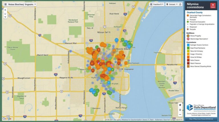
Geospatial data clusters represent a powerful tool for analysis, allowing us to discern geographic patterns and trends. In simple terms, they group geographically proximate data points (often locations) based on their similarities. Think of it like creating neat clusters around cities, counties, or even specific areas in a region. This technology has been revolutionized by Artificial Intelligence, paving the way for advanced, context-rich insights that were previously unimaginable.
AI-Powered Geospatial Clustering: Key Features
Let’s delve into how AI elevates the art of geospatial data clustering:
Advanced clustering algorithms:
- K-means and Gaussian Mixture Models: Traditional groupings based on distance or density measurements.
- Supervised and Unsupervised Learning: AI algorithms learn from previously defined or inherent patterns within data.
Handling Big Data
- Distributed Computing: Processing vast amounts of geospatial data across systems for efficient analysis.
- Parallel Processing: Solving it simultaneously instead of sequentially, significantly reducing processing time.
Feature Extraction and Enrichment
- Incorporation of Additional Features: AI models consider features beyond just location, like elevation, road networks, land use, and more.
- Data Preprocessing: Techniques like outlier detection and feature scaling are applied to enhance clustering accuracy.
Benefits of Using AI for Geospatial Data Clustering
The application of AI in clustering brings extensive benefits. Let’s explore some key advantages:
Enhanced Accuracy
- Accuracy and Precision: AI algorithms can identify distinct patterns and relationships with greater precision.
- Noise reduction: AI models sift through background noise to isolate key clusters, reducing deployment errors and misleading interpretations.
Improved Efficiency and Scalability
- Faster Processing Speed: AI algorithms can analyze data at blazing speeds, allowing more data to be processed in smaller time scales.
- Cost-Effective Solutions: Optimizes resources by targeting the most valuable data analyses for efficient results.
Sectors Driven by AI in Geospatial Data Clustering
The potential of AI-driven geospatial data clustering extends to numerous industries, leading to innovative solutions.
Urban Planning and Management:
- Predictive analysis of disaster risks and mitigation: AI can examine geospatial patterns to alert officials to specific pre-defined areas requiring intervention.
- Traffic management and optimization: Increasing traffic predictions and reducing congestion by analyzing travel patterns.
- Urban development: Identifying feasible sites for development and building.
Environmental Monitoring and Conservation:
- Identifying pollution hotspots: By analyzing data about air quality and soil contamination.
- Preserving natural resources: Identifying endangered species habitats, promoting conservation efforts, and tracking their parameters.
Healthcare and Public Safety
- Disease Outbreak Tracking: AI can quickly identify patterns in disease transmission to forecast density and implement mitigation plans.
- Emergency Response Planning: AI can assist emergency services by predicting the movement of resources and identifying efficient routes to bring help to aid the most in need.
Embracing the Future of Spatial Intelligence
As AI technology continues to evolve, geospatial data clustering, powered by these advancements, is set to become more refined and complex. Underpins an even more profound trend of spatially integrated planning and decision-making. This interconnectedness holds the key to unlocking more data-driven insights from geospatial data— paving the way for a smarter, more informed future.
To delve deeper, consider exploring:
Check similar topics:
“`html
GeoAI Spatial Grouping FAQs
What is GeoAI Spatial Grouping?
GeoAI Spatial Grouping utilizes Artificial Intelligence (AI) to intelligently group spatial data, allowing for insights beyond traditional methods. This powerful tool identifies meaningful patterns across your geographic information, helping you optimize planning decisions, target marketing resources efficiently and understand your data better.
Where can I find an overview of GeoAI Spatial Grouping features and capabilities?
Explore our detailed overview page on GeoAI Spatial Grouping and its capabilities.
What formats are supported for GeoAI Spatial Grouping?
- GeoJSON : Commonly used to represent map data formats with its JSON-based structure.
- GeoWebCache-compliant file formats: Ensuring compatibility and efficient sharing across various platforms.
- Shapefile data format: Trusted and widely used in geospatial analysis and data exchange.
How do I choose the appropriate GeoAI Spatial Grouping solution for my project?
While we believe in each of our powerful solutions, it’s important to consider the specifics of your project. Get in touch for a consultation to determine the optimal solution for your situation.
What are the advantages of using GeoAI Spatial Grouping?
Using GeoAI Spatial Grouping offers numerous benefits:
* **Increased accuracy:** Ensure accurate data merging and enrichment for sound decision-making.
* **Improved insights:** Leverage data segmentation to identify spatial patterns and trends.
* **Optimized resource management:** Optimize marketing strategies and resource allocation.
What is the importance of GeoAI Spatial Grouping?
GeoAI Spatial Grouping is becoming increasingly important across various industries including:
* **Business Intelligence and Analytics** where precise data grouping enhances business forecasts and strategic decisions.
* **Environmental monitoring** where accurate grouping of geographical data relating to environmental processes can be crucial for conservation programs and disaster management.
* **Urban Planning and Development** where spatial grouping allows for efficient land usage and transportation planning improvements.
Actionable insights delivered through GeoAI Spatial Grouping translate into smarter choices for individuals, organizations, and communities. Give your data the intelligent processing it needs and unlock its full potential with GeoAI Spatial Grouping.Learn more and explore the power of GeoAI Spatial Grouping today!
“`
**Website Disclaimer:** The provided website structure is for educational purposes only. Check the URL you provided to be ready for your associated content!
* Remember, this is a basic example. Adapt it and add your specific content according to your website’s needs.

