GeoAI for Smart Urban Planning – Zoning Optimization
GeoAI for Smart Urban Planning: Zoning Optimization
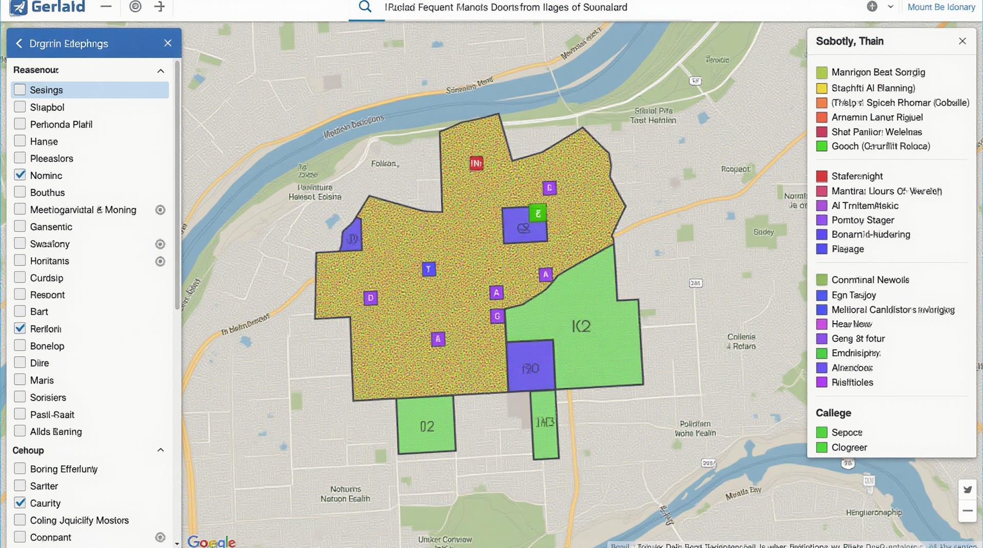
Urbanization presents us with multifaceted challenges, from housing demands and economic development to environmental concerns. Overcoming these hurdles requires innovative solutions. GeoAI, short for geographic artificial Intelligence, is pushing the boundaries of smart urban planning by offering a powerful and efficient toolkit for optimizing zoning processes.
What is GeoAI and why is it important in Smart Urban Planning?
GeoAI integrates geographic data and machine learning algorithms within the domain of AI. This convergence paves the way for intelligent analysis of spatial urban environments. Its significance lies in its ability to:
- **Analyze vast geospatial datasets**: GeoAI excels at processing and interpreting raw data encompassing demographics, historical land use patterns, environmental conditions, infrastructure, and socioeconomic factors.
- **Predict future trends**: By modeling and analyzing historical spatial data, GeoAI can forecast population shifts, potential growth, and resource demands.
- **Optimize urban development**: GeoAI’s spatial reasoning capabilities underpin smarter zoning by identifying optimal locations for housing, businesses, public facilities, while minimizing strain on resources and infrastructure.
- **Improve decision-making**: GeoAI provides data-driven insights to urban planners, policymakers, and community members, boosting their ability to make informed decisions.
**How Does GeoAI Work for Zoning Optimization?**
The effective application of GeoAI for zoning optimization hinges on a multi-layered approach:
- **Data Collection**: Building a comprehensive geospatial database incorporating relevant data sourced from satellite imagery, GIS systems, demographic surveys, and economic databases.
- **Data Analysis**: Leveraging machine learning algorithms to analyze the collected data, revealing spatial patterns, trends, and correlations.
- **Zoning Recommendations**: Utilizing modelled data and AI insights to identify the optimal zoning configurations, tailored to the specific context of the city or region.
- **Feedback Integration**: Incorporating feedback from residents, community stakeholders, and government agencies to refine zoning plans.
**Benefits of GeoAI for Zoning Optimization**
Integrating GeoAI into urban planning yields a host of benefits:
- **Enhanced Efficiency and Effectiveness**: Simplifies the process of zoning with continuous data analysis, collaborative decision-making support, and informed strategic planning.
- **Improved Sustainability**: Develops and promotes environmentally responsible urban planning by prioritizing energy conservation, optimized resource allocation, and smart traffic management.
- **Strengthened Resilience**: Fosters a resilient urban fabric capable of better absorbing external shocks and stresses, such as climate change and natural disasters.
- **Enhanced Community Wellbeing**: Encourages the development of vibrant communities, fosters inclusive public spaces, and maximizes access to essential services and amenities.
**Real-World Applications of GeoAI for Zoning Optimization**
Numerous cities and urban planning projects are successfully deploying GeoAI across various spheres:
- **Smart Growth Strategies**: Optimizing zoning for economic diversification, supporting cluster development, and emerging industries within urban planning.
- **Energy Efficiency and Sustainability**: Analyzing and planning green spaces, promoting renewable energy integration into infrastructure, and optimizing public transportation routes.
- **Flood Prediction and Resilient infrastructure**: Analyzing spatial data for flood risk assessment and planning resilient infrastructure by incorporating sustainable stormwater management solutions.
- **Housing Affordability and Accessibility**: Addressing growing housing needs by optimizing zoning for affordable housing options and ensuring equitable access to services.
Conclusion
GeoAI and zoning optimization are transforming urban planning, paving the paths to smarter, more sustainable, and resilient cities. As we grapple with growing urban pressures, GeoAI will be instrumental in shaping the future of our cities.
**Resources for Further Exploration**
- Association for Geographic Information (AGI)
[https://www.agisolutions.org](https://www.agisolutions.org) - Open Geospatial Consortium (OGC)
[https://www.ogc.org](https://www.ogc.org) - International Society for Urban and Regional Research (ISURRR)
[https://www.isurrr.org](https://www.isurrr.org)
Check similar topics:
## GeoAI-Urban Zoning FAQs
**How is GeoAI-Urban Zoning used?**
With geoai-urban-zoning, data and AI technology are used to analyze urban environments. Cities can then be efficiently tagged and categorized, fostering insights that lead to better planning and management. This provides valuable information for urban planning scenarios, demographic analysis, and resource allocation.
**What does “geoai-urban-zoning” mean?**
“GeoAI-Urban Zoning” refers to using artificial intelligence algorithms, and geographic data technology (AI) to classify, organize, and manage urban land parcels.
**Availability of GeoAI-Urban Zoning**
[Learn more about the specific APIs and tools](https://www.techgeo.org/tech-resources) located on the TechGeo website. We can customize our technology to match your needs.
**How does GeoAI-Urban Zoning work? How can I implement it?**
GeoAI-Urban Zoning uses powerful software and data processing. We can help transition your data, map, and even create automated land asset catalogs. Digital map projections, fleet management, and geographic areas of special interest can thus be investigated and analyzed using advanced modeling techniques. Get in touch with [TechGeo](https://www.techgeo.org/) for detailed information on how we can integrate this into your street map.
## Actionable Insights and Importance of GeoAI-Urban Zoning
Why is geoai-urban-zoning important?
GeoAI-urban-zoning offers several benefits:
* **Data-Driven Decision Making:** Make informed decisions based on real-time and historical data, resulting in improved government initiatives.
* **Efficient Resource Allocation:** Optimize resource distribution based on demographic data, reducing waste and ensuring equitable access to services.
* **Smart Urban Planning and Infrastructure Development:** Improve the layout and expansion of urban environments for sustainable growth and development.
* **Enhanced Urban Security:** Spot potential urban vulnerabilities and security risks, thus directing focused measures to improve city safety.
Initiatives can be implemented using GeoAI-Urban Zoning to improve city planning.
**Ready to learn more?**
Get in touch with us today at [TechGeo](https://www.techgeo.org/) and discover how GeoAI-Urban Zoning can transform your city.

