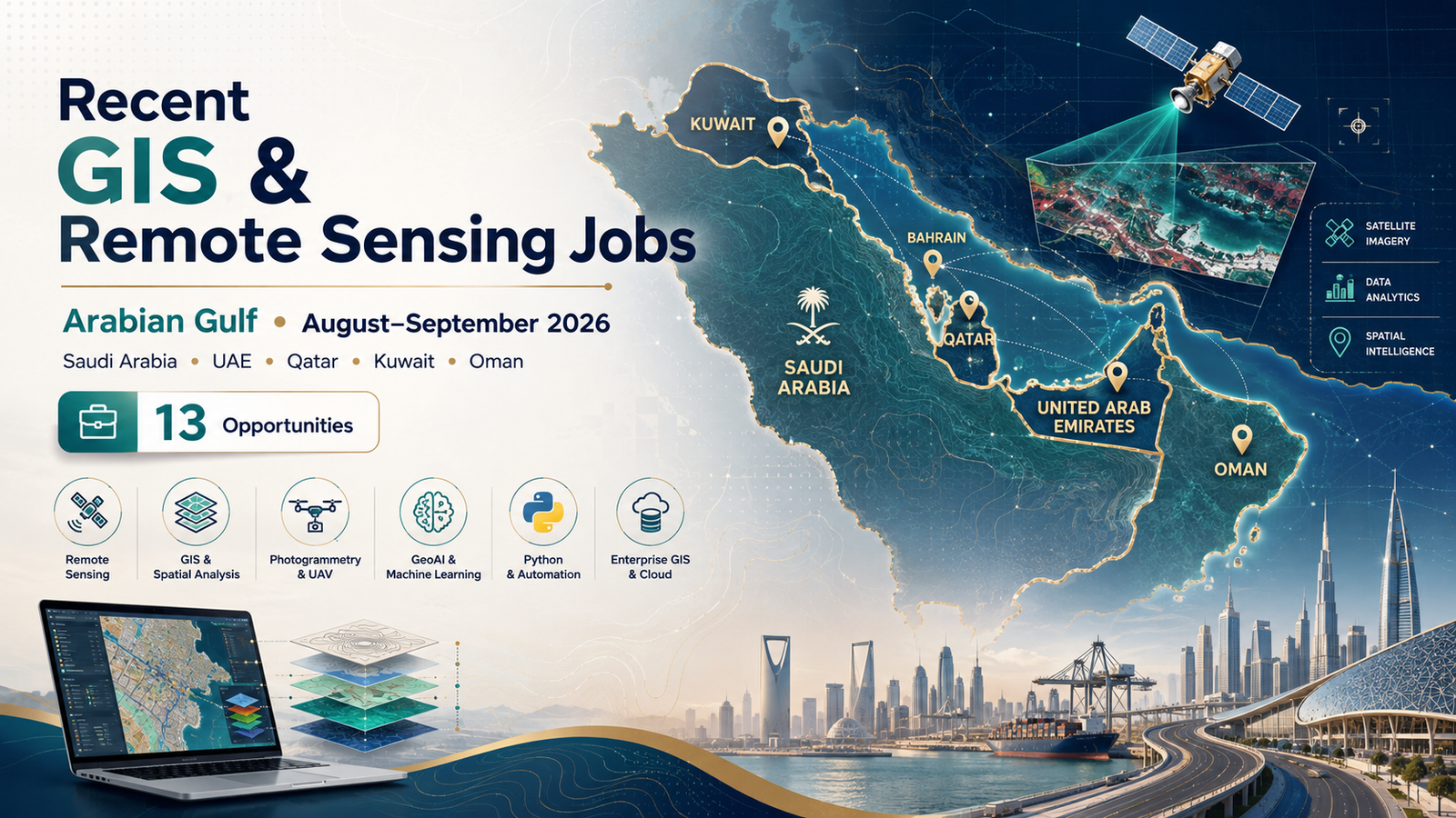
13 Recent GIS, Remote Sensing & Geospatial Jobs in the Arabian Gulf – August–September 2026
The Arabian Gulf continues to offer attractive career opportunities for GIS analysts, geomatics engineers, remote-sensing specialists, geospatial developers, photogrammetrists and enterprise GIS professionals.
The current recruitment market is particularly interesting because employers are increasingly looking beyond traditional map production.
Many vacancies now combine GIS with infrastructure engineering, asset management, spatial databases, Python automation, CAD, artificial intelligence, web GIS, photogrammetry and enterprise geospatial platforms.
For this TechGeo career update, we reviewed recently advertised vacancies across Saudi Arabia, the United Arab Emirates, Qatar, Kuwait and Oman and selected positions that were still visible and accepting applications when checked on August 11, 2026.
Saudi Arabia currently has the largest concentration of advanced vacancies in this selection, particularly in GIS development, GeoAI, photogrammetry and transportation GIS. The UAE shows strong demand in utilities and enterprise platforms, while Qatar remains attractive for infrastructure and asset-management GIS professionals.
Important: Job listings can be modified or closed by employers without notice. Always verify the vacancy on the linked recruitment page before submitting your application.
Current GIS and Remote Sensing Jobs in the Gulf
| Country | Position | Employer | Location | Experience / Level | Salary | Application |
|---|---|---|---|---|---|---|
| 🇸🇦 Saudi Arabia | Geomatics / Geographic Information Systems Analyst | Aramco | Saudi Arabia | 5–8 years | Not disclosed | View Job & Apply |
| 🇸🇦 Saudi Arabia | Senior GIS Applications Development Specialist | BAE Systems | Riyadh | Senior | Competitive | View Job & Apply |
| 🇸🇦 Saudi Arabia | Geospatial AI Specialist | BAE Systems | Riyadh | Experienced | Competitive package | View Job & Apply |
| 🇸🇦 Saudi Arabia | Senior Photogrammetry Specialist | BAE Systems | Riyadh | Senior | Competitive package | View Job & Apply |
| 🇸🇦 Saudi Arabia | Senior GIS Analyst | HDR | Riyadh | Senior | Not disclosed | View Job & Apply |
| 🇦🇪 UAE | CAD / GIS Specialist | AECOM | Al Ain | 8–12 years preferred | Not disclosed | View Job & Apply |
| 🇦🇪 UAE | GIS Engineer | SUEZ | Abu Dhabi | Experienced | Not disclosed | View Job & Apply |
| 🇦🇪 UAE | GIS Developer | Dicetek | Dubai | 5–10 years | Not disclosed | View Job & Apply |
| 🇶🇦 Qatar | GIS Engineer – Roads O&M | Egis | Doha | Minimum 5 years | Not disclosed | View Job & Apply |
| 🇶🇦 Qatar | GIS Analyst / GIS Specialist | Petroltecnica Environmental Services | Doha | 3–5 years | To be discussed | View Job & Apply |
| 🇶🇦 Qatar | GIS Engineer | KEO International Consultants | Doha | 10+ years | Competitive package | View Job & Apply |
| 🇰🇼 Kuwait | CAD & GIS Specialist – Marine and Ports | Egis | Kuwait City | Mid-senior | Not disclosed | View Job & Apply |
| 🇴🇲 Oman | Geospatial Exploration Director | Altegeo | Muscat | Senior / leadership | Not disclosed | View Job & Apply |
GIS and Remote Sensing Jobs in Saudi Arabia
Saudi Arabia currently stands out in this search because several employers are recruiting for highly specialized geospatial roles rather than only conventional GIS analyst positions.
The current openings include enterprise GIS, geospatial artificial intelligence, photogrammetry, land-management GIS and transportation applications.
1. Geomatics / Geographic Information Systems Analyst – Aramco
Employer: Aramco
Location: Saudi Arabia
Experience: Approximately 5–8 years
Salary: Not disclosed
Employment: Full-time
Job Req ID: 17434
Aramco is recruiting a Geomatics / Geographic Information Systems Analyst for its Geospatial and System Support Division within the Land Affairs Department.
The position is focused on using authoritative spatial information and advanced geospatial analysis to support land management, land-use approvals, conflict identification and strategic decision-making.
What makes this role particularly interesting is its emphasis on combining conventional GIS with emerging digital technologies.
The employer specifically refers to the integration of artificial intelligence, machine learning, deep learning and automated geospatial workflows.
Skills worth highlighting
- ArcGIS Pro
- ArcGIS Enterprise
- ArcGIS Online
- Spatial databases
- Advanced spatial analysis
- Coordinate reference systems
- Python
- Arcade
- Git
- GIS automation
- GeoAI
- Machine learning
- Data integration
- Land-management GIS
The position therefore suits professionals who have progressed beyond basic desktop GIS and can demonstrate experience developing operational geospatial solutions.
Best suited to: Experienced GIS analysts, geomatics engineers, spatial-data specialists and GeoAI professionals interested in the energy and land-management sectors.
👉 View the Aramco job and apply
2. Senior GIS Applications Development Specialist – BAE Systems
Employer: BAE Systems
Location: Riyadh, Saudi Arabia
Salary: Competitive
Level: Experienced professional
Employment: Full-time
This position is much closer to a geospatial software-development role than a traditional GIS analyst vacancy.
The Senior GIS Applications Development Specialist is responsible for developing and maintaining GIS applications supporting geospatial-data and intelligence products.
The position requires the ability to build GIS applications that are usable, optimized and compliant with geospatial standards.
Relevant technologies
Candidates targeting this role should emphasize knowledge of technologies such as:
- ArcGIS Pro
- ArcGIS Desktop
- QGIS
- GeoServer
- Python
- SQL
- JavaScript
- R
- Spatial databases
- Web GIS
- Mobile GIS
- GIS application development
The role is particularly suitable for GIS professionals who have moved from analysis toward development, database design and enterprise applications.
BAE Systems also describes expatriate employment benefits for its Saudi operations, including accommodation, healthcare, recreation facilities and leave/travel allowances for eligible appointments.
👉 View the BAE Systems vacancy and apply
3. Geospatial AI Specialist – BAE Systems
Employer: BAE Systems
Location: Riyadh, Saudi Arabia
Level: Experienced professional
Field: GeoAI / GIS / Artificial Intelligence
This is one of the most technically interesting geospatial vacancies currently available in the Gulf.
BAE Systems is recruiting a Geospatial AI Specialist to develop artificial-intelligence and machine-learning solutions for geospatial applications.
The role involves developing algorithms that can extract useful information from satellite imagery, vector information and other geospatial datasets. It also includes applying technologies such as computer vision and machine learning to automate spatial-data processing.
Technical skills requested
- Python
- R or Java
- TensorFlow
- PyTorch
- Scikit-learn
- Machine learning
- Computer vision
- Spatial databases
- GIS technologies
- Satellite imagery analysis
- Geospatial standards
- AI model deployment
Knowledge of standards such as OGC, ISO and other geospatial-data specifications is also relevant.
This vacancy illustrates how quickly GeoAI is moving from academic experimentation into operational geospatial environments.
Best suited to: GIS professionals with strong programming skills, data scientists specializing in spatial information, remote-sensing researchers and GeoAI specialists.
👉 View the Geospatial AI Specialist vacancy and apply
4. Senior Photogrammetry Specialist – BAE Systems
Employer: BAE Systems
Location: Riyadh, Saudi Arabia
Salary: Competitive
Level: Senior / experienced professional
Remote-sensing and photogrammetry specialists should pay particular attention to this position.
BAE Systems is recruiting a Senior Photogrammetry Specialist responsible for collecting, processing and analysing aerial and satellite imagery for geospatial-data and intelligence products.
Responsibilities include producing accurate:
- Orthorectified imagery
- Digital elevation models
- 3D terrain information
- Photogrammetric products
- Aerial and satellite-image datasets
Technologies mentioned
The employer specifically references experience with:
- ERDAS Imagine
- ArcGIS Pro
- ArcGIS Desktop
- Trimble Inpho
- Photogrammetric processing
- Remote sensing
- Digital elevation models
- Orthorectification
- 3D modelling
Professional photogrammetry or remote-sensing certification is considered valuable.
The role also advertises expatriate benefits including company accommodation, healthcare and travel/leave allowances for eligible employees.
Best suited to: Photogrammetrists, remote-sensing specialists, geomatics engineers and professionals experienced with aerial or satellite-image processing.
👉 View the Senior Photogrammetry Specialist job and apply
5. Senior GIS Analyst – HDR
Employer: HDR
Location: Riyadh, Saudi Arabia
Level: Senior
Salary: Not disclosed
HDR is recruiting a Senior GIS Analyst in Riyadh to develop and implement geospatial solutions supporting transportation projects.
The vacancy was published on July 30, 2026 and remained visible on HDR’s recruitment platform when reviewed.
This type of role is particularly relevant to candidates who already understand how GIS integrates with engineering and transportation planning rather than working only as a standalone mapping function.
Useful experience
- Transportation GIS
- Infrastructure mapping
- Spatial analysis
- Geospatial project delivery
- Engineering datasets
- Database management
- Multidisciplinary project coordination
- Technical communication
Best suited to: Senior GIS analysts with transportation, infrastructure or engineering-consultancy experience.
👉 View the HDR Senior GIS Analyst vacancy and apply
GIS Jobs in the United Arab Emirates
The UAE continues to show strong demand for GIS professionals within utilities, infrastructure, asset management and enterprise digital systems.
Abu Dhabi, Al Ain and Dubai are currently the most important locations represented in this selection.
6. CAD / GIS Specialist – AECOM
Employer: AECOM
Location: Al Ain, United Arab Emirates
Sector: Infrastructure and urban development
Salary: Not disclosed
AECOM is seeking an experienced CAD / GIS Specialist to work on infrastructure and urban-development projects.
The successful candidate will manage both CAD drawings and spatial information throughout engineering design, construction supervision and asset handover.
Main responsibilities
- Maintain GIS databases
- Manage utility information
- Integrate survey and as-built data
- Prepare infrastructure maps
- Maintain CAD drawings
- Support roads and drainage projects
- Handle coordinate systems
- Integrate engineering information
- Prepare GIS asset data for project handover
This is a strong example of why AutoCAD + GIS remains one of the most valuable skill combinations for professionals targeting large Gulf infrastructure projects.
Best suited to: Infrastructure GIS professionals, CAD/GIS specialists and geomatics engineers with utilities or construction experience.
👉 View the AECOM CAD / GIS Specialist vacancy and apply
7. GIS Engineer – SUEZ
Employer: SUEZ
Location: Abu Dhabi, UAE
Sector: Water and wastewater infrastructure
Contract: Fixed-term / temporary listing
Salary: Not disclosed
SUEZ is recruiting a GIS Engineer to manage geospatial information associated with investigation and refurbishment of sewage and wastewater networks.
The role involves maintaining and analysing spatial databases, updating information following network repairs and creating digital mapping products and reports.
Important skills
- ArcGIS
- Geodatabase management
- AutoCAD
- Infrastructure mapping
- Wastewater networks
- Utility GIS
- Asset information
- Digital mapping
- Data visualization
- Spatial-data QA/QC
SUEZ has significant water and wastewater operations across the Middle East, including projects in the UAE and other Gulf markets.
Best suited to: GIS engineers with water, wastewater, utilities or underground-infrastructure experience.
👉 View the SUEZ GIS Engineer vacancy and apply
8. GIS Developer – Dicetek
Employer: Dicetek LLC
Location: Dubai, UAE
Experience: Approximately 5–10 years
Field: Enterprise GIS development
Salary: Not disclosed
This GIS Developer vacancy focuses on designing and implementing enterprise GIS solutions supporting digital asset management, property management, infrastructure planning and spatial analytics.
The technical stack is particularly extensive.
Technologies mentioned
- ArcGIS Enterprise
- ArcGIS Pro
- ArcGIS Online
- Experience Builder
- Web AppBuilder
- Survey123
- Field Maps
- ArcGIS JavaScript API
- Python
- ArcPy
- .NET
- REST APIs
- SQL Server
- Enterprise geodatabases
- ModelBuilder
The developer may also integrate GIS with corporate platforms such as SAP, Oracle and other enterprise systems.
This makes the position highly relevant to GIS professionals who want to move beyond spatial analysis toward enterprise architecture and application development.
Best suited to: GIS developers, enterprise GIS specialists, spatial database professionals and experienced analysts with programming expertise.
👉 View the Dicetek GIS Developer job and apply
GIS Jobs in Qatar
Qatar currently offers particularly relevant opportunities for GIS professionals with backgrounds in roads, asset management, infrastructure, utilities and engineering consultancy.
9. GIS Engineer – Roads Operations & Maintenance – Egis
Employer: Egis
Location: Doha, Qatar
Employment: On-site
Experience: Minimum 5 years
Salary: Not disclosed
Egis is seeking a GIS Engineer specializing in Roads Operations and Maintenance.
The successful candidate will develop spatial solutions supporting road-network management, infrastructure assets and maintenance planning.
Responsibilities include
- Road-network GIS analysis
- Infrastructure asset management
- Maintenance planning
- Spatial database development
- Cartographic production
- GIS data integration
- Project management
- Data-quality control
Candidates need a bachelor’s degree in GIS, geomatics, geography or a related discipline and at least five years of relevant experience.
Advanced knowledge of ArcGIS and QGIS is specifically requested.
Best suited to: Road GIS engineers, transportation specialists and infrastructure asset-management professionals.
👉 View the official Egis GIS Engineer vacancy and apply
10. GIS Analyst / GIS Specialist – Petroltecnica Environmental Services
Employer: Petroltecnica Environmental Services
Location: Doha, Qatar
Experience: 3–5 years
Work arrangement: On-site
Salary: To be discussed
Listing expiry: September 24, 2026
This position is particularly relevant for professionals searching for an opportunity that remains open into September 2026.
The role supports environmental, engineering and infrastructure projects through geodatabase development, spatial analysis, cartography and integration of engineering drawings with GIS information.
The listing was posted on July 26 and indicates an expiry date of September 24, 2026.
Core requirements
- ArcGIS Pro
- ArcMap and/or QGIS
- AutoCAD
- GPS data processing
- Survey-data integration
- Spatial databases
- Coordinate systems and projections
- Spatial analysis
- Cartography
- Engineering GIS
Applicants must have approximately three to five years of relevant experience, and the current listing specifically indicates that candidates should be locally available in Qatar.
Best suited to: Mid-career GIS analysts with environmental, infrastructure, civil-engineering, utilities, surveying or Oil & Gas experience.
👉 View the GIS Analyst / Specialist vacancy and apply
11. GIS Engineer – KEO International Consultants
Employer: KEO International Consultants
Location: Doha, Qatar
Experience: 10+ years
Employment: Professional / senior role
Package: Competitive
KEO is recruiting a GIS Engineer in Doha to support asset-management and infrastructure projects for a government-sector client.
The official KEO recruitment page confirms the Doha vacancy is active.
Responsibilities include:
- Managing GIS databases
- Maintaining spatial information
- Developing SQL-based GIS tools
- Producing maps and geospatial reports
- Supporting asset management
- Analysing as-built drawings
- Reviewing aerial imagery
- Conducting field verification
- Supporting operational planning
Candidates are expected to have more than ten years of relevant experience and strong expertise in Esri GIS technologies and spatial database management.
Experience with SQL, ArcGIS Server, Python, C#.NET or VBA can strengthen an application.
Best suited to: Senior GIS engineers with substantial infrastructure, asset-management and spatial-database experience.
👉 View the official KEO GIS Engineer vacancy and apply
GIS Jobs in Kuwait
12. CAD & GIS Specialist – Marine and Ports – Egis
Employer: Egis
Location: Kuwait City, Kuwait
Sector: Marine and ports
Level: Mid-senior
Salary: Not disclosed
This vacancy combines several important areas of geomatics: CAD, GIS, geodesy, spatial databases and marine infrastructure.
The CAD & GIS Specialist supports marine and port projects by developing technical drawings, maintaining GIS datasets and producing spatial analysis for engineers and project managers.
Relevant skills include
- AutoCAD
- Civil 3D
- ArcGIS
- Spatial databases
- Coordinate systems
- Projections
- Geodetic principles
- Technical mapping
- QA/QC
- Infrastructure GIS
Knowledge of remote sensing, Python scripting and 3D visualization can also be valuable for this type of position.
Best suited to: Geomatics engineers, CAD/GIS professionals and spatial-data specialists interested in maritime and port infrastructure.
👉 View the Egis CAD & GIS Specialist vacancy and apply
Geospatial Jobs in Oman
13. Geospatial Exploration Director – Altegeo
Employer: Altegeo
Location: Muscat, Oman
Level: Senior leadership
Employment: Full-time
Salary: Not disclosed
This vacancy is aimed at experienced geospatial professionals capable of managing multidisciplinary exploration programmes rather than performing only technical GIS production.
The Geospatial Exploration Director will oversee geospatial exploration initiatives, manage teams and integrate advanced spatial technologies with geological and operational information.
Responsibilities include
- GIS strategy
- Remote-sensing strategy
- Spatial-data management
- Exploration planning
- Team leadership
- Spatial modelling
- Geological data integration
- Quality management
- Project budgeting
- Client and stakeholder management
- Technical reporting
Relevant educational backgrounds include geospatial science, GIS, geomatics, surveying, geology and Earth sciences.
A master’s degree is preferred, and previous leadership of geospatial exploration or spatial-data projects is expected.
Best suited to: Senior GIS managers, geospatial directors, exploration specialists and experienced geomatics professionals.
👉 View the Geospatial Exploration Director vacancy and apply
What Skills Are Gulf Employers Looking For?
One of the most important findings from these vacancies is that employers are increasingly looking for hybrid geospatial profiles.
Knowing how to create maps remains important, but many of the most attractive roles demand additional expertise.
1. ArcGIS Pro and Enterprise GIS
The Esri ecosystem appears repeatedly across these vacancies.
Important technologies include:
- ArcGIS Pro
- ArcGIS Enterprise
- ArcGIS Online
- ArcGIS Server
- Enterprise geodatabases
- Experience Builder
- Survey123
- Field Maps
GIS professionals who understand how enterprise systems work generally have access to a broader range of senior roles than candidates limited to desktop GIS.
2. Python and GIS Automation
Python appears across enterprise GIS, GeoAI and application-development roles.
Knowing basic Python syntax is useful, but employers are more interested in what you can actually automate.
A CV statement such as:
Developed ArcPy workflows to automate GIS quality control and map production across multiple infrastructure datasets.
is much stronger than simply listing “Python” under software skills.
3. SQL and Spatial Databases
Database expertise is particularly important for enterprise and infrastructure GIS positions.
Useful skills include:
- SQL
- SQL Server
- PostgreSQL
- Enterprise geodatabases
- Database design
- Spatial queries
- Data integrity
- Data migration
- Database performance
4. CAD + GIS Integration
AECOM, Petroltecnica and Egis demonstrate the importance of integrating engineering drawings and spatial databases.
Professionals targeting Gulf infrastructure projects can significantly strengthen their profiles by combining:
ArcGIS Pro + AutoCAD/Civil 3D + spatial databases + survey data.
5. Remote Sensing and Photogrammetry
Remote sensing does not always appear directly in the job title.
The BAE Systems photogrammetry vacancy, for example, requires processing aerial and satellite imagery to create elevation models, orthophotos and geospatial intelligence products.
Useful skills include:
- Satellite-image processing
- Aerial imagery
- Orthorectification
- DEM generation
- Stereo photogrammetry
- ERDAS Imagine
- Trimble Inpho
- ArcGIS Pro
- Remote-sensing QA/QC
6. GeoAI and Machine Learning
GeoAI is also becoming a real professional specialization.
BAE Systems is actively recruiting a Geospatial AI Specialist with requirements spanning Python, TensorFlow, PyTorch, Scikit-learn, computer vision and satellite-image analysis.
Aramco similarly describes AI and machine-learning integration within its Geomatics/GIS Analyst position.
For GIS professionals, this is a strong indication that GeoAI expertise can increasingly differentiate candidates.
Best Skills to Develop for a Gulf GIS Career
A competitive profile for the current Gulf market might include:
Core GIS
- ArcGIS Pro
- ArcGIS Enterprise
- ArcGIS Online
- QGIS
- Spatial analysis
- Geodatabases
- Coordinate systems
- Cartography
Programming
- Python
- ArcPy
- SQL
- JavaScript
- R
- Arcade
- .NET
- REST APIs
Engineering and Infrastructure
- AutoCAD
- Civil 3D
- Survey-data processing
- GNSS/GPS
- Utility mapping
- Asset management
- As-built information
- Engineering drawings
Remote Sensing
- Satellite imagery
- Photogrammetry
- ERDAS Imagine
- Orthophoto production
- DEM/DSM generation
- 3D reconstruction
- Image classification
Emerging Technologies
- GeoAI
- Machine learning
- Computer vision
- Digital twins
- 3D GIS
- Cloud GIS
- Automated spatial workflows
Professional Skills
- Project management
- Technical reporting
- Stakeholder communication
- QA/QC
- Team leadership
- Client coordination
Which Gulf Country Currently Has the Most Opportunities?
Based on this particular selection, Saudi Arabia currently has the strongest concentration of highly specialized geospatial positions.
The current Saudi vacancies include:
- GIS analysis
- Enterprise GIS development
- GeoAI
- Photogrammetry
- Transportation GIS
BAE Systems alone currently lists multiple geospatial roles in Riyadh, while Aramco continues to recruit advanced GIS expertise for land-management applications.
The UAE market is particularly relevant to GIS developers and infrastructure professionals, while Qatar remains strong for road networks, engineering projects and asset-management GIS.
Are There Opportunities for Fresh GIS Graduates?
The majority of jobs in this particular selection target professionals with several years of experience.
That does not mean graduates should ignore the Gulf market.
Instead, new GIS professionals should broaden their searches beyond senior titles.
Useful keywords include:
- Junior GIS Analyst
- GIS Technician
- Graduate GIS Specialist
- Junior Geomatics Engineer
- CAD/GIS Technician
- Junior Spatial Analyst
- Survey GIS Technician
- Graduate Geospatial Engineer
Building two or three years of strong professional GIS experience can significantly improve access to the enterprise and infrastructure positions commonly advertised in the Gulf.
TechGeo readers who are still developing their skills can also explore our guide to Upcoming Free Esri MOOCs with Certification in 2026.
How to Prepare Your CV for Gulf GIS Jobs
Tailor the CV to each vacancy
Do not send exactly the same CV to Aramco, AECOM, BAE Systems and Egis.
These employers are looking for different profiles.
For example:
Aramco: emphasize GeoAI, enterprise GIS, land management and advanced spatial analysis.
AECOM: emphasize infrastructure, utilities, CAD, GIS databases and asset handover.
BAE Systems Photogrammetry: emphasize imagery, DEMs, orthophotos, remote sensing and photogrammetric software.
Dicetek: emphasize ArcGIS Enterprise, Python, APIs, SQL and GIS application development.
Quantify your work
Avoid:
Responsible for maintaining GIS databases.
Prefer:
Maintained and quality-controlled more than 150,000 infrastructure features within an enterprise geodatabase.
Avoid:
Used Python for GIS automation.
Prefer:
Developed ArcPy automation reducing weekly spatial-data validation from six hours to approximately forty minutes.
Numbers help recruiters understand the scale of your professional experience.
Highlight infrastructure experience
If you have worked with:
- Roads
- Water networks
- Sewerage
- Electricity
- Telecommunications
- Railways
- Airports
- Ports
- Oil & Gas
- Urban planning
- Construction
- Renewable energy
make this visible near the top of your CV.
Infrastructure knowledge appears repeatedly in current Gulf geospatial recruitment.
Do not underestimate coordinate systems
Survey, engineering and GIS datasets frequently need to be combined in Gulf projects.
Knowledge of:
- Coordinate reference systems
- Datum transformations
- Projections
- Survey control
- GNSS
- CAD/GIS alignment
can therefore be an important practical advantage.
Applying from Outside the Gulf
International applicants should evaluate the complete employment package, not only base salary.
Depending on the employer and contract, a Gulf package may include:
- Visa sponsorship
- Accommodation
- Housing allowance
- Medical insurance
- Annual flights
- Relocation assistance
- Transportation
- Annual bonus
- Paid leave
- End-of-service benefits
For example, BAE Systems explicitly describes accommodation, healthcare and travel/leave benefits for eligible expatriate employees in its Saudi geospatial vacancies.
Before accepting an offer, clarify whether the quoted compensation represents:
- Basic salary
- Total monthly salary
- Total package
- Salary plus housing
- Salary plus transport
- Family or single status
These distinctions can make a substantial difference.
Five Mistakes to Avoid When Applying
1. Applying without reading the experience requirement
A ten-year KEO GIS Engineer role is not equivalent to a three-year GIS Analyst vacancy.
Target positions that realistically match your profile.
2. Listing software without evidence
Writing “ArcGIS, QGIS, Python, SQL” tells a recruiter very little.
Show what you built or improved using those technologies.
3. Ignoring CAD
For Gulf infrastructure GIS, AutoCAD or Civil 3D can be highly valuable.
4. Ignoring asset management
Utilities, transportation and infrastructure employers frequently use GIS to manage real-world assets rather than simply make maps.
5. Applying too late
Some vacancies are removed once enough qualified applications are received.
If a position strongly matches your experience, applying early is usually preferable.
Compare GIS Job Opportunities in Other Regions
If you are open to international mobility, TechGeo has also reviewed current opportunities outside the Gulf.
🇬🇧 United Kingdom
Explore 11 Recent GIS and Remote Sensing Jobs in the UK for positions in GIS consulting, research, geodesy, enterprise platforms and remote sensing.
🌍 Explore GIS Career Paths
If you are still deciding which specialization to pursue, read Top 10 Geomatics, Surveying & GIS Jobs in 2026.
This can help you compare career paths in GIS analysis, geomatics, surveying, remote sensing and related spatial technologies.
Frequently Asked Questions
Are these Gulf GIS jobs still available?
The vacancies included in this article were checked on August 11, 2026 and selected because their recruitment pages were still visible or actively accepting applications at that time.
Employers may close vacancies at any time, so always use the application links above to verify availability.
Is there a GIS job open through September 2026?
Yes.
The Petroltecnica Environmental Services GIS Analyst / Specialist listing in Qatar currently states an expiry date of September 24, 2026.
Which Gulf country currently has the best GIS opportunities?
For this particular August 2026 selection, Saudi Arabia has the greatest concentration of advanced vacancies.
However, the best country depends on your specialization.
Saudi Arabia: enterprise GIS, GeoAI, photogrammetry, energy and infrastructure.
UAE: enterprise GIS, utilities, CAD/GIS and digital asset management.
Qatar: road infrastructure, asset management and engineering GIS.
Kuwait: marine, port and engineering GIS.
Oman: exploration and senior geospatial leadership.
Is Python important for Gulf GIS jobs?
Increasingly, yes.
Python appears in several advanced roles, especially enterprise GIS, GIS development and GeoAI.
For higher-level GIS careers, combining ArcGIS + Python + SQL is particularly valuable.
Is remote sensing in demand?
Yes, but relevant jobs are not always called “Remote Sensing Specialist.”
Current examples include photogrammetry, GeoAI, exploration and satellite-data analysis.
BAE Systems’ current Senior Photogrammetry Specialist and Geospatial AI Specialist positions are good examples.
Do Gulf employers recruit international candidates?
Some do, but eligibility varies significantly by employer, project and nationality requirements.
Certain BAE Systems vacancies explicitly describe expatriate employee packages, while other employers may prioritize local availability or candidates with existing Gulf experience.
The Petroltecnica position, for example, currently states that applicants should already be locally available in Qatar.
Always read the eligibility requirements before applying.
Final Thoughts
The August–September 2026 Gulf geospatial market demonstrates how rapidly GIS careers are evolving.
Traditional GIS knowledge remains fundamental, but many of the strongest current opportunities require professionals who can combine geospatial analysis with another technical specialization.
The most valuable combinations emerging from these vacancies include:
GIS + Python
GIS + SQL
GIS + CAD
GIS + Asset Management
GIS + Remote Sensing
GIS + Photogrammetry
GIS + Artificial Intelligence
GIS + Infrastructure Engineering
For traditional GIS analysts, developing stronger programming, database and enterprise-platform skills can open access to more advanced positions.
For surveyors and geomatics engineers, combining field measurement expertise with GIS databases and infrastructure systems can create additional career opportunities.
For remote-sensing specialists, photogrammetry, GeoAI and computer vision are increasingly important areas to watch.
And for experienced professionals targeting international careers, Saudi Arabia, the UAE and Qatar remain particularly important geospatial employment markets to monitor throughout the remainder of 2026.
Last reviewed: August 11, 2026
Disclaimer: TechGeo.org is not affiliated with any employer included in this article. Job availability, salary, benefits, eligibility requirements and closing dates can change without notice. Always verify the latest information through the linked employer or recruitment page before applying.