13 Recent GIS and Remote Sensing Jobs in the USA – August 2026
Table of Contents
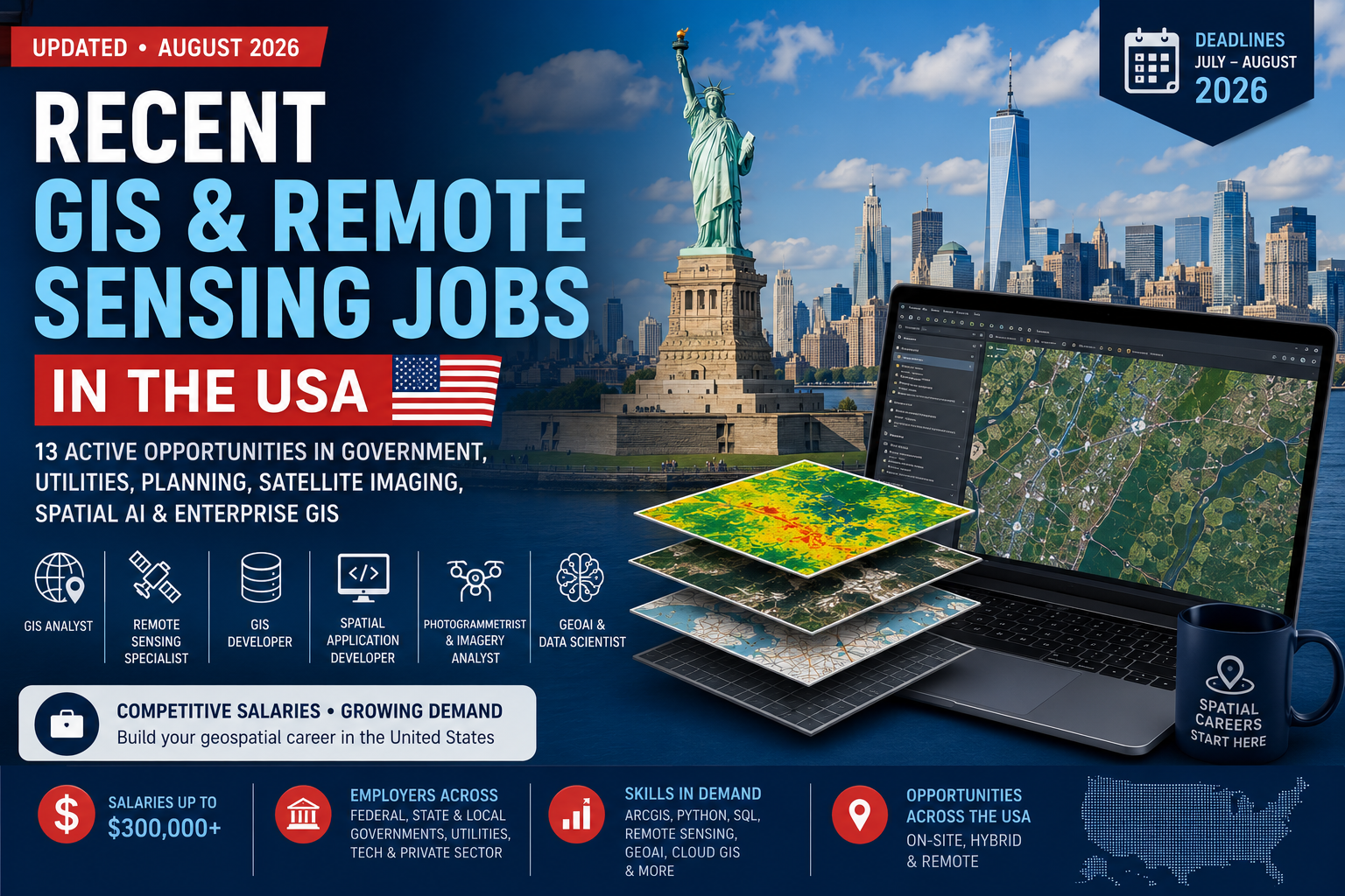
Employers across the United States advertise relevant opportunities under titles such as Geographer, Photogrammetrist, GIS Developer, Spatial Applications Developer, GIS Planner, Asset Management Technician and Computer Vision Engineer.
This updated selection brings together recent opportunities in federal government, local authorities, public utilities, satellite Earth observation, spatial artificial intelligence and enterprise GIS development.
The vacancies were reviewed on July 28, 2026. Several have deadlines during the next few days, so applicants should verify availability and submit their materials as early as possible.
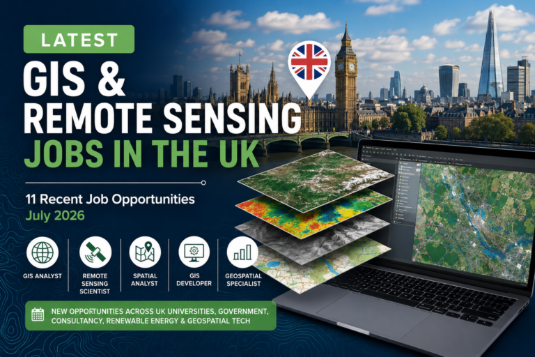
Professionals also interested in international opportunities can explore TechGeo’s guide to recent GIS and remote sensing jobs in the UK.
Current GIS and remote sensing jobs at a glance
| Application deadline | Position | Employer | Location | Advertised salary |
|---|---|---|---|---|
| July 30, 2026 | Geographer – Mobile Solutions Specialist | USDA | Fort Collins, Colorado, or Raleigh, North Carolina | $93,468–$129,742 |
| July 30, 2026 | Geographer | U.S. Geological Survey | Colorado, Missouri or Virginia | $74,678–$111,087, depending on location |
| July 31, 2026 | GIS Analyst 1–3 | City of Renton | Renton, Washington | $92,724–$127,764 |
| August 1, 2026 | Photogrammetrist | National Geospatial-Intelligence Agency | St. Louis, Missouri | $76,573–$141,880 |
| August 3, 2026 | GIS Developer and Systems Analyst | Lane County | Oregon | $39.87–$51.94 per hour |
| August 6, 2026 | GIS Analyst or Senior GIS Analyst | City of Charlottesville | Charlottesville, Virginia | $61,455–$92,206 preferred hiring ranges |
| August 9, 2026 | GIS and Asset Management Technician | City of Richfield | Richfield, Minnesota | $32.84–$37.61 per hour starting range |
| August 10, 2026 | GIS Enterprise Spatial App Developer | City of Portland | Portland, Oregon; primarily remote regionally | $114,275–$160,784 |
| August 10, 2026 | GIS Planner | Town of Cary | Cary, North Carolina | $69,139–$107,162 |
| August 12, 2026 | Visiting Scientist – Geospatial AI | Planet | San Francisco, California | $144,500–$180,600 |
| August 16, 2026 | GIS Analyst | Chesterfield County | Chesterfield, Virginia | $62,154–$83,906 |
| August 16, 2026 | GIS Technician | Mohave County | Kingman, Arizona | $43,867–$53,934 |
| Open until filled | Staff Software Engineer – Computer Vision | Array Labs | Redwood City, California; hybrid | $150,000–$300,000 |
Which opportunity best matches your experience?
Entry-level and early-career applicants
The Mohave County GIS Technician position is one of the most accessible vacancies in this selection. It accepts candidates with relevant college coursework and approximately one year of GIS, mapping, surveying or field-data experience.
The Richfield asset-management position may also be suitable for candidates who already have practical ArcGIS experience but have not yet moved into senior analysis or development.
GIS analysts and spatial-data professionals
Renton, Charlottesville and Chesterfield County are recruiting GIS analysts to support utilities, infrastructure, public works and local government operations.
These positions emphasize practical skills such as data maintenance, spatial analysis, map production, quality control, web maps, dashboards and communication with non-GIS departments.
GIS developers and enterprise specialists
The Portland and Lane County vacancies are designed for professionals who combine GIS with software development, databases and enterprise-system administration.
Applicants should be comfortable with technologies such as ArcGIS Enterprise, SQL Server, PostgreSQL, Python, JavaScript, ArcPy, React, .NET and enterprise geodatabases.
Remote sensing and photogrammetry specialists
Planet’s visiting-scientist opportunity focuses on geospatial foundation models, satellite time series and multi-sensor Earth observation.
The NGA vacancy is centered on photogrammetry, stereo imagery, triangulation, orthorectification and elevation extraction.
Array Labs offers a highly technical computer-vision position involving photogrammetry, radar reconstruction, 3D geospatial data and satellite-derived products.
Federal geospatial applicants
The USDA, USGS and NGA opportunities follow federal hiring rules. Applicants should carefully read the eligibility section of each announcement before preparing a federal résumé.
Some positions are open to the general public, while others are limited to current or former federal employees and applicants eligible through specific hiring authorities.
Detailed job descriptions and official application links
1. Geographer – Mobile Solutions Specialist
Employer: U.S. Department of Agriculture
Agency: Animal and Plant Health Inspection Service
Locations: Fort Collins, Colorado, or Raleigh, North Carolina
Salary: $93,468–$129,742 per year
Grade: GS-12
Contract: Permanent, full-time
Closing date: July 30, 2026
Telework: Eligible according to agency policy
This position combines mobile GIS, field-data collection, application support and cartographic production.
The successful candidate will help develop and manage mobile geospatial solutions used in plant-protection programmes. The work includes analysing user requirements, configuring applications, supporting mobile devices, preparing training materials and managing national or international datasets.
Applicants should have practical experience with Esri Field Maps, Survey123 and other Esri mobile data-collection tools. The announcement also asks for experience providing technical support and delivering training through webinars, videos or classroom sessions.
This vacancy is open to U.S. citizens and nationals. A geography degree or qualifying combination of geography coursework and professional experience is required.
View the official USDA vacancy and apply
Best suited to: Mobile GIS specialists, field-application administrators and experienced GIS professionals working with environmental or agricultural datasets.
2. Geographer
Employer: U.S. Geological Survey
Department: Core Science Systems, Cartographic Data Services
Locations: Lakewood, Colorado; Rolla, Missouri; or Reston, Virginia
Salary: Approximately $74,678–$111,087, depending on duty location
Grade: GS-11
Contract: Permanent, full-time
Closing date: July 30, 2026
Telework: Eligible according to agency policy
The USGS is recruiting a geographer to support the U.S. Board on Geographic Names and the Geographic Names Information System.
Responsibilities include researching proposed geographic names, analysing maps and geospatial datasets, preparing case briefs and coordinating with federal, state, tribal, local and private-sector organisations.
The role requires knowledge of geographic research, cartographic information, data integrity and the spatial relationships between natural and human features.
This announcement is not a standard open-to-everyone federal vacancy. It is directed primarily toward current or former federal employees and candidates eligible under specific noncompetitive hiring authorities. Applicants should confirm that they qualify under one of the listed hiring paths before investing time in the application.
View the official USGS vacancy and eligibility requirements
Best suited to: Geographers, cartographic researchers, geographic-names specialists and eligible federal employees with strong analytical writing skills.
3. GIS Analyst 1–3
Employer: City of Renton
Department: Public Works – Utility Systems
Location: Renton, Washington
Salary: $92,724–$127,764 per year
Contract: Regular, full-time
Closing date: July 31, 2026
The City of Renton is recruiting at three possible professional levels:
- GIS Analyst 1: $92,724–$112,920
- GIS Analyst 2: $97,368–$118,692
- GIS Analyst 3: $104,856–$127,764
The selected candidate will support GIS and asset-management activities related to public utilities, transportation and infrastructure planning.
The role includes geospatial-data management, application improvement and support for short- and long-term asset-management decisions. The flexible classification makes this vacancy relevant to both developing analysts and experienced GIS professionals.
The position also includes public-sector benefits such as retirement-plan participation, medical insurance, paid leave and employer contributions to deferred-compensation programmes.
View the City of Renton GIS Analyst vacancy and apply
Best suited to: Utility GIS analysts, asset-management professionals and candidates seeking a structured progression from analyst level 1 to level 3.
4. Photogrammetrist
Employer: National Geospatial-Intelligence Agency
Location: St. Louis, Missouri
Salary: $76,573–$141,880 per year
Contract: Permanent, full-time
Closing date: August 1, 2026
Telework: Not currently eligible
Security requirement: Sensitive Compartmented Information clearance
Photogrammetrists at the NGA work with imagery, elevation information and geospatial intelligence.
Typical activities include image assessment, point selection, mensuration, triangulation, orthorectification, stereo-image exploitation and elevation-data extraction. The work supports the production of accurately positioned imagery and other GEOINT products.
This vacancy is open to external applicants who are U.S. citizens, nationals or otherwise owe allegiance to the United States. Candidates should understand that the security-clearance process can be extensive.
The specific assignment may be determined after selection and clearance, meaning some working conditions may vary from the initial announcement.
View the NGA Photogrammetrist vacancy and apply
Best suited to: Photogrammetrists, image scientists, stereo-compilation specialists and remote-sensing professionals interested in geospatial intelligence.
5. GIS Developer and Systems Analyst
Employer: Lane County
Department: Technology Services
Location: Oregon
Salary: $39.87–$51.94 per hour
Contract: Regular position
Closing date: August 3, 2026
Lane County is seeking an experienced professional to develop and support enterprise GIS solutions used across public safety, transportation, elections, public health and land management.
The position combines application development, enterprise GIS administration, systems integration and workflow automation.
Desired experience includes:
- ArcGIS Enterprise administration
- Python and ArcPy
- JavaScript, React or Arcade
- SQL and .NET
- SQL Server and PostgreSQL
- Enterprise geodatabases
- GIS integration with other business systems
This is a strong opportunity for a traditional GIS analyst who has developed substantial programming and systems-administration expertise.
View the Lane County vacancy and apply
Best suited to: GIS developers, enterprise administrators, spatial database specialists and analysts transitioning into geospatial software engineering.
6. GIS Analyst or Senior GIS Analyst
Employer: City of Charlottesville
Department: Public Works
Location: Charlottesville, Virginia
Contract: Regular, full-time
Closing date: August 6, 2026
The position may be filled at one of two levels:
- GIS Analyst preferred hiring range: $61,455.89–$74,002.72
- Senior GIS Analyst preferred hiring range: $75,286.10–$92,206
The successful candidate will support the city’s enterprise GIS, develop spatial datasets and improve business processes through automation.
Senior-level responsibilities include managing GIS initiatives, configuring field and desktop applications, developing maps and content, leading project teams and training other staff.
This flexible recruitment gives applicants an opportunity to be considered at a level corresponding to their education, technical ability and professional experience.
View the Charlottesville GIS vacancy and apply
Best suited to: Municipal GIS analysts, public-works specialists and candidates with experience automating spatial-data workflows.
7. GIS and Asset Management Technician
Employer: City of Richfield
Department: Public Works
Location: Richfield, Minnesota
Starting salary: $32.84–$37.61 per hour
Full range: Up to $43.07 per hour
Contract: Full-time
Closing date: August 9, 2026
Working arrangement: In person initially, with a possible hybrid arrangement after six months
The technician will help administer the city’s public-works asset-management programme while collecting, maintaining, analysing and presenting spatial information.
Responsibilities include building dashboards, configuring field solutions, updating as-built and right-of-way data, maintaining datasets, supporting users and documenting workflows.
Applicants should understand ArcGIS Pro, ArcGIS Online or Portal and enterprise GIS applications. Communication and user-support skills are important because the position includes training staff with different levels of GIS experience.
Candidates must already be local or be prepared to relocate at their own expense.
View the Richfield GIS and Asset Management vacancy
Best suited to: Early- to mid-career GIS professionals interested in infrastructure, field applications and asset management.
8. GIS Enterprise Spatial App Developer
Employer: City of Portland
Department: Bureau of Technology Services
Location: Portland, Oregon
Salary: $114,275.20–$160,784 per year
Contract: Regular, full-time
Closing date: August 10, 2026
Working arrangement: Primarily remote, but remote work must be performed within Oregon or Washington
This is one of the most technically advanced and highest-paying enterprise GIS roles in the selection.
The developer will support SQL Server spatial geodatabases and the city’s Esri ArcGIS technology stack. Work includes database development, application configuration, migration, automation, integration, troubleshooting and performance optimisation.
The position combines:
- SQL development
- Enterprise geodatabase administration
- GIS application development
- Systems integration
- Data architecture
- Spatial analysis
- Automated data workflows
Candidates should demonstrate that they can translate organisational requirements into scalable, secure and reliable geospatial solutions.
View the City of Portland vacancy and apply
Best suited to: Senior GIS developers, spatial database administrators and enterprise-application specialists located in Oregon or Washington.
9. GIS Planner
Employer: Town of Cary
Department: Planning
Location: Cary, North Carolina
Salary: $69,139.20–$107,161.60 per year
Anticipated hiring range: $69,139.20–$84,905.60
Contract: Regular, full-time
Closing date: August 10, 2026
The GIS Planner will maintain planning-related maps, layers and databases while supporting development, demographic and real-estate analysis.
Responsibilities include developing dashboards, web maps and ArcGIS Pro projects; analysing development data; producing material for council and commission meetings; maintaining addressing information; and supporting open-data products.
The role sits at the intersection of GIS and urban planning. Applicants should be able to translate spatial information into clear products for planners, decision-makers and the public.
View the Town of Cary GIS Planner vacancy
Best suited to: GIS professionals with experience in planning, land development, demographics, addressing or public-facing mapping.
10. Visiting Scientist – Geospatial Artificial Intelligence
Employer: Planet
Location: San Francisco, California
Salary: $144,500–$180,600 per year
Contract: One-year, full-time residency
Closing date: August 12, 2026
Planet is recruiting a postdoctoral researcher to help develop proprietary geospatial foundation models trained on high-frequency satellite imagery.
The research will include time-series representation, environmental-change detection, flood and disaster mapping, foundation-model benchmarking and multi-sensor data fusion.
The scientist will work with PlanetScope, Sentinel-1 and other Earth-observation datasets while helping transition experimental research into scalable products.
Important technical requirements include:
- A recently completed PhD
- Python
- PyTorch or TensorFlow
- GeoPandas, Rasterio, xarray and Dask
- Geospatial foundation models
- Satellite time-series analysis
- Automated large-scale data pipelines
Experience with TerraMind, Prithvi, Clay, Landsat, Sentinel-1, Sentinel-2 or flood mapping is particularly relevant.
View the Planet Visiting Scientist vacancy and apply
Best suited to: Recent PhD graduates in remote sensing, GeoAI, computer science or geospatial analytics.
Professionals developing similar skills can review TechGeo’s guide to AI-based geospatial land-cover classification.
11. GIS Analyst
Employer: Chesterfield County
Department: Utilities
Location: Chesterfield, Virginia
Salary: $62,154–$83,906 per year
Contract: Full-time
Closing date: August 16, 2026
This position supports the development and administration of GIS services for Chesterfield County Utilities.
Work includes maintaining spatial-data layers, creating custom maps and reports, performing database queries, integrating data from multiple sources and conducting quality-control procedures.
Applicants should have a bachelor’s degree in geography, cartography, planning, engineering or a related subject, alongside approximately two years of GIS experience. An equivalent combination of training and professional experience may also be considered.
Knowledge of Esri software, AutoCAD, relational databases, programming tools and data conversion is valuable.
View the Chesterfield County GIS Analyst vacancy
Best suited to: Mid-level GIS analysts with utility, engineering, CAD or relational-database experience.
12. Geographic Information System Technician
Employer: Mohave County
Department: Information Technology
Location: Kingman, Arizona
Salary: $43,867.20–$53,934.40 per year
Contract: Full-time, regular
Closing date: August 16, 2026
This is the clearest entry-level opportunity in the selection.
The technician will create and update digital maps, maintain GIS databases, research land-use and parcel information, prepare cartographic products and perform data-quality checks.
Minimum qualifications include a high-school diploma or equivalent, relevant college coursework and one year of experience in GIS, mapping, surveying, field-data collection or related technical work.
A bachelor’s degree is preferred but not listed as an absolute requirement. This makes the role accessible to candidates who have built practical skills through coursework, internships or technical employment.
View the Mohave County GIS Technician vacancy
Best suited to: GIS graduates, mapping technicians, survey technicians and applicants seeking their first full-time county GIS position.
13. Staff Software Engineer – Computer Vision
Employer: Array Labs
Location: Redwood City, California
Working arrangement: Hybrid
Salary: $150,000–$300,000 per year
Contract: Full-time
Closing date: Not stated; application page currently active
Array Labs is developing radar-satellite systems designed to produce frequently updated, high-resolution 3D information about Earth.
The Staff Software Engineer will work on photogrammetry, radar reconstruction and large-scale 3D geospatial-processing pipelines.
Responsibilities include improving bundle adjustment, dense matching, point-cloud generation, georeferencing, geometric refinement and satellite-data delivery systems.
Applicants need substantial software-engineering and computer-vision experience, including strong Python and C++ skills. Cloud computing, Docker, Kubernetes, geometric computer vision and multi-view reconstruction are central requirements.
Experience with remote sensing, SAR, Cesium, Three.js, CUDA, NeRF or 3D Gaussian Splatting is considered valuable.
The position is subject to U.S. space-technology export-control requirements. Applicants must satisfy the stated citizenship, permanent-residency or authorisation conditions.
View the Array Labs Computer Vision vacancy
Best suited to: Senior geospatial software engineers, computer-vision specialists and remote-sensing developers with 3D-processing experience.
Salary overview
The advertised compensation reflects the wide technical range of the U.S. geospatial sector.
The highest salary ranges in this selection are associated with advanced satellite imaging, computer vision and enterprise GIS:
| Career area | Example salary range |
|---|---|
| Computer vision and radar Earth observation | $150,000–$300,000 |
| Satellite GeoAI research | $144,500–$180,600 |
| Enterprise spatial application development | $114,275–$160,784 |
| Federal photogrammetry and GEOINT | $76,573–$141,880 |
| Mobile federal GIS | $93,468–$129,742 |
| Municipal GIS analysis | Approximately $61,000–$128,000 |
| Entry-level GIS technician | Approximately $43,000–$54,000 |
Salary should be evaluated alongside local living costs, retirement contributions, health insurance, hybrid-work options, paid leave and career-progression opportunities.
A $100,000 salary in a high-cost metropolitan area may not provide the same purchasing power as a lower salary in a smaller city.
Skills U.S. geospatial employers are seeking
ArcGIS Pro, Online and Enterprise
ArcGIS Pro remains a core requirement for analyst and technician positions.
More advanced vacancies increasingly require ArcGIS Enterprise, Portal, enterprise geodatabases, security, service publishing and system administration.
Python and workflow automation
Python appears across mobile GIS, enterprise development, remote sensing and satellite AI.
Strong applicants should demonstrate how they used Python or ArcPy to reduce processing time, improve data quality or build reproducible workflows.
SQL and spatial databases
SQL Server, PostgreSQL, enterprise geodatabases and relational-data modelling are especially important for developer and systems-analyst positions.
Candidates should understand database queries, data integrity, indexing, schemas, access control and automated integration.
Field and mobile GIS
Field Maps, Survey123 and mobile-data collection are important in agriculture, utilities, infrastructure and asset management.
A portfolio should show how field information moves from data collection to validation, storage, analysis and final reporting.
Remote sensing and GeoAI
Advanced Earth-observation positions now combine satellite imagery with deep learning, foundation models, time-series analysis and cloud-based data engineering.
Useful technologies include Rasterio, GeoPandas, xarray, Dask, PyTorch, TensorFlow and multi-sensor fusion.
Communication and public service
Local-government GIS roles require more than technical expertise.
Successful analysts need to explain maps and spatial results to planners, engineers, elected officials, field personnel and members of the public.
How to apply more effectively
Do not search only for “GIS Analyst”
Use broader job-title searches, including:
- Geographer
- Cartographer
- Photogrammetrist
- Spatial Data Analyst
- GIS Developer
- Geospatial Software Engineer
- Asset Management Technician
- Spatial Applications Developer
- Imagery Analyst
- Earth Observation Scientist
- Location Intelligence Analyst
- GIS Planner
Searching these related titles can reveal opportunities that are not displayed in a standard GIS Analyst search.
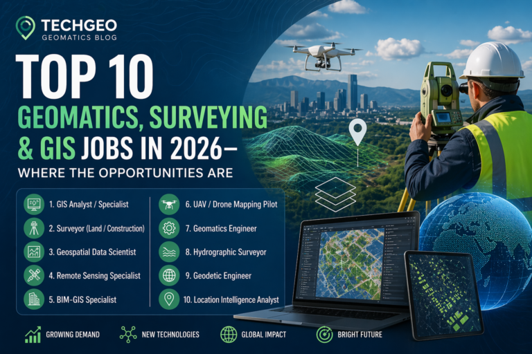
For a broader overview of career directions, read TechGeo’s guide to the top geomatics, surveying and GIS jobs in 2026.
Prepare a different résumé for federal applications
A federal résumé is generally more detailed than a conventional one-page private-sector résumé.
For USAJOBS applications, clearly describe:
- Exact employment dates
- Weekly working hours
- Detailed responsibilities
- Relevant software and methods
- Measurable accomplishments
- Education and required coursework
- Eligibility under the advertised hiring path
Do not assume that a reviewer will infer experience from a job title.
Confirm citizenship and work-authorisation rules
Some federal and national-security positions are restricted to U.S. citizens.
Space-sector employers may also impose ITAR or export-control requirements. Other employers may accept candidates with existing U.S. work authorisation but decline to sponsor visas.
Review these conditions before preparing a lengthy application.
Build a targeted portfolio
A strong GIS portfolio might include:
- ArcGIS Online applications
- Dashboards and StoryMaps
- Python automation scripts
- PostGIS or SQL projects
- Remote-sensing classifications
- Web GIS applications
- Field Maps or Survey123 workflows
- Spatial database designs
- GeoAI experiments
- Cartographic products
Each project should explain the problem, data, method, result and practical value.
Quantify professional achievements
Replace generic statements such as:
Created maps and managed GIS data.
With evidence-based statements such as:
Automated a Python and ArcPy quality-control workflow for 250,000 utility features, reducing weekly validation time by 70%.
Specific results make technical experience easier for recruiters and hiring managers to evaluate.
Strengthen skills before the next application cycle
Candidates who need additional ArcGIS experience can explore TechGeo’s guide to upcoming free Esri MOOCs with certification.
GIS and remote-sensing professionals can also assess their knowledge through the TechGeo Mapping Certification platform, which covers GIS, remote sensing, photogrammetry, web mapping and spatial analysis.
Frequently asked questions
Are these GIS vacancies still open?
The application pages were reviewed on July 28, 2026. Vacancies can close early, particularly when an employer receives enough applications.
Always confirm that the apply button remains active before preparing your submission.
Are there remote GIS jobs in this list?
The Portland enterprise-developer role is primarily remote, but the employee must work from Oregon or Washington.
Several federal positions are telework eligible but are not classified as fully remote. Applicants should not interpret “telework eligible” as permission to work from any U.S. state or another country.
Can international applicants apply?
Eligibility differs by employer.
The USDA, USGS and NGA positions have U.S.-citizenship or federal hiring restrictions. Array Labs is subject to export-control rules. Other employers may require existing legal authorisation to work in the United States.
Applicants needing visa sponsorship should confirm sponsorship availability directly with the employer.
Which position is most suitable for a recent GIS graduate?
The Mohave County GIS Technician vacancy has the most accessible minimum requirements. It accepts relevant college coursework and approximately one year of GIS, mapping, surveying or field-data experience.
Recent graduates may also consider the Richfield position when they can demonstrate practical ArcGIS and asset-management skills.
Which roles pay the most?
The highest published range is the Array Labs computer-vision position at $150,000–$300,000 per year.
Planet’s geospatial-AI role and Portland’s enterprise spatial-developer role also advertise salaries above $140,000 at the upper end.
These positions require advanced research, software-development, database or computer-vision expertise.
What is the most important technical skill?
There is no single skill that applies to every vacancy.
ArcGIS remains important for traditional analyst positions, while Python and SQL provide access to higher-level automation, development, remote-sensing and GeoAI opportunities.
The strongest candidates combine sound geographic reasoning with at least one advanced technical specialisation.
Final thoughts
The current U.S. geospatial job market offers opportunities across a much wider range of titles than “GIS Analyst.”
Public agencies need professionals to manage utilities, assets, planning data and enterprise GIS. Federal organisations recruit geographers and photogrammetrists. Satellite companies need researchers and software engineers who can process imagery, radar data and large geospatial datasets.
Candidates should first identify the career path that best matches their current experience:
- GIS technician and data maintenance
- Spatial analysis and cartography
- Planning and public service
- Utility and asset-management GIS
- Enterprise GIS and databases
- GIS software development
- Remote sensing and photogrammetry
- Geospatial artificial intelligence
A focused application showing relevant projects, measurable results and the employer’s exact required skills will usually be stronger than a generic résumé submitted to dozens of vacancies.
Last reviewed: July 28, 2026
Disclaimer: TechGeo.org is not affiliated with the employers listed in this article. Job availability, salaries, eligibility requirements, work arrangements and closing dates may change without notice. Applicants should verify all information on the official recruitment page before applying.