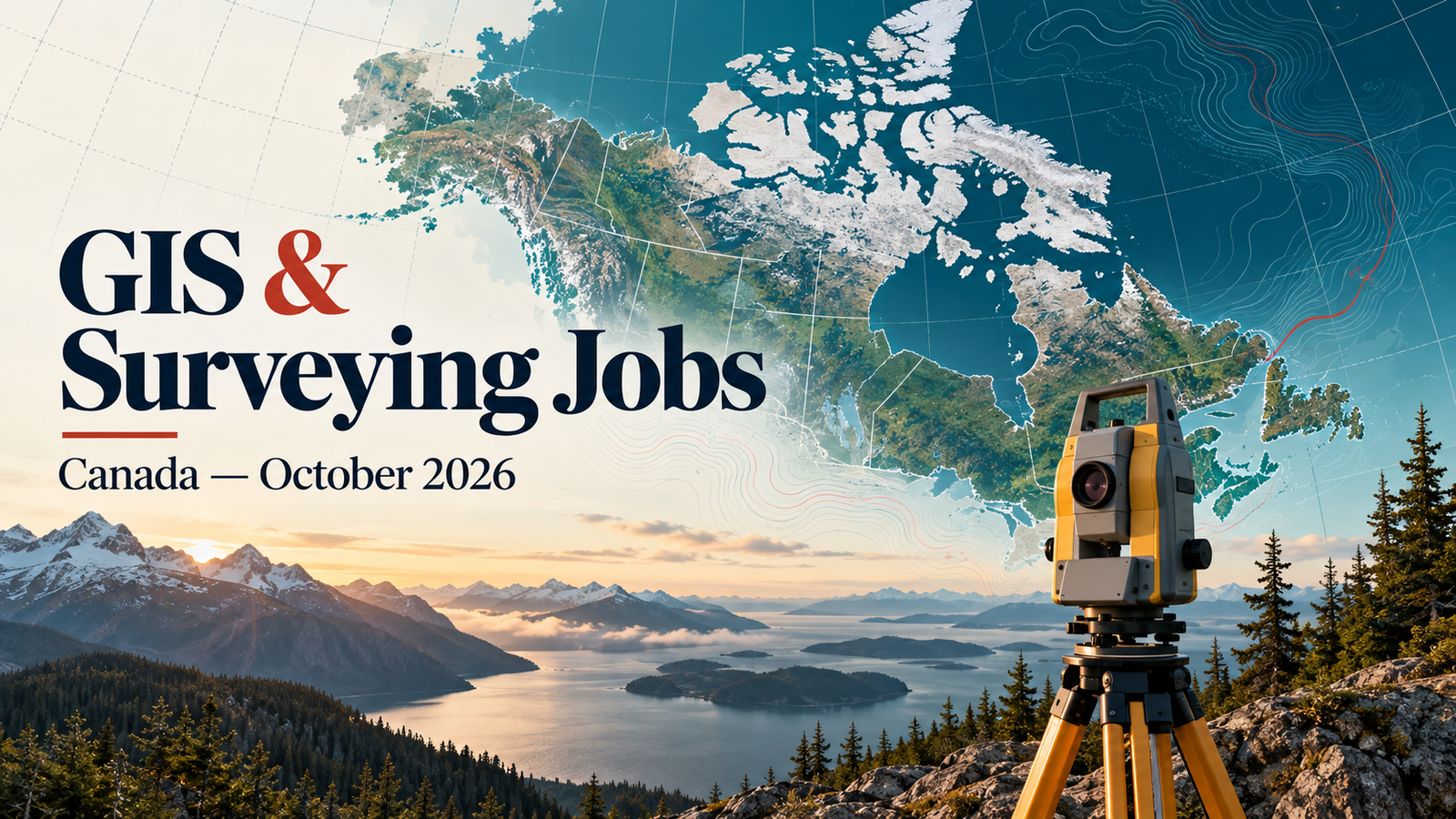
9 Current GIS, Remote Sensing & Land Surveying Jobs in Canada – October 2026
GIS jobs in Canada October 2026 cover enterprise systems, environmental analysis, restoration databases, regulatory mapping and precise field measurement. This roundup contains 9 vacancies individually checked on 19 October 2026, with opportunities in British Columbia, Ontario and Québec, plus a flexible Canada-wide role. The locations represented include Kamloops, Surrey, Burnaby, Toronto, Sherbrooke and Saint-Germain-de-Grantham.
The selection is weighted toward candidates with practical experience, from two years in survey technology to senior enterprise-GIS and field-team responsibilities. ArcGIS Pro, QGIS, spatial databases, Python, GPS, AutoCAD, data quality and technical communication recur across the adverts. Remote sensing jobs in Canada appear through environmental GIS and imagery processing; land surveying jobs in Canada include legal boundaries, construction measurements and seismic fieldwork. These are verified examples, not a complete national market survey.
Apply promptly: Forests Canada gives 19 October as its closing date, or until a candidate is found, for a November start. AGS closes on 20 October. The Sherbrooke surveyor advertisement remains open into November, with an advertised-until date of 6 November 2026. Later start dates are included only where recruitment is already open.
Prepare with TechGeo’s GIS interview questions and answers guide, or compare the current United States careers roundup and South America GIS and surveying opportunities.
Job advertisements may be changed or closed by employers without notice. Every vacancy in this article was accessible and appeared open when checked on 19 October 2026. Always verify the details on the employer’s page before applying.
Current Canadian GIS and Surveying Vacancies
Amounts are in Canadian dollars. On phones, each row becomes a labelled card. If needed in a narrow desktop column, scroll the table horizontally to reach salary and application details. “Not stated” means no value was provided on the checked page.
| Country | Job title | Employer | Location | Level/experience | Work arrangement | Posting date | Deadline | Salary | Application |
|---|---|---|---|---|---|---|---|---|---|
| Canada | GIS Analyst II | Thompson-Nicola Regional District | Kamloops, BC | GIS diploma/degree or equivalent; minimum 5 years | Permanent, full-time; workplace arrangement not specified | 7 Oct 2026 | 25 Oct 2026, 11:00 pm (portal; advert says PST) | CAD 2,946.58–3,419.85 biweekly (2025 rates) | View Job & Apply |
| Canada | Senior GIS Technician – BC Energy Regulatory Mapping | Beairsto & Associates Engineering Ltd. | British Columbia | At least 3 years GIS/production mapping | Remote; permanent, full-time; expected 40 hours/week | Exact date not stated; portal says 1 day ago | Not stated; Quick apply available | CAD 38–55/hour | View Job & Apply |
| Canada | Land Survey Technologist | Onoya Construction Surveys | Surrey, BC; varying sites | Bachelor’s degree; 2 to less than 3 years | On the road; permanent, full-time; 40 hours/week | 8 Oct 2026 | 29 Oct 2026 | CAD 38.46/hour | View Job & Apply |
| Canada | Land Survey Technician | Tatra Survey Inc. | Burnaby, BC | Bachelor’s degree; 3 to less than 5 years | On-site; permanent, full-time; 40 hours/week | 5 Oct 2026 | 26 Oct 2026 | CAD 40/hour | View Job & Apply |
| Canada | GIS Officer (Systems) – 249324 | Ontario Ministry of the Environment, Conservation and Parks | Toronto, ON | GIS, automation, databases and project-coordination skills | Temporary, up to 12 months, possible extension; work arrangement not specified | 7 Oct 2026 | 22 Oct 2026, 11:59 pm EDT | CAD 1,408.64–1,773.85/week | View Job & Apply |
| Canada | Environmental GIS Analyst | Consor Canada | Toronto, ON | Relevant diploma/degree; detailed requirements say 5+ years | Regular full-time; hybrid/remote options described—confirm arrangement | 7 Oct 2026 | Not stated; employer application link active | CAD 75,000–115,000/year projected | View Job & Apply |
| Canada | Land Surveyor | Lessard L’Hérault Blanchard arpenteurs-géomètres | Sherbrooke, QC | Bachelor’s degree; experience an asset; French | On-site; permanent, full-time; 40 hours/week | 16 Oct 2026 | 6 Nov 2026 | CAD 75,000–90,000/year, negotiable | View Job & Apply |
| Canada | Land Survey Technician | AGS ENVIRONNEMENT INC. | Saint-Germain-de-Grantham, QC | Trades certificate/diploma; 2 to less than 3 years; French | On-site; permanent, full-time; 40 hours/week | 29 Sep 2026 | 20 Oct 2026 | CAD 29.17/hour | View Job & Apply |
| Canada | Senior Coordinator, GIS & Data Management | Forests Canada | Flexible within Canada | Relevant degree/diploma; 3+ years | Remote/hybrid; full-time one-year contract; November 2026 start | 1 Oct 2026 | 19 Oct 2026, or until candidate found—apply promptly | CAD 50,000–65,000/year | View Job & Apply |
British Columbia: Vacancy Profiles
1. GIS Analyst II — Thompson-Nicola Regional District
The Thompson-Nicola Regional District needs a senior technical analyst to develop and maintain corporate GIS applications, databases, services and integrations in Kamloops. Responsibilities connect advanced spatial analysis with database modelling, production support, system upgrades, documentation, staff training and emergency-operations support. A recognized GIS diploma or degree, or an accepted equivalent, and at least five years of relevant experience are requested. The technology list includes ArcGIS Pro, ArcGIS Enterprise, SQL, Python, ArcPy, Arcade, JavaScript, HTML and CSS. Applicants should demonstrate a reliable production workflow rather than only attractive maps. Honest CV keywords include enterprise GIS, spatial databases, application integration, automation and Tier 2 support. A Class 5 licence, criminal-record check and driver’s abstract are stated conditions. Pay is CAD 2,946.58–3,419.85 biweekly at the quoted 2025 rates. The portal closes on 25 October 2026 at 11:00 pm; confirm its stated PST time convention. View Job & Apply.
2. Senior GIS Technician – BC Energy Regulatory Mapping — Beairsto & Associates Engineering Ltd.
Beairsto & Associates is recruiting a remote senior technician for British Columbia energy and resource mapping. The work integrates cadastral, survey, environmental and regulatory information into submission-ready products for well sites, pipelines, facilities, access roads and rights-of-way. Applicants need at least three years of GIS or production-mapping experience; a relevant diploma or degree is preferred, with equivalent experience considered. QGIS or ArcGIS Pro, CAD-to-GIS integration, legal-plan interpretation and consistent spatial quality control are central. Knowledge of BC Energy Regulator requirements and provincial datasets is especially valuable. This suits someone who can identify missing land information and recognize when professional interpretation must be escalated. Honest keywords include BCER mapping, cadastral data, ParcelMap BC, QGIS, ArcGIS Pro and spatial QA. Pay is CAD 38–55 per hour for an expected 40-hour week. The exact posting date and deadline are not stated; the checked portal labels it one day old and provides Quick apply. View Job & Apply.
3. Land Survey Technologist — Onoya Construction Surveys
Onoya Construction Surveys seeks a permanent technologist based in Surrey, with frequent or constant travel between work sites. The role combines field measurement, GPS positioning, calculations, drafting, survey records and coordination of technical staff. The advert identifies GIS, computerized land-information systems, AutoCAD and topographic or engineering surveys. Applicants need a bachelor’s degree and two to less than three years of experience, with English as the stated language. Basic security clearance and a criminal-record check are listed, alongside willingness to travel and varied schedules that can include evenings, weekends, on-call work and overtime. A useful application should show accurate survey notes and the connection between field measurements and finished plans. Honest CV keywords include GPS, AutoCAD, topographic survey, field calculations and survey documentation. The job pays CAD 38.46 per hour for 40 hours per week. Applications are advertised until 29 October 2026. View Job & Apply.
4. Land Survey Technician — Tatra Survey Inc.
Tatra Survey’s Burnaby technician opening is an outdoor, on-site position supporting field surveys and their technical records. Responsibilities include measuring distances, angles, elevations and contours; assisting with calculations; preparing detailed drawings, charts and plans; and keeping measurements and survey information systematically organized. The employer asks for a bachelor’s degree and three to less than five years of experience. English is specified. The page does not name an instrument brand, GNSS workflow or software package, so applicants should not treat those as confirmed requirements. This role suits a technician able to demonstrate dependable field procedures and traceable records under supervision. Appropriate CV keywords include field surveying, measurement computation, survey notes, drawing preparation and data organization. The permanent full-time role pays CAD 40 per hour for 40 hours per week, with day work stated. The advertisement runs until 26 October 2026. View Job & Apply.
Ontario: Vacancy Profiles
5. GIS Officer (Systems) – 249324 — Ontario Ministry of the Environment, Conservation and Parks
Ontario’s Ministry of the Environment, Conservation and Parks is hiring a GIS Officer for the Spill Action Centre in Toronto. The temporary assignment lasts up to twelve months, with possible extension. Work supports environmental incident response through GIS analysis, mapping, applications, data solutions, automation, troubleshooting, training and technical projects. Applicants should demonstrate geospatial data management, spatial analysis, relational databases and programming or automation knowledge such as Python, SQL, C++, .NET or Java. Project coordination, root-cause analysis and communication with non-specialists also matter. The advert does not prescribe a fixed number of years in the visible criteria. Honest CV keywords include environmental response, GIS automation, database management, technical support and stakeholder requirements. The position language is English, and pay is CAD 1,408.64–1,773.85 weekly. Apply online using job ID 249324 by 22 October 2026 at 11:59 pm EDT; the combined cover letter and résumé must not exceed five pages. View Job & Apply.
6. Environmental GIS Analyst — Consor Canada
Consor’s Toronto environmental analyst opening connects GIS with ecology, hydrology, archaeology, permitting and infrastructure projects. Duties include spatial modelling, maps, dashboards, geodatabases, field-data workflows and technical reporting, using datasets such as LiDAR, orthophotography, satellite and drone imagery, terrain models and watershed information. The detailed requirements request five or more years of consulting or industry experience and a relevant GIS, geography or engineering-technology qualification. ArcGIS Pro, ArcGIS Online and mobile applications are central; Python, ModelBuilder, Arcade and SQL are assets. This suits an analyst able to explain how data quality and modelling choices affect environmental decisions. Honest CV keywords include environmental GIS, LiDAR, field collection, geodatabases, remote sensing and metadata. Projected compensation is CAD 75,000–115,000 annually. Although the page header says onsite, the description offers hybrid and remote options: confirm the actual arrangement. No closing date is stated; the employer’s application route was active when checked. View Job & Apply.
Québec: Vacancy Profiles
7. Land Surveyor — Lessard L’Hérault Blanchard arpenteurs-géomètres
Lessard L’Hérault Blanchard is recruiting a permanent land surveyor in Sherbrooke. The role includes developing legal-survey methods, supervising boundary-survey documentation, establishing property boundaries, preparing development layouts and analysing information with GIS and CAD. The advert also includes certification and professional-liability responsibilities, making it important to confirm the appropriate professional eligibility before applying. A bachelor’s degree is requested, experience is described as an asset and French is the stated language. Specializations include condominiums, geodetic work, land development and topography. This is not simply a map-production vacancy: applicants should distinguish technical surveying experience from authority to certify boundary work. Honest CV keywords include legal boundaries, geodetic survey, subdivision layout, GIS/CAD and survey documentation. Pay is CAD 75,000–90,000 annually, negotiable, for 40 hours per week. The posting is advertised until 6 November 2026 and requires existing Canadian work authorization. View Job & Apply.
8. Land Survey Technician — AGS ENVIRONNEMENT INC.
AGS ENVIRONNEMENT is hiring an on-site survey technician in Saint-Germain-de-Grantham. The work involves field surveys, measurement calculations, development of survey procedures with engineers or professional surveyors, preparation of drawings and reports, and supervision of drafting or technical staff. A trades certificate or diploma and two to less than three years of experience are requested. French is specified. The page does not identify a required software package or instrument brand, so focus the application on actual surveying responsibilities and accurate documentation rather than guessing a technology stack. Honest CV keywords include field measurements, survey computations, technical drawings, survey reports and technical-staff coordination. The permanent full-time role pays CAD 29.17 per hour for 40 hours weekly. Several shift periods are mentioned, with details to be determined. The advertised-until date is 20 October 2026, so this is an urgent application opportunity. Existing Canadian work authorization is explicitly required. View Job & Apply.
Flexible within Canada: Vacancy Profiles
9. Senior Coordinator, GIS & Data Management — Forests Canada
Forests Canada is recruiting a senior coordinator to support national restoration projects through GIS, database operations, monitoring and reporting. Responsibilities include maintaining tree-planting databases and applications, producing interactive maps and dashboards, checking field and database consistency, documenting standards and training partners. A relevant degree or diploma and at least three years of related experience are required. ArcGIS Pro, ArcGIS Online, QGIS, SQL and Python or R appear in the criteria, alongside experience working with Indigenous communities, conservation organizations or government agencies. The flexible Canada-based role is remote/hybrid, with travel when needed and a valid G licence requested. Honest CV keywords include restoration GIS, data quality, SQL, workflow automation, monitoring and partner training. Salary is CAD 50,000–65,000 for a full-time, one-year contract with possible extension and a November 2026 start. The stated closing date is today, 19 October 2026, or until a candidate is found. Follow the advert’s email application instructions promptly. View Job & Apply.
Skills in Demand Across These Canadian Vacancies
The collected adverts show three distinct technical pathways. Enterprise GIS roles emphasize reliable systems and business integration; environmental and restoration roles connect geographic information to decisions and monitoring; survey roles prioritize measurement, calculations, records and field delivery. Choose the pathway that matches your evidence rather than treating every geospatial job as interchangeable.
Enterprise GIS and dependable spatial services
TNRD and Ontario need more than desktop map production. Their adverts describe applications, databases, integrations, troubleshooting, training and system improvement. Demonstrate how a workflow moves from source data to an operational service: who uses it, how access is managed, what validation is performed and what happens when something fails. Python and SQL matter where they solve an identifiable operational problem. A short example of automating a recurring task, testing the result and documenting its limitations is stronger than a long list of programming languages without context.
Environmental imagery and restoration information
Consor combines imagery and terrain information with environmental analysis, while Forests Canada links GIS to restoration-program data and partner reporting. These are complementary but different responsibilities. One candidate might demonstrate LiDAR or orthophoto interpretation and field-data integration; another might show database validation, monitoring dashboards and clear training materials. Explain the decision supported by the analysis and how uncertainty was handled. “Remote sensing” should describe real experience with imagery or derived datasets, not merely viewing a basemap.
Survey records, CAD and professional judgment
The survey vacancies repeatedly mention measurements, calculations, drawings and organized notes. Onoya explicitly identifies GPS and AutoCAD, whereas Tatra and AGS do not name a technology package. Keep that distinction in your application. Record the survey types you worked on, the instruments you actually used, the checking procedures followed and your exact level of responsibility. For a role involving property-boundary certification, technical experience and professional authorization are separate questions that must both be resolved.
Regulatory and cadastral context
Beairsto’s role gives a particularly clear example of domain-specific GIS: BC energy application mapping, land interests, regulatory spatial submissions and provincial datasets. General cartography skills are valuable but do not replace familiarity with the relevant records and standards. A suitable portfolio could explain how you reconciled survey and CAD inputs, checked spatial attributes and escalated ambiguous land information. Do not imply legal or regulatory authority you do not hold.
Application Advice for Canada
Match the advertised level before tailoring your résumé
This selection contains no dedicated student internship. Onoya asks for two to less than three years of experience; Tatra asks for three to less than five; TNRD asks for at least five. Lessard describes experience as an asset but includes professional boundary-survey responsibilities. Read the whole notice rather than judging seniority from the job title alone. If you are early in your career, distinguish supervised tasks from work you were authorized to complete independently, and explain the relevance of your education and project evidence without inflating responsibility.
Use a role-specific evidence section
For enterprise GIS, show applications, spatial databases, integrations and support outcomes. For environmental GIS, explain the datasets, analysis and quality controls behind a deliverable. For surveying, list project dates, survey types, field methods, calculations and finished plans. Use anonymized or public examples rather than confidential client data. A concise account of a problem, your method, the check performed and the result gives recruiters something concrete to evaluate. Only include software keywords that you can discuss confidently in an interview.
Respect the actual language requirements
The Sherbrooke and AGS listings specify French. Ontario’s GIS Officer position specifies English, although the competition is published in both official languages. Onoya and Tatra also identify English. Do not assume that every Canadian role requires bilingualism, or that a translated vacancy changes its language criteria. For French-language applications, keep qualification names accurate and use clear technical terms for survey calculations, plans and records. Ask the employer how foreign qualification documents should be presented where this is not explained.
Check authorization and professional eligibility separately
The checked Job Bank pages for Lessard, Onoya, Tatra and AGS explicitly restrict applicants to Canadian citizens, permanent residents and temporary residents with valid work permits. An invitation to apply does not establish sponsorship or permission to start work. The remaining notices should not be described as sponsorship offers without an explicit employer statement.
Professional survey authorization and recognition of qualifications depend on the duties and jurisdiction. In particular, the Sherbrooke advert includes certifying property-boundary surveys and assuming liability. Verify eligibility with the employer and the appropriate provincial professional authority before representing yourself as qualified for those functions. This article does not provide a blanket licensing or immigration determination.
Compare compensation on the stated basis
Hourly, weekly, biweekly and annual amounts appear here. Do not compare the figures as if they cover identical hours or employment terms. TNRD quotes a 2025 collective-agreement rate; Consor describes its annual range as projected compensation. Clarify overtime, rotations, benefits, travel time and any seasonal limitations directly. Do not convert a daily field rate into an annual salary without knowing the paid work schedule.
Confirm what remote, hybrid and field travel mean
Beairsto advertises remote work and Forests Canada specifies flexibility within Canada. Neither statement automatically permits employment from another country. Consor’s page combines an onsite header with hybrid/remote options in its description, so confirm the actual arrangement. Onoya requires frequent or constant travel between field sites. Ask about the working base, site access, rotations, accommodation and travel responsibilities before making financial or relocation commitments.
Apply early and retain a submission record
Prioritize the nearest deadlines and use the exact job reference where provided. Ontario requires an online application and a combined cover letter and résumé of no more than five pages. Forests Canada requests an emailed cover letter and résumé with the position title in the subject line; use the contact instructions on the linked advert. Save the vacancy reference, your submitted document versions and any confirmation. A public page can remain visible after a recruitment decision, so always reconfirm the application route immediately before submission.
How the Vacancies Were Checked
The research compared individual employer, government and publicly accessible vacancy pages against the current run date, then checked TechGeo’s previous 90 days of posts to exclude repeated adverts. URLs were compared alongside employer, title and location, so a new posting number alone was not treated as a new opportunity. Closed dates, missing descriptions, inaccessible application details and older postings were grounds for exclusion. Search-result dates were used as leads, not as the final evidence of an open vacancy.
Job Bank’s “advertised until” date is reproduced as an advertisement end date, not a guarantee that an employer will wait until then to hire. Where an employer did not state a deadline, the table says so. Beairsto’s portal provides a relative age but not an exact calendar posting date; no date has been invented. Forests Canada was marked open on the verification date, but its closing date is today and it may close once a candidate is selected.
Frequently Asked Questions
Are all nine opportunities open now?
Each vacancy showed a current application route, instructions or a future advertisement closing date when checked on 19 October 2026. Employers can change or close adverts early. Forests Canada’s stated deadline is today, so verify and act promptly.
Are November opportunities included?
Yes. The Sherbrooke land-surveyor advert runs until 6 November 2026, and Forests Canada is recruiting for a November start. Both were already open when checked; neither is a future vacancy that has not begun accepting applications.
Which jobs involve remote sensing?
Consor explicitly includes LiDAR, UAV/drone, orthophoto and satellite imagery. Forests Canada lists remote-sensing knowledge as an asset for ecological monitoring. These are broader environmental or restoration roles, not exclusively satellite-image-processing positions.
Can international candidates apply?
Eligibility differs by advert. Several survey listings require existing Canadian authorization. Do not assume that an application invitation is a sponsorship guarantee. Confirm your circumstances directly before applying or planning travel.
Are remote roles available?
Beairsto states remote work, Forests Canada offers remote/hybrid work within Canada, and Consor describes flexible options that need confirmation. Field travel and remote camps should not be confused with home-based employment.
Choose a Focused Next Step
These geomatics jobs in Canada span operational systems, environmental decisions, restoration programmes, regulatory mapping and field measurement. Pick the strongest match to your verified skills, read the original conditions and submit evidence tailored to that position. Follow TechGeo Geo-News career updates for the next regional roundup, covering the Arabian Gulf.